 geocatalogue.geoportail.lu
dataset
Type of resources
Available actions
Topics
Keywords
Contact for the resource
Provided by
Groups
Years
Representation types
Update frequencies
status
Scale
-

The WFD's quantitative status objectives aim to ensure a balance between groundwater withdrawal and recharge.
-
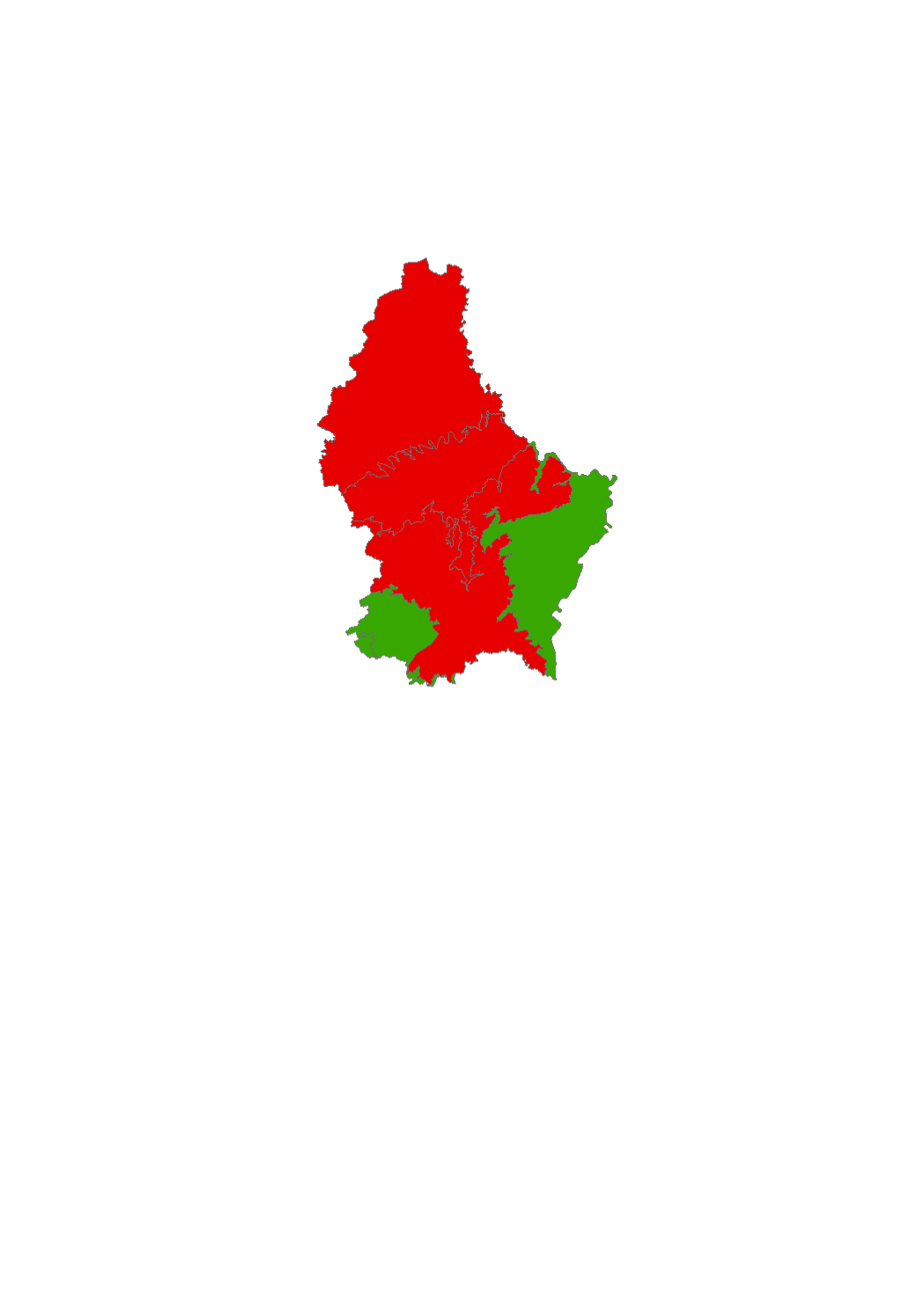
The groundwater bodies are classified according to 6 states: no data available, very good, good, moderate, unsatisfactory, bad.
-

Jul. 2012 - Precipitation, monthly difference to reference [%] lux_2012_07_map_pluvio_diff_perc,lux_2012_07_samples_pluvio_diff_perc The thematic maps presented here are published annually in the hydro-climatological Atlas of the Grand-Duchy of Luxembourg. The project is a collaboration between the Luxemburg Institute of Science and Technology (LIST), the Administration de la gestion de l’eau (AGE) and the Administration des services techniques de l’agriculture (ASTA). The maps show the spatial distribution and temporal evolution of air temperature and precipitation providing an overview of the meteorological situation in Luxembourg. The basis of this documentation is a dense and continuously operating measurement network throughout the country. For regions in which measurements are unavailable, values were estimated by means of spatial interpolation (Inverse Distance Weighting). The current precipitation patterns are compared with a climatic reference period (30 years).
-

May 2013 - Precipitation, monthly difference to reference period [mm] lux_2013_05_map_pluvio_diff_mm,lux_2013_05_samples_pluvio_diff_mm The thematic maps presented here are published annually in the hydro-climatological Atlas of the Grand-Duchy of Luxembourg. The project is a collaboration between the Luxemburg Institute of Science and Technology (LIST), the Administration de la gestion de l’eau (AGE) and the Administration des services techniques de l’agriculture (ASTA). The maps show the spatial distribution and temporal evolution of air temperature and precipitation providing an overview of the meteorological situation in Luxembourg. The basis of this documentation is a dense and continuously operating measurement network throughout the country. For regions in which measurements are unavailable, values were estimated by means of spatial interpolation (Inverse Distance Weighting). The current precipitation patterns are compared with a climatic reference period (30 years).
-

Jul. 2013 - Temperature monthly average [ºC] lux_2013_07_map_temp_average,lux_2013_07_samples_temp_average The thematic maps presented here are published annually in the hydro-climatological Atlas of the Grand-Duchy of Luxembourg. The project is a collaboration between the Luxemburg Institute of Science and Technology (LIST), the Administration de la gestion de l’eau (AGE) and the Administration des services techniques de l’agriculture (ASTA). The maps show the spatial distribution and temporal evolution of air temperature and precipitation providing an overview of the meteorological situation in Luxembourg. The basis of this documentation is a dense and continuously operating measurement network throughout the country. For regions in which measurements are unavailable, values were estimated by means of spatial interpolation (Inverse Distance Weighting). The current precipitation patterns are compared with a climatic reference period (30 years).
-

Oct. 2012 - Precipitation, monthly sum [mm] lux_2012_10_map_pluvio_sum,lux_2012_10_samples_pluvio_sum The thematic maps presented here are published annually in the hydro-climatological Atlas of the Grand-Duchy of Luxembourg. The project is a collaboration between the Luxemburg Institute of Science and Technology (LIST), the Administration de la gestion de l’eau (AGE) and the Administration des services techniques de l’agriculture (ASTA). The maps show the spatial distribution and temporal evolution of air temperature and precipitation providing an overview of the meteorological situation in Luxembourg. The basis of this documentation is a dense and continuously operating measurement network throughout the country. For regions in which measurements are unavailable, values were estimated by means of spatial interpolation (Inverse Distance Weighting). The current precipitation patterns are compared with a climatic reference period (30 years).
-

Jul. 2012 - Precipitation, monthly sum [mm] lux_2012_07_map_pluvio_sum,lux_2012_07_samples_pluvio_sum The thematic maps presented here are published annually in the hydro-climatological Atlas of the Grand-Duchy of Luxembourg. The project is a collaboration between the Luxemburg Institute of Science and Technology (LIST), the Administration de la gestion de l’eau (AGE) and the Administration des services techniques de l’agriculture (ASTA). The maps show the spatial distribution and temporal evolution of air temperature and precipitation providing an overview of the meteorological situation in Luxembourg. The basis of this documentation is a dense and continuously operating measurement network throughout the country. For regions in which measurements are unavailable, values were estimated by means of spatial interpolation (Inverse Distance Weighting). The current precipitation patterns are compared with a climatic reference period (30 years).
-

Jan. 2013 - Average monthly minimum temperatures [ºC] lux_2013_01_map_temp_minimum,lux_2013_01_samples_temp_minimum The thematic maps presented here are published annually in the hydro-climatological Atlas of the Grand-Duchy of Luxembourg. The project is a collaboration between the Luxemburg Institute of Science and Technology (LIST), the Administration de la gestion de l’eau (AGE) and the Administration des services techniques de l’agriculture (ASTA). The maps show the spatial distribution and temporal evolution of air temperature and precipitation providing an overview of the meteorological situation in Luxembourg. The basis of this documentation is a dense and continuously operating measurement network throughout the country. For regions in which measurements are unavailable, values were estimated by means of spatial interpolation (Inverse Distance Weighting). The current precipitation patterns are compared with a climatic reference period (30 years).
-

Jun. 2012 - Average monthly maximum temperatures [ºC] lux_2012_06_map_temp_maximum,lux_2012_06_samples_temp_maximum The thematic maps presented here are published annually in the hydro-climatological Atlas of the Grand-Duchy of Luxembourg. The project is a collaboration between the Luxemburg Institute of Science and Technology (LIST), the Administration de la gestion de l’eau (AGE) and the Administration des services techniques de l’agriculture (ASTA). The maps show the spatial distribution and temporal evolution of air temperature and precipitation providing an overview of the meteorological situation in Luxembourg. The basis of this documentation is a dense and continuously operating measurement network throughout the country. For regions in which measurements are unavailable, values were estimated by means of spatial interpolation (Inverse Distance Weighting). The current precipitation patterns are compared with a climatic reference period (30 years).
-

Nov. 2013 - Precipitation, monthly difference to reference period [mm] lux_2013_11_map_pluvio_diff_mm,lux_2013_11_samples_pluvio_diff_mm The thematic maps presented here are published annually in the hydro-climatological Atlas of the Grand-Duchy of Luxembourg. The project is a collaboration between the Luxemburg Institute of Science and Technology (LIST), the Administration de la gestion de l’eau (AGE) and the Administration des services techniques de l’agriculture (ASTA). The maps show the spatial distribution and temporal evolution of air temperature and precipitation providing an overview of the meteorological situation in Luxembourg. The basis of this documentation is a dense and continuously operating measurement network throughout the country. For regions in which measurements are unavailable, values were estimated by means of spatial interpolation (Inverse Distance Weighting). The current precipitation patterns are compared with a climatic reference period (30 years).