 geocatalogue.geoportail.lu
farming
Type of resources
Available actions
Topics
Keywords
Contact for the resource
Provided by
Groups
Years
Representation types
Update frequencies
status
Scale
-

FLIK parcel of the previous year (2024)
-
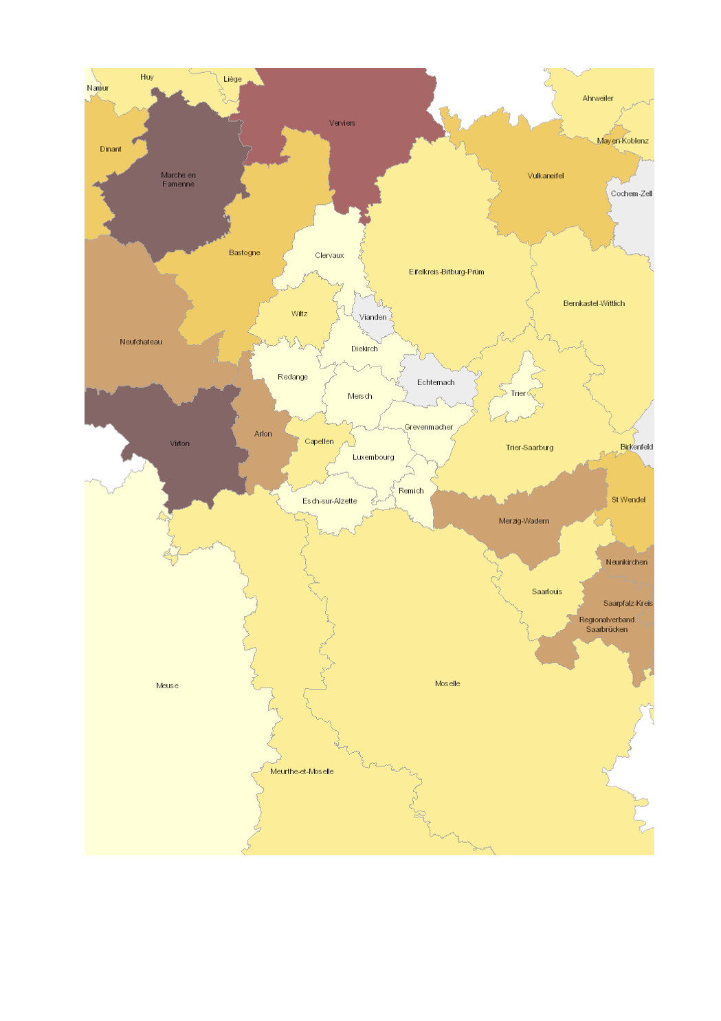
- Share of total utilised agricultural area (UAA) occupied by organic farming (2016-2017) - Territorial entities: arrondissements (Wallonie), départements (Lorraine), cantons (Luxembourg), Kreise (Saarland, Rheinland-Pfalz) - Statistical data sources: Division des Statistiques Agricoles, des Marchés Agricoles et des Relations Extérieures (LUX) 2017; Natagriwal 2017 ; Ministerium für Umwelt und Verbraucherschutz Saarland 2017; ADD Rheinland-Pfalz 2016; Agence BIO / OC Agreste 2016. Harmonization: IGEAT 2018 - Geodata sources: ACT Luxembourg 2017, IGN France 2017, GeoBasis-DE / BKG 2017, NGI-Belgium 2017. Harmonization: SIG-GR / GIS-GR 2018
-
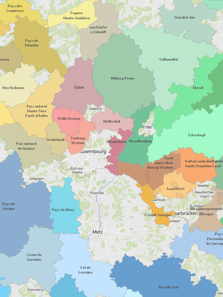
- LEADER Regions 2023-2027 - Data: LVermGeo Rheinland-Pfalz, Ministère de l'Agriculture, de l’Alimentation et de la Viticulture Luxembourg, Ministerium für Umwelt, Klima, Mobilität, Agrar und Verbraucherschutz Saarland, Région Grand Est, Réseau wallon PAC. Harmonization: GIS-GR 2024
-
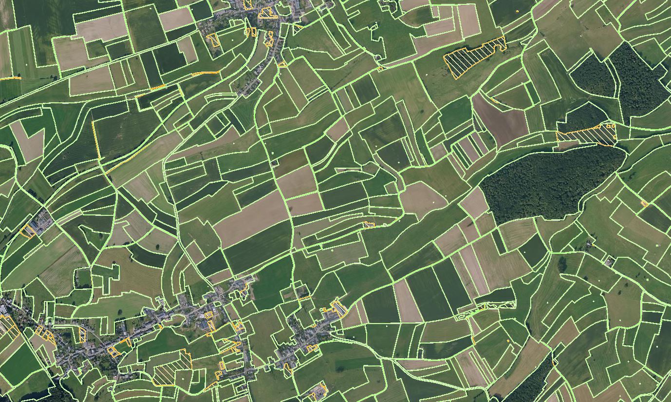
Current status of FLIK parcels after the annual update of the agricultural parcel reference system. The update was performed from the beginning of May to the end of July based on the latest national aerial photos (orthophotos) from 2025. This layer is provisionally and the geometry changes are being validated by the concerned farmers in the course of the participation process (border adjustments, merge and division of parcels with new FLIK numbers, size changes, etc.).
-
- Calendar 2024 of the Greater Region: wine and viticulture - Data: Working party Land registry and mapping of the Summit of the Greater Region: Harmonization: GIS-GR 2023
-

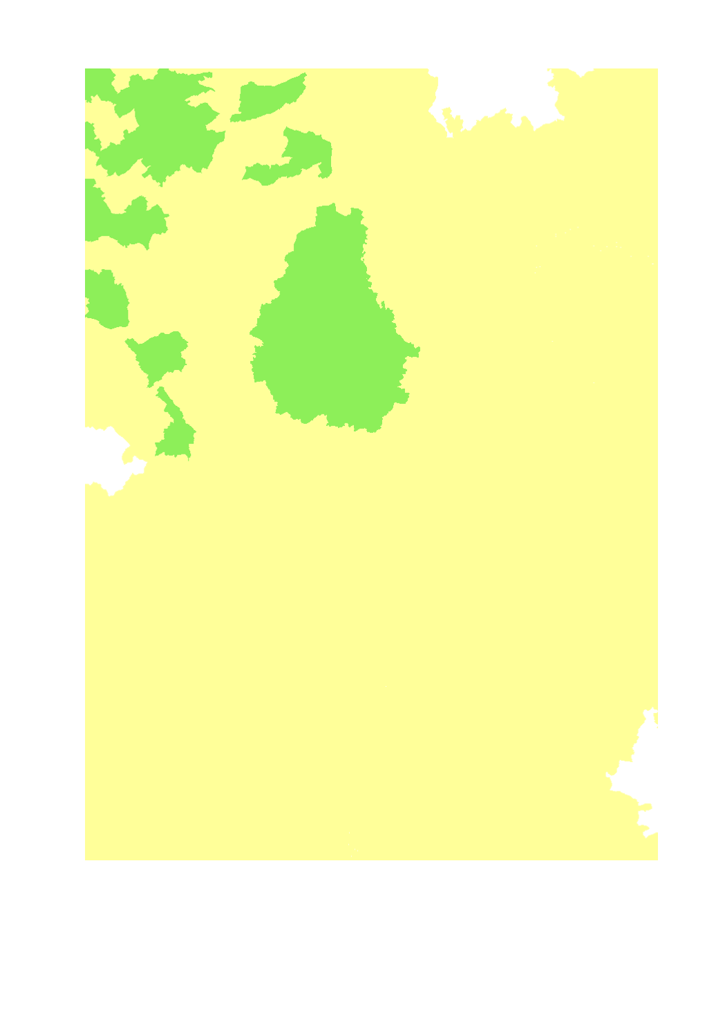
Project for delimitating the winegrowing areas in Luxemburg
-

Project for delimitating the small winegrowing areas in Luxemburg
-
- Livestock units of pigs per ha of agricultural area - Territorial entity: Lorraine: canton (2010), Luxembourg: canton (2015), Rhineland-Palatinate: Landkreise and kreisfreie Städte (2010), Saarland: Landkreise (2016), Wallonia: municipality (2015) - Sources: SIG-GR 2018; DRAAF Grand Est 2017; ASTA Luxembourg 2017; Statistisches Landesamt Rheinland-Pfalz 2017; Statistisches Amt Saarland 2017; Direction générale statistique 2017; Groupe de travail "Agriculture et forêt" de la Grande Région
-

Climate Map of the vineyards in Luxemburg
-
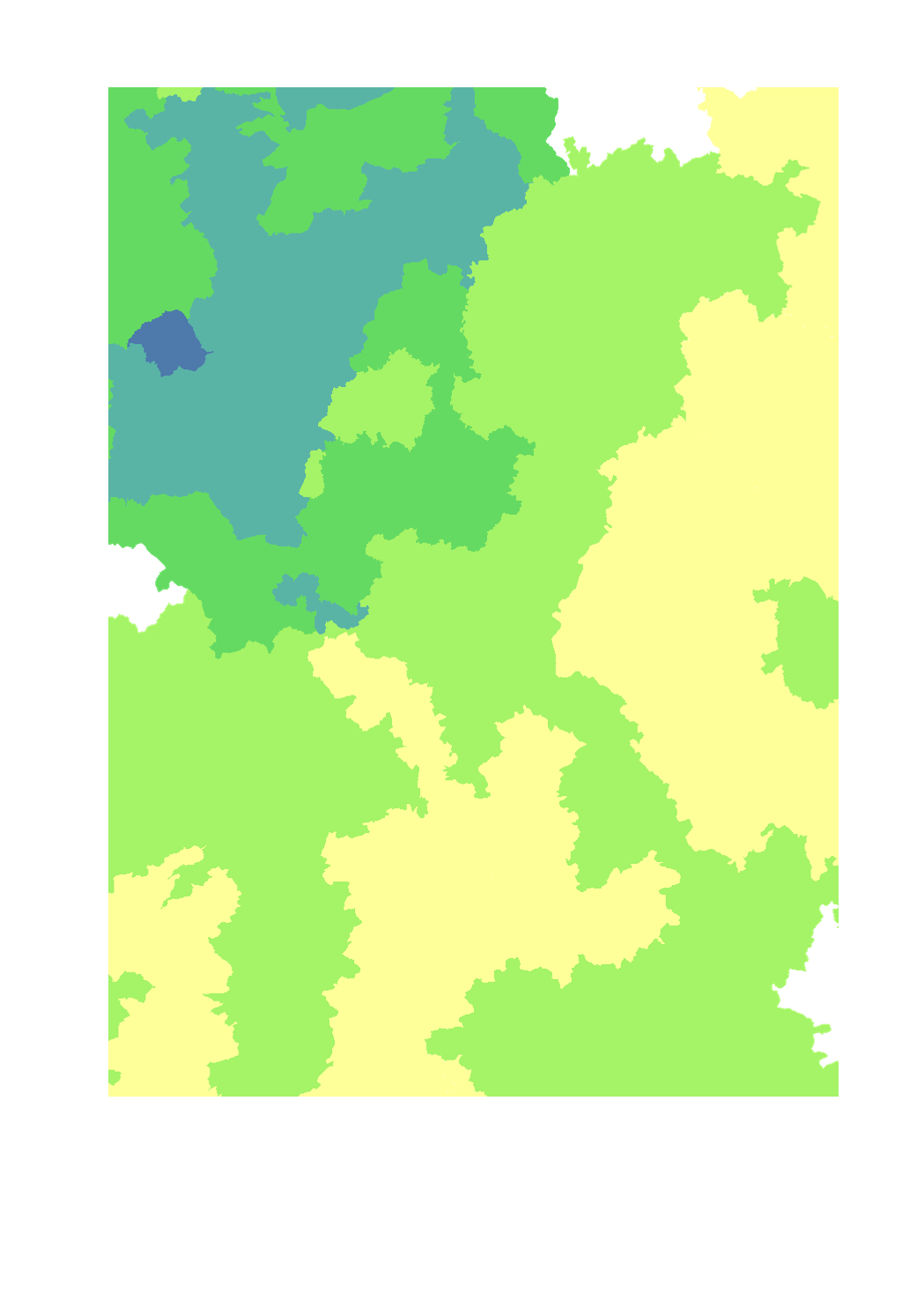
- Livestock units of cattle per ha of agricultural area - Territorial entity: Lorraine: canton (2010), Luxembourg: canton (2015), Rhineland-Palatinate: Landkreise and kreisfreie Städte (2010), Saarland: Landkreise (2016), Wallonia: municipality (2015) - Sources: DRAAF Grand Est 2017; ASTA Luxembourg 2017; Statistisches Landesamt Rheinland-Pfalz 2017; Statistisches Amt Saarland 2017; Direction générale statistique 2017; Groupe de travail "Agriculture et forêt" de la Grande Région. Harmonization: SIG-GR / GIS-GR 2018