 geocatalogue.geoportail.lu
0
Type of resources
Available actions
Topics
Keywords
Contact for the resource
Provided by
Groups
Years
Representation types
Update frequencies
status
Scale
-
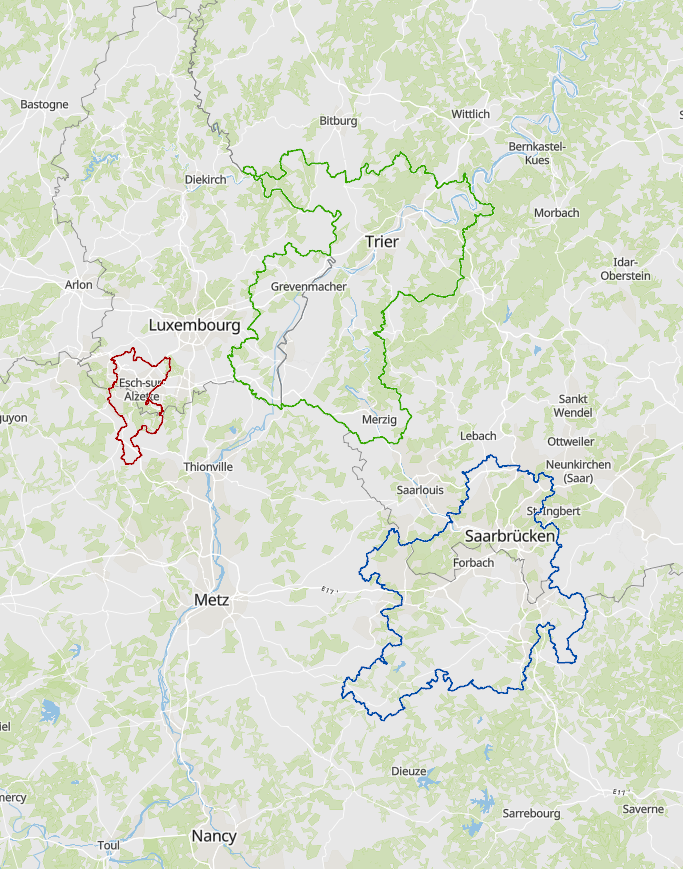
- Cross-border functional areas defined within the Interreg programme of the Greater Region in 2023. - Sources: Entiwcklungskonzept Oberes Moseltal, Eurodistrict SaarMoselle, EGTC Alzette-Belval, . Harmonization: SIG-GR 2023
-
- Spatial planning documents at national/regional level of the greater-regional partners (08/2020) - Sources: MEA-Dater 2020; MDI Rheinland-Pfalz 2020; Région Grand Est 2020; MIBS Saarland 2020
-
- Spatial planning documents at national/regional/cantonal level in the Greater Region and the Upper Rhine 2024 - Sources: GeoRhena, MDI Rheinland-Pfalz, MIBS Saarland, Ministerium der Deutschsprachigen Gemeinschaft, MLOGAT-DATer Luxembourg, Région Grand Est, Service public de Wallonie 2024. Harmonization: GIS-GR 2024
-
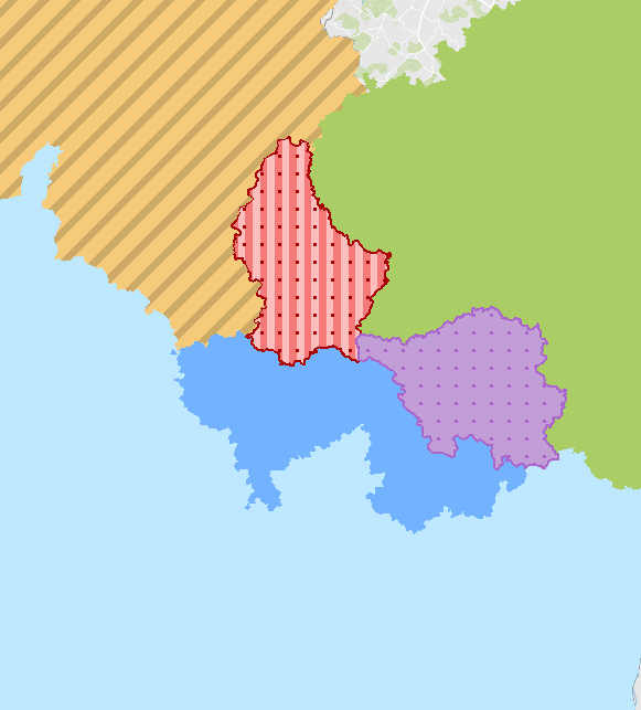
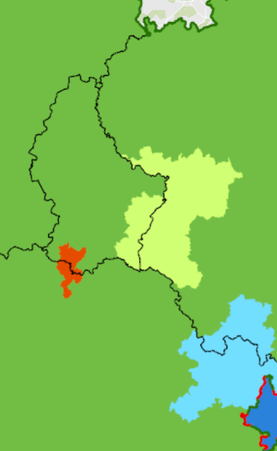
Charging stations for electric vehicles in Luxembourg and within a radius of 40km from its borders (2021) - Sources: Bundesnetzagentur.de, Chargemap, Creos Luxembourg - Electro-mobility, DREAL Grand Est, LVGL Saarland, MWAEV Saarland, MWVLW Rheinland-Pfalz. Harmonization: SIG-GR / GIS-GR 2021
-
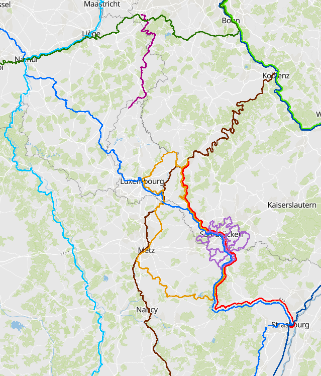
European and cross-border cycle paths 2021 - Sources: EuroVelo, biroto-Redaktion (biroto.eu), Luxembourg for Tourism 2021, OpenStreetMap and Contributors, Saarschleifenland Tourismus GmbH, Service pubic de Wallonie - DGO1, Stadtverband Saarbrücken, Tourismus Zentrale Saarland GmbH. Harmonization: SIG-GR / GIS-GR 2021
-
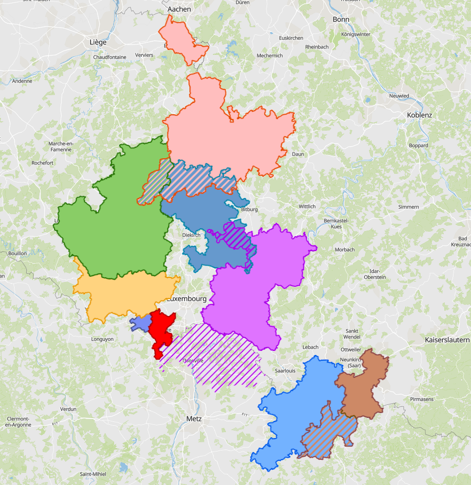
- Cross-border functional areas defined within the Interreg programme of the Greater Region in 2025. - Sources: Entwicklungskonzept Oberes Moseltal (EOM), Eurodistrict SaarMoselle, GECT Alzette-Belval, MLOGAT-DATer, Idelux, Eifel-Ostbelgien-Eislek (EOE), Mëllerdall-Our-Südeifel (MOSE), TNT Chiers Alzette, Parc archéologique européen - Europäischer Kulturpark Bliesbruck-Reinheim. Harmonisation: SIG-GR 2025
-
National and regional cycle paths 2021 - Sources: OpenStreetMap and Contributors, biroto-Redaktion (biroto.eu), Landesbetrieb Mobilität Rheinland-Pfalz, Landesbetrieb für Strassenbau (LfS), LVGL Saarland, Velo & Territoires, Veremes, Administration des Ponts et Chaussées - Divsion de la mobilité durable (LU), Service public de Wallonie (SPW - DGO1). Harmonization: SIG-GR / GIS-GR 2021
-
- Cross-border spatial planning documents in the Greater Region and the Upper Rhine 2024 - Sources: EOM, Eurodistrict SaarMoselle, GECT Alzette Belval, GeoRhena, GT Aménagement Rhin supérieur - AG Raumordnung Oberrhein, MLOGAT-DATer Luxembourg 2024. Harmonization: GIS-GR 2024
-
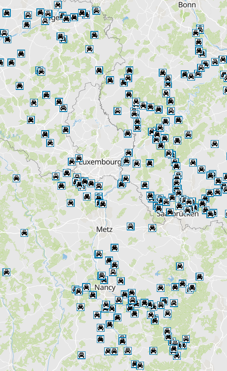
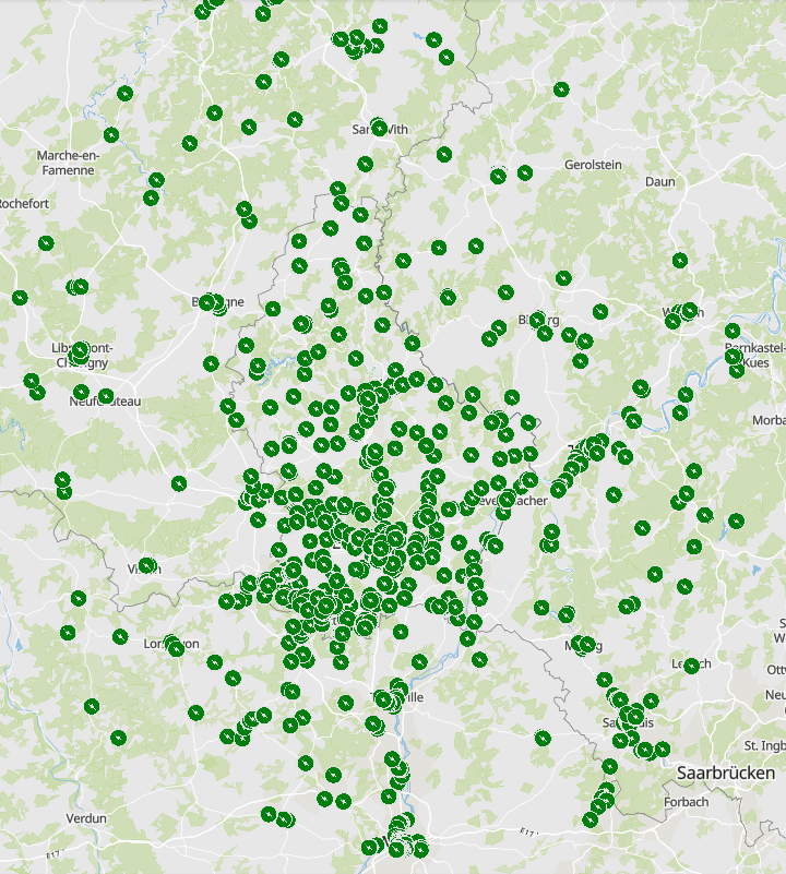
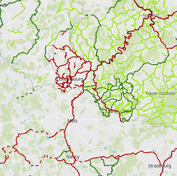
Carpool parkings in the Greater Region 2021 - Sources: BlablaCar, LBM Rheinland-Pfalz, MWAEV Saarland, LVGL Saarland, Service public de Wallonie, Conseil départemental de Meurthe-et-Moselle, MoselleInfoGéo, DREAL Grand Est, Région Grand Est, SANEF. Harmonization: SIG-GR / GIS-GR 2021
-
Carpool parkings within a radius of 40km from the Luxembourgish border - Source: Working party "Transport" of the Summit of the Greater Region. Harmonization: SIG-GR / GIS-GR 2016