 geocatalogue.geoportail.lu
0
Type of resources
Available actions
Topics
Keywords
Contact for the resource
Provided by
Groups
Years
Representation types
Update frequencies
status
Scale
-

3D buildings with LOD 2.3 classification resulting from a proof of concept of 2017. The buildings are modelled based on a photogrammetric evaluation of aerial images from 2017 and are only available on a total area of 3 km2 in Diekirch and Bastendorf.
-
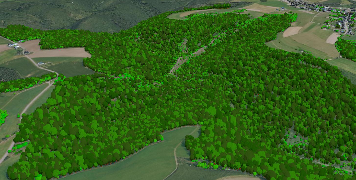
3D models of trees on the national territory of the Grand Duchy of Luxembourg, derived from the point cloud of the LiDAR survey in February 2019. The models do not correspond to the actual shape or type of the trees, but consist of a generalised model that has been scaled according to the tree parameters extracted from the point cloud.
-
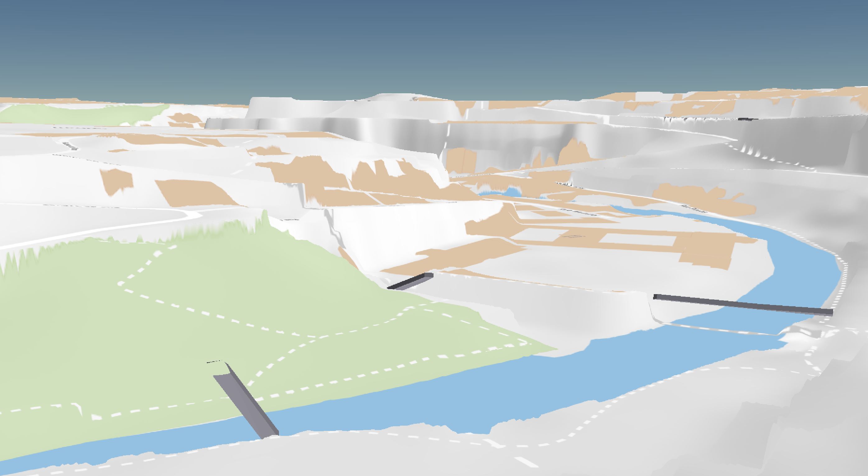
3D models with LOD 1 classification of the bridges on the national territory of the Grand Duchy of Luxembourg in 2019. The 3D models were automatically extracted from the point cloud of the LiDAR survey in February 2019.
-
3D model of the Luxembourg terrain based on vertical and oblique aerial images from summer 2020.
-
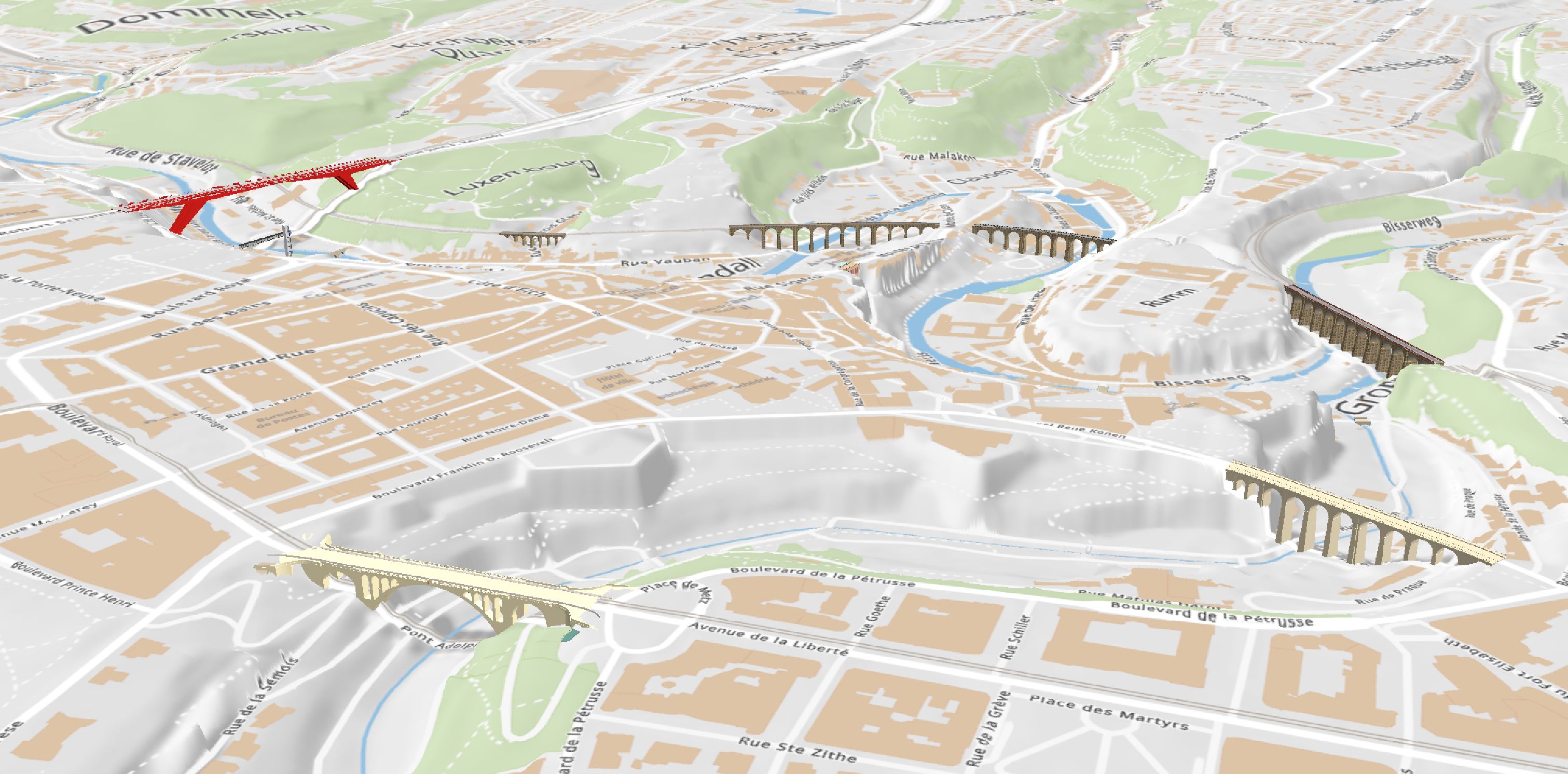
3D models with LOD 3 classification of a selection of remarkable bridges. The 3D models were created partly by the Administration du Cadastre et de la Topographie and partly by the Service Topographie et géomatique of Luxembourg City.
-

-
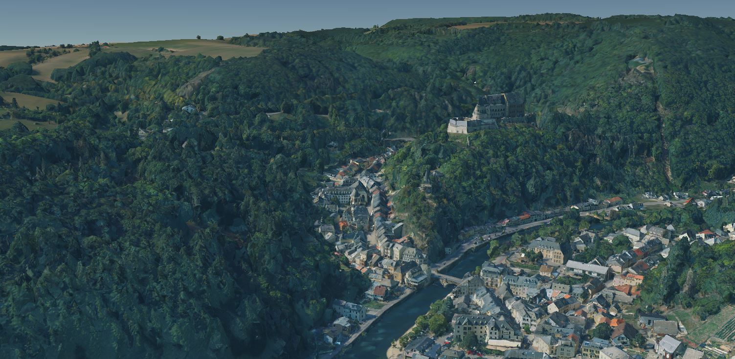
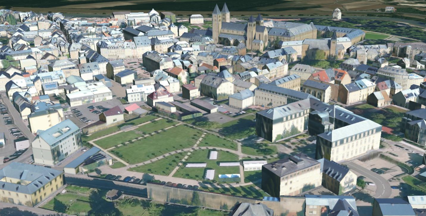
3D buildings with LOD 2.2 classification on the municipal territory of Luxembourg City in 2019.
-
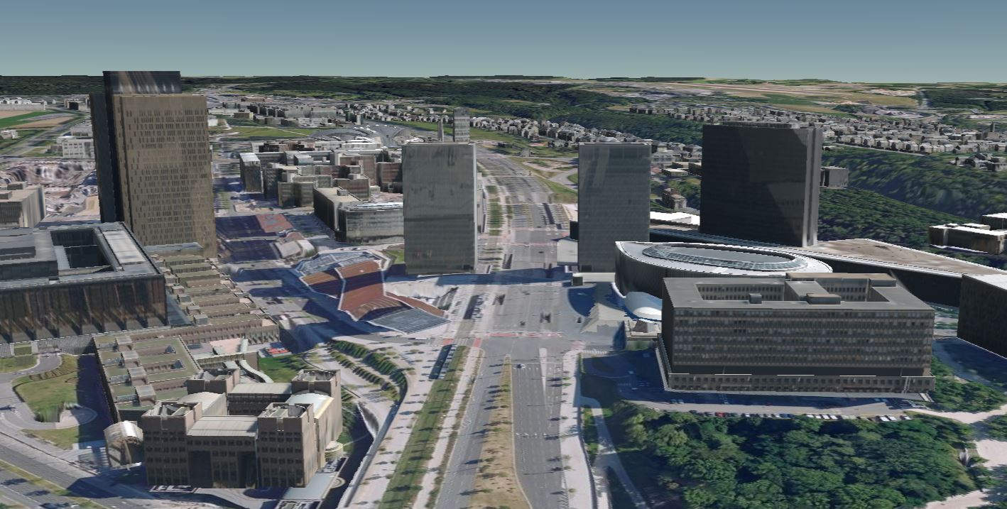
3D buildings with LOD 2.2 classification on the national territory of the Grand Duchy of Luxembourg in 2020, with the exception of the municipal territory of Luxembourg City. The 3D buildings were created on the basis of aerial images from summer 2020 (flight period: end of July, beginning of August and mid-September 2020; flight height: +/- 3500 m above ground level) by photogrammetric restitution of the roofs (MSE in x, y and z ≤ 20 cm), followed by downward extrusion and texturing of the resulting 3D models of the buildings with oblique aerial images. Only the roofs of buildings with a footprint greater than 20 m2 were captured, taking into account superstructures (e.g. dormers) whose longest side exceeds 50 cm and which have a volume greater than 1 m3.
-

-

This layer contains information on potentially polluted sites (sites where use could have caused soil contamination). An entry in the database does not necessarily mean that the soil is polluted.