 geocatalogue.geoportail.lu
2018
Type of resources
Available actions
Topics
Keywords
Contact for the resource
Provided by
Groups
Years
Representation types
Update frequencies
status
Scale
-
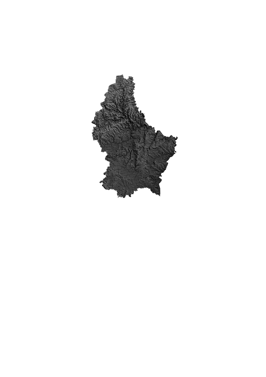
Grayscale relief raster based on Digital Elevation Model from 2017. The DEM from 2017 is based on a photogrammetric exploitation of aerial images and has a ground resolution of 1 m approximately.
-
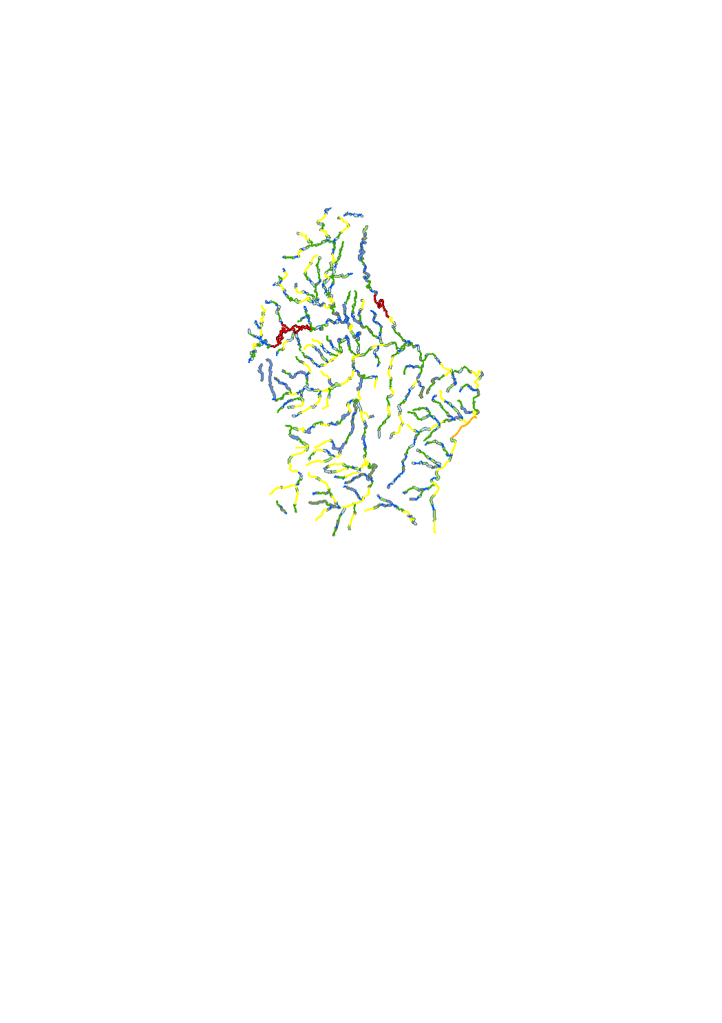
The concept of aquatic habitat connectivity is based on the migration of aquatic species from habitats presenting favorable local conditions to habitats presenting less favorable habitats. Based on the structural quality mapping carried out in 2019-2020 and the planning conditions and restrictions, the watercourse network of the luxemburgish surface water bodies was divided into six categories of functional elements.
-
According to the ordinance of april 16, 2021 of the sanitary protection zones of the Upper Sûre lake, the temporary storage of silage as mentioned in point 6.12.2. (Index 27) of the appendix II, compost (point 6.17.2., index 29, appendix II) and manure as mentioned in point 6.18.2. (index 30) of the appendix II on sub-parcels of the protection zones IIC and III that show a slope of less than 5% is allowed, respecting certain conditions. Citizens concerned can use the map to see which sub-parcels within the agricultural areas are affected.
-
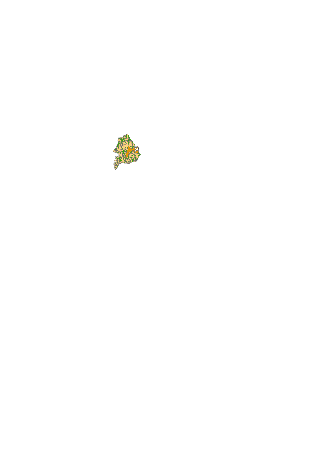
By prohibitions or conditions protected zones to prevent contamination of the lake as a drinking water reservoir.
-

http://amenagement-territoire.public.lu/fr/plans-caractere-reglementaire/plans-sectoriels/logement.html
-
The sectoral plan ‘landscapes’ aims at creating a framework for spatial planning in the context of the management, planing and protection of the landscapes. For this purpose, it defines protection zones for the large landscape units, the interurban green zone, the green belts as well as the protection zone of the ecological network. http://www.dat.public.lu/plans_caractere_reglementaire/plans_sectoriels/paysage/index.html
-

The sectoral plan ‚economic activity zones’ pursues the aim to reserve areas for the development of craft and industrial activities and the economic diversification until 2030, whilst ensuring a balanced and sustainable spatial planning. http://www.dat.public.lu/plans_caractere_reglementaire/plans_sectoriels/zones_activites_economiques/index.html
-

The main objective of the sectoral plan ‘transport’ is to reserve corridors for road and railway infrastructure, to improve and develop the soft mobility and to create a parking space management system in order to increase the share of public transport in the modal split and to promote soft mobility. http://www.dat.public.lu/plans_caractere_reglementaire/plans_sectoriels/transports/index.html
-

Vineyards along the Mosel in Luxemburg