 geocatalogue.geoportail.lu
500
Type of resources
Available actions
Topics
Keywords
Contact for the resource
Provided by
Groups
Years
Representation types
Update frequencies
status
Scale
-
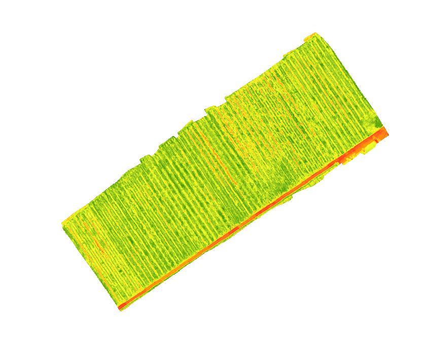
This layer shows the NDVI calculated using the spectral information from a hyperspectral camera (Headwall – Nano) recorded with a drone over the vineyard on September 13, 2021. NDVI (= Normalized Difference Vegetation Index) belongs to the vegetation indices, which can map the vitality of plants by using spectral information in the red and near-infrared. It has a defined value range and can be easily interpreted as healthy vegetation has values from 0.6 to 1 maximum.
-
This layer shows the NDVI calculated using the spectral information from a hyperspectral camera (Headwall – Nano) recorded with a drone over the vineyard on August 23, 2023. NDVI (= Normalized Difference Vegetation Index) belongs to the vegetation indices, which can map the vitality of plants by using spectral information in the red and near-infrared. It has a defined value range and can be easily interpreted as healthy vegetation has values from 0.6 to 1 maximum.
-

This layer shows the NDVI calculated using the spectral information from a hyperspectral camera (Headwall – Nano) recorded with a drone over the vineyard on July 30, 2020. NDVI (= Normalized Difference Vegetation Index) belongs to the vegetation indices, which can map the vitality of plants by using spectral information in the red and near-infrared. It has a defined value range and can be easily interpreted as healthy vegetation has values from 0.6 to 1 maximum.
-

A topographic map is intended to be a representation of the terrain. It differs from thematic maps (city maps, road maps etc.) by the richness of its content, its high precision and above all the representation of the topography by the contour lines. The cadastre and topography administration publishes topographic maps at the scales of 1:5,000, 1:20,000, 1:50,000, 1:100,000 and 1:250,000.
-
This layer shows the NDVI calculated using the spectral information from a hyperspectral camera (Headwall – Nano) recorded with a drone over the vineyard on August 22, 2023. NDVI (= Normalized Difference Vegetation Index) belongs to the vegetation indices, which can map the vitality of plants by using spectral information in the red and near-infrared. It has a defined value range and can be easily interpreted as healthy vegetation has values from 0.6 to 1 maximum.
-

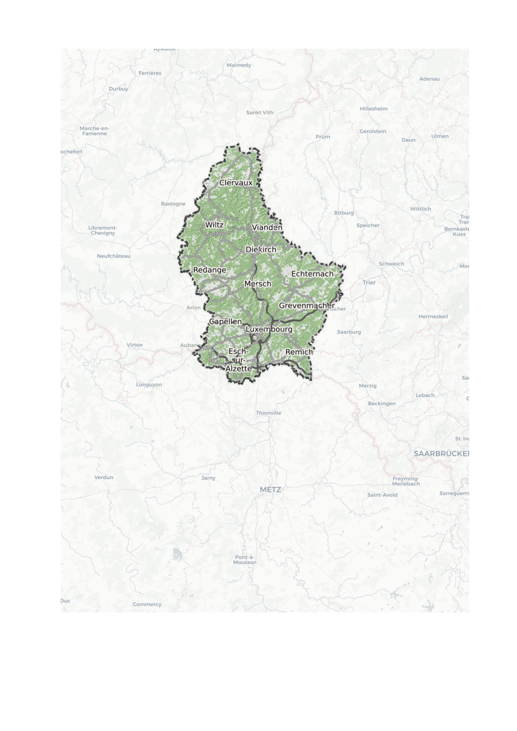
The hybrid map uses the most recent aerial image as background. In addition, it contains roads, street names and locality names.
-

This layer displays the latest aerial image (orthophoto) available. An orthophoto represents a mosaic composed of digital aerial photographs geometrically rectified (orthorectified) and georeferenced in the LUREF national coordinate system. The digital orthophotos of the Grand Duchy are managed in the BD-L-ORTHO database which covers the entire territory of the Grand Duchy of Luxembourg and are accessible both on the national geoportal and on the open data portal (data.public.lu). Since 2016, ACT has carried out an annual survey of the entire country. Other aerial images are available under General public> Land cover> Aerial and satellite images.
-
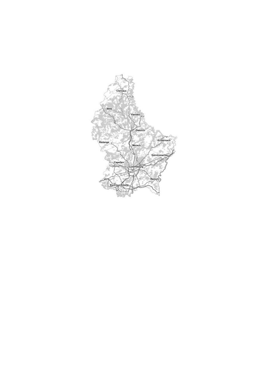
The road map is a multi-scale digital map that contains transport networks, buildings, vegetation and hydrology. It is updated monthly and the new roads are entered at the same time as the changes on the cadastral plan. The road map uses vector tile technology, which gives you new possibilities to display the road map. The style editor gives you the choice between 3 editing modes: - Choose a predefined style: This editing mode provides you with a list of predefined colour palettes, which you can use to colour the map. - Modify the main colors: In this mode you can select an individual colour by theme. You also have the option of activating or deactivating a theme by checking the box. Advanced possibilities: This mode allows you to adapt the style of your map without restrictions. Using the Maputnik external style editor (https://maputnik.github.io/), you can make all kinds of modifications. When you are done editing, you can upload your style. The settings remain stored in your browser. When you are logged in, they are loaded into your profile so that they can be reused on another computer. Of course, the settings can also be used to create a custom background map and integrate it into your own website.
-
A topographic map is intended to be a representation of the terrain. It differs from thematic maps (city maps, road maps etc.) by the richness of its content, its high precision and above all the representation of the topography by the contour lines. The cadastre and topography administration publishes topographic maps at the scales of 1:5,000, 1:20,000, 1:50,000, 1:100,000 and 1:250,000.
-
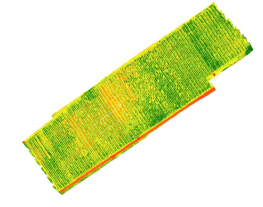
This layer shows the NDVI calculated using the spectral information from a hyperspectral camera (Headwall – Nano) recorded with a drone over the vineyard on September 3, 2019. NDVI (= Normalized Difference Vegetation Index) belongs to the vegetation indices, which can map the vitality of plants by using spectral information in the red and near-infrared. It has a defined value range and can be easily interpreted as healthy vegetation has values from 0.6 to 1 maximum.