 geocatalogue.geoportail.lu
Imagery base maps earth cover
Type of resources
Available actions
Topics
Keywords
Contact for the resource
Provided by
Groups
Years
Representation types
Update frequencies
status
Scale
-
This layer contains the regulations contained in the land use plan of the municipality of Lintgen. The information in this geoportal layer has no legal value and must be considered as mere indications related to the original document. The original plan can be viewed in the local administration.
-

This layer contains the regulations contained in the land use plan of the Préizerdaul municipality. The information in this geoportal layer have no legal value and must be considered as mere indications related to the original document. The original plan can be viewed in the Préizerdaul administration.
-
This layer contains the orthophoto covering the territory of the Préizerdaul municipality, that have been made in 2012 for the municipality administration.
-
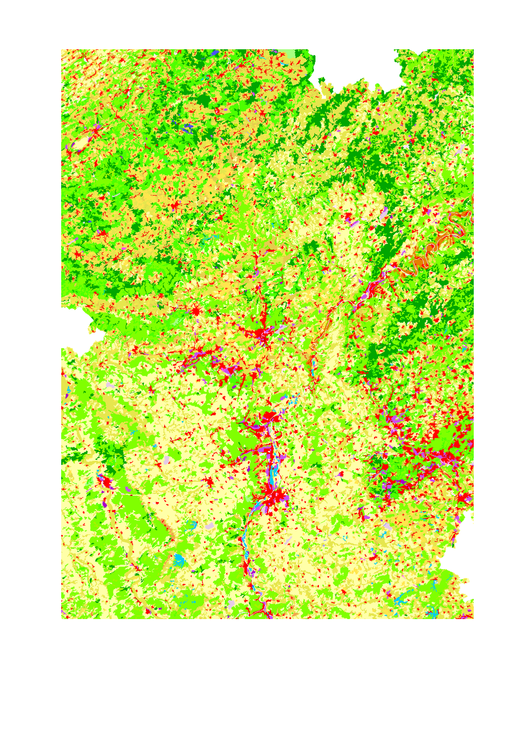
Land use in the Greater Region according to Corine Land Cover 2012 - Source: EEA - Corine Land Cover 2012 European seamless vector database: STATUS 2012 layer (CLC12)
-
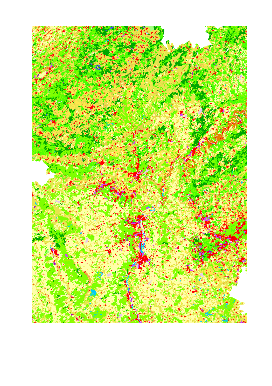
Land use in the Greater Region according to Corine Land Cover 2006 - Source: EEA - Corine Land Cover 2006 European seamless vector database: version 15 (08/2011)
-
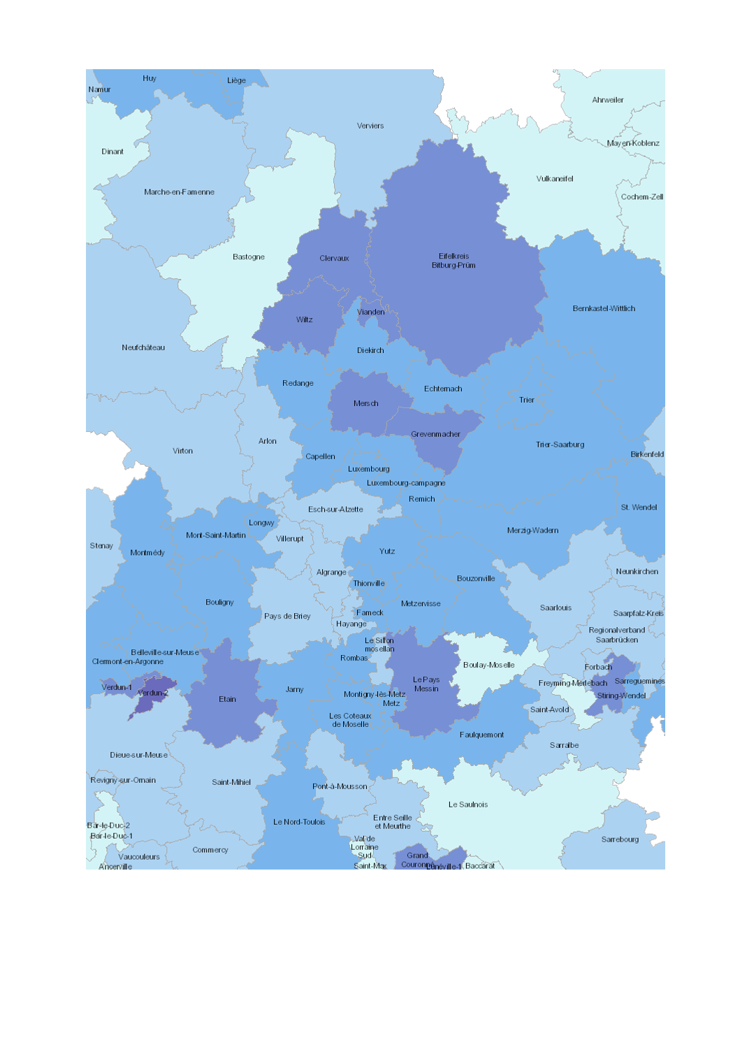
- Change in soil sealing 2(imperviousness) 2009-2015 - Territorial entities: cantons (LOR and LUX), Kreise (RLP and SL), arrondissements (WAL) - Thematic data sources: Imperviousness Density (IMD)2009 & 2015, European Environment Agency. Calculations: LISER 2018 - Geodata sources: © GeoBasis-DE / BKG 2017; IGN France 2017; NGI-Belgium 2017; ACT Luxembourg 2017. Harmonization: SIG-GR / GIS-GR 2018
-
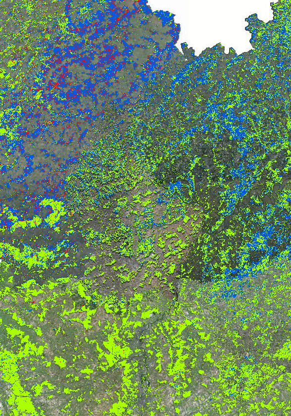
Forest types in the Greater Region 2019 - Source: INTERREG VA project Regiowood II (https://www.regiowood2.info/en) - Data sources and processing: - France/Lorraine: SPOT4-5 images acquired in 2005, RapidEye images acquired in 2010 and 2011. Data processing: ICube-SERTIT University of Strasbourg (https://sertit.unistra.fr) - Belgium: aerial image coverage from 2009, 2012 and 2016, LiDAR coverage 2014. Data processing: Gembloux Agro-Bio Tech University of Liège (https://www.gembloux.ulg.ac.be/gestion-des-ressources-forestieres) - Germany and Luxembourg: cadastral data, Landsat 8 from 2014. Data processing: Umweltfernerkundung & Geoinformatik University of Trier (https://www.fernerkundung.uni-trier.de/) - Data for the entire Greater Region from 2016: Sentinel-2 A/B. Although the classification is based on different methodologies in different regions, the final result is a consistent cross-border map. The accuracy of the classification is 88%. Please note that the date of the "Aerial Imagery" background map data may differ from the Regiowood data depending on the sub-entity of the Greater Region.
-
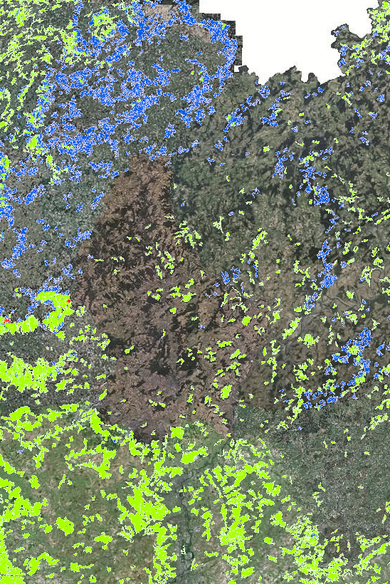
Forest types in the Greater Region 2021 (Lorraine: 2020) - Source: INTERREG VA project Regiowood II (https://www.regiowood2.info/en) - Data: Sentinel-2 from summer 2020 (Grand-Est), spring 2021 (Rhineland-Palatinate, Saarland, Luxembourg) and early summer 2021 (Wallonia). Although the classification is based on different methodologies in different regions, the final result is a consistent cross-border map. The accuracy of the classification is 88%. - Classifications methods: - France: SPOT4-5 images acquired in 2005 from the vegetation layer of the BD Topo (IGN). Data processing: ICube-SERTIT University of Strasbourg (https://sertit.unistra.fr) - Belgium: aerial image coverage from 2009, 2012 and 2016, LiDAR coverage 2014. Data processing: Gembloux Agro-Bio Tech University of Liège (https://www.gembloux.ulg.ac.be/gestion-des-ressources-forestieres) - Rhineland-Palatinate and Saarland: use of cadastral data (ATKIS). Data processing: Umweltfernerkundung & Geoinformatik University of Trier (https://www.uni-trier.de/universitaet/fachbereiche-faecher/fachbereich-vi/faecher/erdbeobachtung-und-klimaprozesse/umweltfernerkundung-und-geoinformatik) - Luxembourg: use of the dataset "arrondissements forestiers" from ANF. Data processing: Umweltfernerkundung & Geoinformatik University of Trier (https://www.uni-trier.de/universitaet/fachbereiche-faecher/fachbereich-vi/faecher/erdbeobachtung-und-klimaprozesse/umweltfernerkundung-und-geoinformatik) Please note that the date of the "Aerial Imagery" background map data may differ from the Regiowood data depending on the sub-entity of the Greater Region.
-

Forest types in the Greater Region 2016 - Source: INTERREG VA project Regiowood II (https://www.regiowood2.info/en) - Data sources and processing: - France/Lorraine: SPOT4-5 images acquired in 2005, RapidEye images acquired in 2010 and 2011. Data processing: ICube-SERTIT University of Strasbourg (https://sertit.unistra.fr) - Belgium: aerial image coverage from 2009, 2012 and 2016, LiDAR coverage 2014. Data processing: Gembloux Agro-Bio Tech University of Liège (https://www.gembloux.ulg.ac.be/gestion-des-ressources-forestieres) - Germany and Luxembourg: cadastral data, Landsat 8 from 2014. Data processing: Umweltfernerkundung & Geoinformatik University of Trier (https://www.fernerkundung.uni-trier.de/) - Data for the entire Greater Region from 2016: Sentinel-2 A/B. Although the classification is based on different methodologies in different regions, the final result is a consistent cross-border map. The accuracy of the classification is 88%. Please note that the date of the "Aerial Imagery" background map data may differ from the Regiowood data depending on the sub-entity of the Greater Region.
-
This layer contains the regulations contained in the land use plan of the Remich municipality. The information in this geoportal layer have no legal value and must be considered as mere indications related to the original document. The original plan can be viewed in the Préizerdaul administration.