 geocatalogue.geoportail.lu
intranet
Type of resources
Available actions
Topics
Keywords
Contact for the resource
Provided by
Groups
Years
Representation types
Update frequencies
status
Service types
Scale
-
WMS which contains all layers of map.geoportail.lu with exactly the same structure (identical tree structure and layer numbers). The service contains maps (images), get featureinfo (click on image), legends and metadata.
-
This layer contains the trails provided by the nature parc Our.
-
This layer contains the other services situated in the nature parc Our
-
This layer contains the rescue services situated in the nature parc Our
-
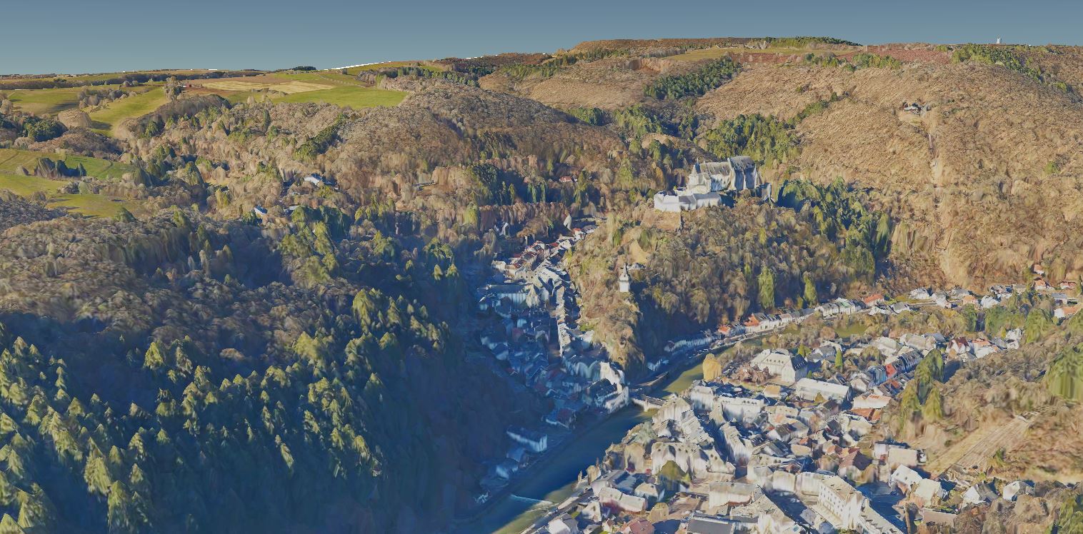
3D model of the Luxembourg terrain based on vertical aerial images from winter 2019.
-

Enchanted forests, narrow paths, bizarre rock formations, overwhelming views, extensive mountain plateaus, deeply incised river valleys – all this can be experienced on the Éislek Pied. In total, the Éislek region counts 18 of these circular trails, which are based on the strict criteria of the European Hiking Association and are referred to as "quality tours".
-

This layer contains the proportion of Frenchmen among the population by municipality recorded during the population census of the 8th November 2021.
-
According to Articles 6 to 14 of Directive 2008/50/EC of the European Parliament and of the Council (15), the two following areas have been defined for Luxembourg: (1) One area, called here “Active”, groups historical LCPU and CES districts as well as all cities where a high urbanization degree (1 or 2) and cities with a lower degree but which are surrounded by cities with a higher degree and impacted by traffic. Some cities from the border of the country (Germany/Luxembourg) filling these criteria have also been considered. Isolated cities of the urbanization map belonging to the same district and located between cities with high level of urbanization and showing high level of traffic have also been included in the Active area. (2) The second area, called “Rural” represents the area of the country where the traffic, the density of inhabitants and the number of industries are low. The total number of inhabitants of this area would be 151097 for 2021.
-
This layer contains the population density by municipality recorded during the population census of the 8th November 2021.
-

This layer contains the proportion of Belgiums among the population by municipality recorded during the population census of the 8th November 2021.