 geocatalogue.geoportail.lu
2022
Type of resources
Available actions
Topics
Keywords
Contact for the resource
Provided by
Groups
Years
Representation types
Update frequencies
status
Scale
-
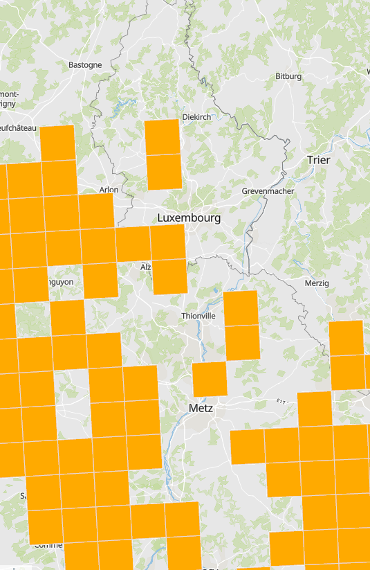
Presence of the Southern damselfly (Coenagrion mercuriale) - Illustration as grid cells 10x10km - Data sources: MNHN Luxemburg, MNHN France, Ministerium für Umwelt und Verbraucherschutz Saarland, Landesamt für Umwelt (LfU) Rheinland-Pfalz, SPW/ARNE/DEMNA, Natagora and collaborators
-
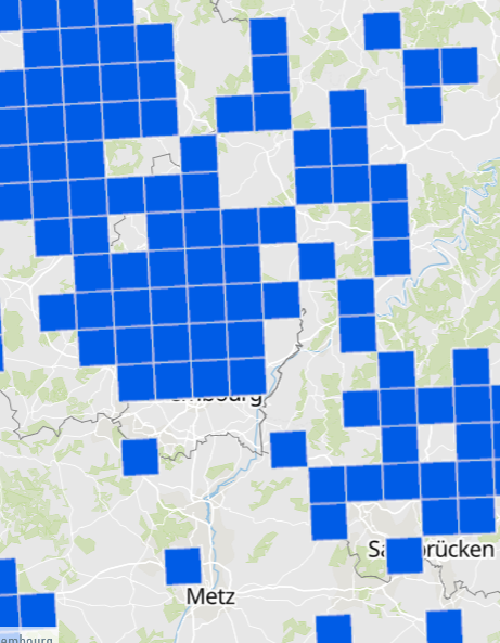
Presence of the Common midwife toad (Alytes obstetricans) - Illustration as grid cells 10x10km - Data sources: MNHN Luxemburg, MNHN France, Ministerium für Umwelt und Verbraucherschutz Saarland, Landesamt für Umwelt (LfU) Rheinland-Pfalz, SPW/ARNE/DEMNA, Natagora and collaborators
-
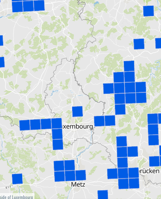
Presence of the Natterjack Toad (Bufo calamita) - Illustration as grid cells 10x10km - Data sources: MNHN Luxemburg, MNHN France, Ministerium für Umwelt und Verbraucherschutz Saarland, Landesamt für Umwelt (LfU) Rheinland-Pfalz, SPW/ARNE/DEMNA, Natagora and collaborators
-
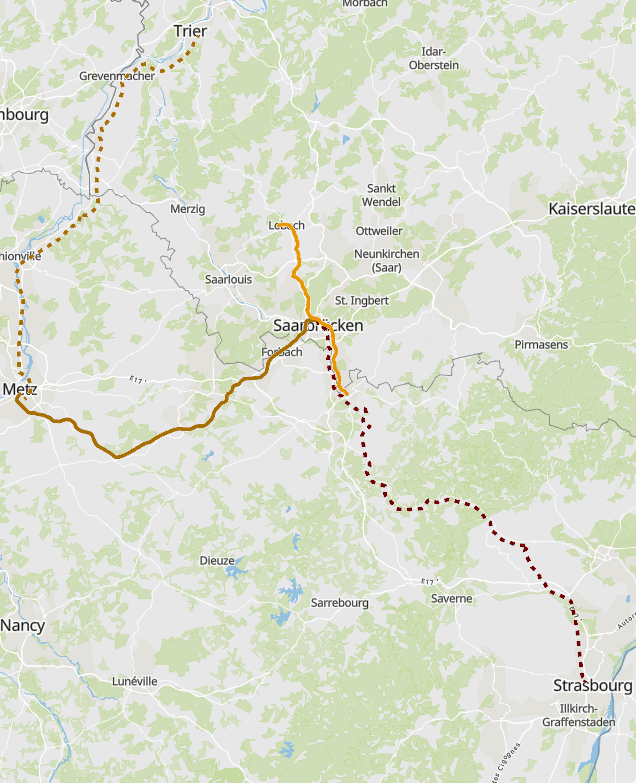
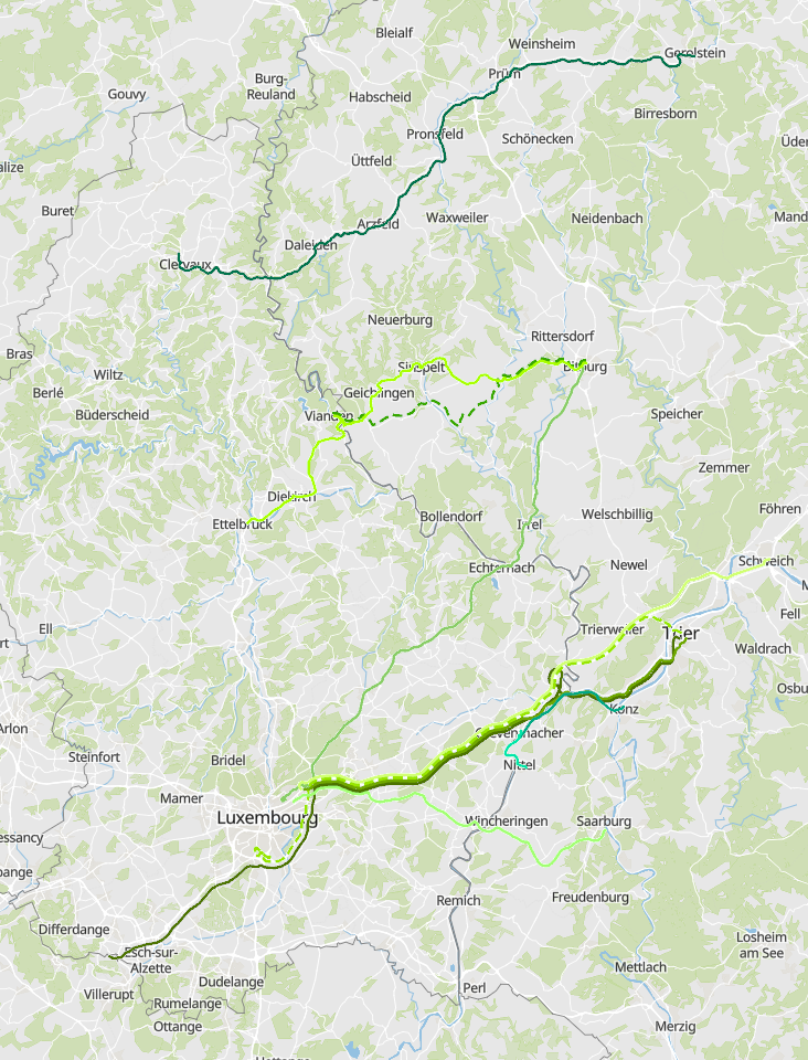
Cross-border railway lines France-Germany in 2022 - Data sources: SNCF Grand Est, DB, Ministerium für Umwelt Saarland. Harmonization: SIG-GR / GIS-GR 2022
-
Cross-border bus lines Luxembourg-Saarland in 2022 - Data sources: Ministère de la Mobilité et des Travaux publics (LU), Zweckverband Personennahverkehr Saarland (ZPS). Harmonization: SIG-GR / GIS-GR 2022
-
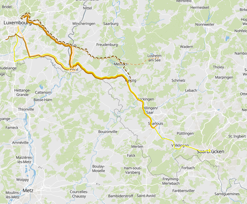
Cross-border bus lines Luxembourg-Rhineland-Palatinate in 2022 - Data sources: Ministère de la Mobilité et des Travaux publics (LU), Verkehrsverbund Region Trier. Harmonization: SIG-GR / GIS-GR 2022
-
Cross-border bus lines Rhineland-Palatinate - East Belgium in 2022 - Data sources: Verkehrsverbund Region Trier. Harmonization: SIG-GR / GIS-GR 2022
-
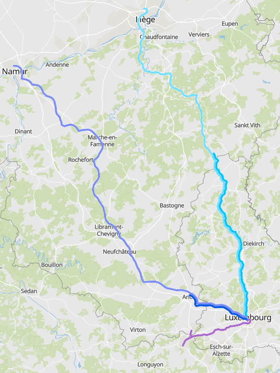
Cross-border railway lines Luxembourg-Belgium in 2022 - Data sources: SNCB, CFL. Harmonization: SIG-GR / GIS-GR 2022
-
Cartography of cross profiles of a representative river section every 1000 meters. The assessment of the rate of river incision was calculated from the ratio between bankfull height and bankfull width.
-
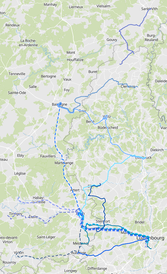
Cross-border bus lines Luxembourg-Wallonie in 2022 - Data sources: Ministère de la Mobilité et des Travaux publics (LU), Opérateur de Transport de Wallonie – OTW. Harmonization: SIG-GR / GIS-GR 2022