 geocatalogue.geoportail.lu
2019
Type of resources
Available actions
Topics
Keywords
Contact for the resource
Provided by
Groups
Years
Representation types
Update frequencies
status
Scale
-
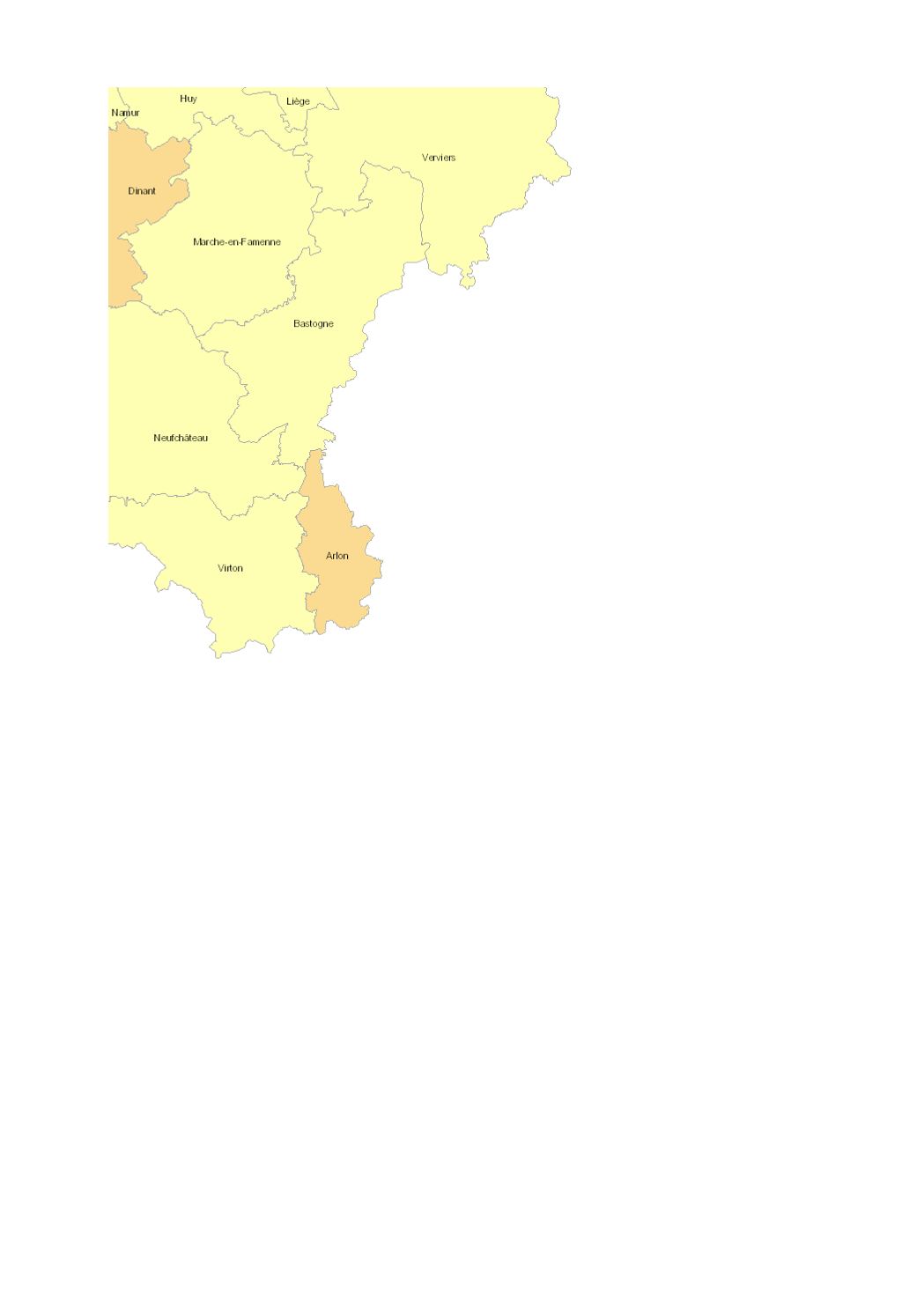
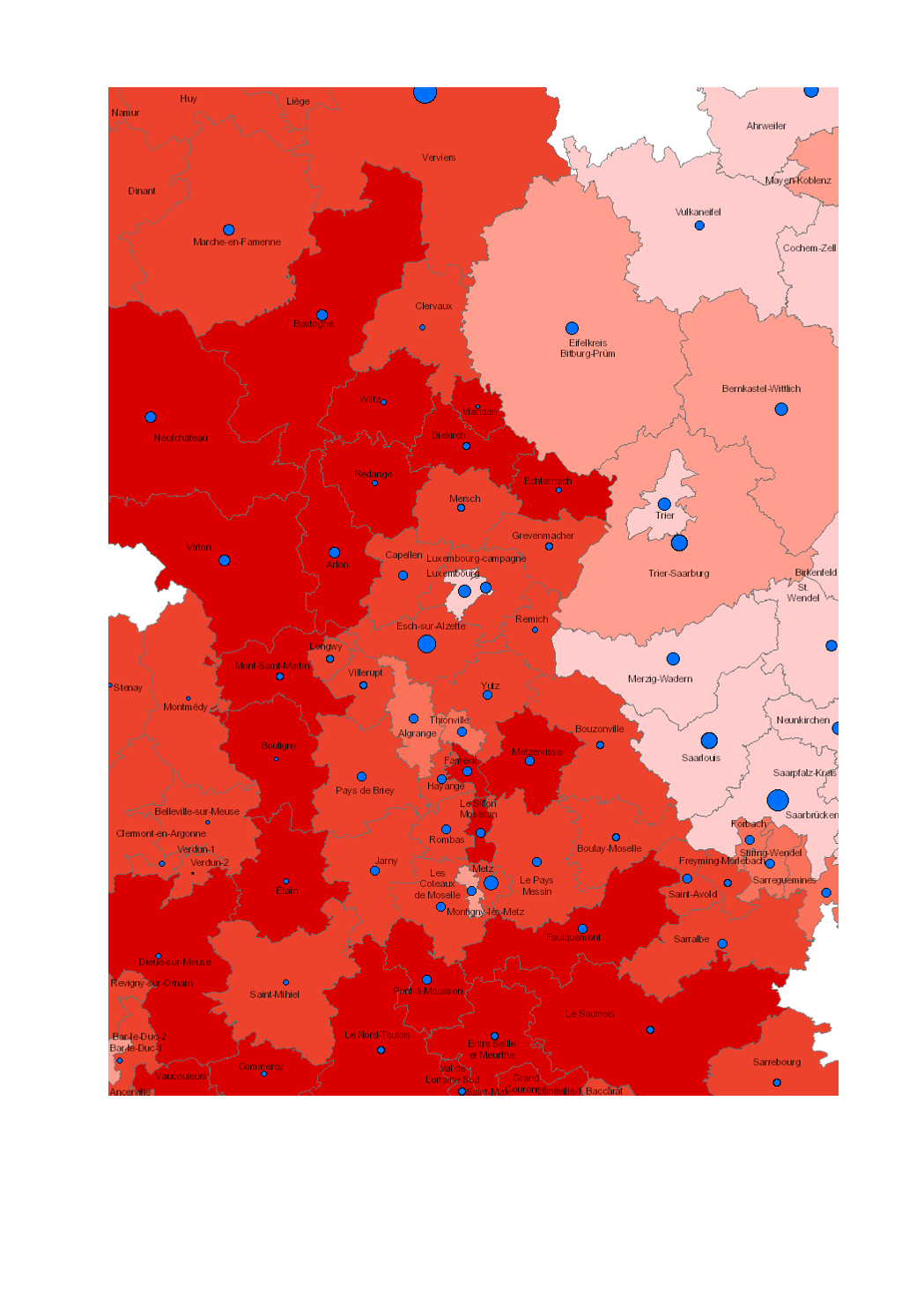
- Cross-border commuters from Wallonia to France at place of residence (Arrondissements): 2007-2017 - Territorial entities: Arrondissements - Commuting data sources: INAMI 2018. Calculations: OIE/IBA 2018 - Geodata sources: NGI-Belgium 2017. Harmonization: SIG-GR / GIS-GR 2018
-
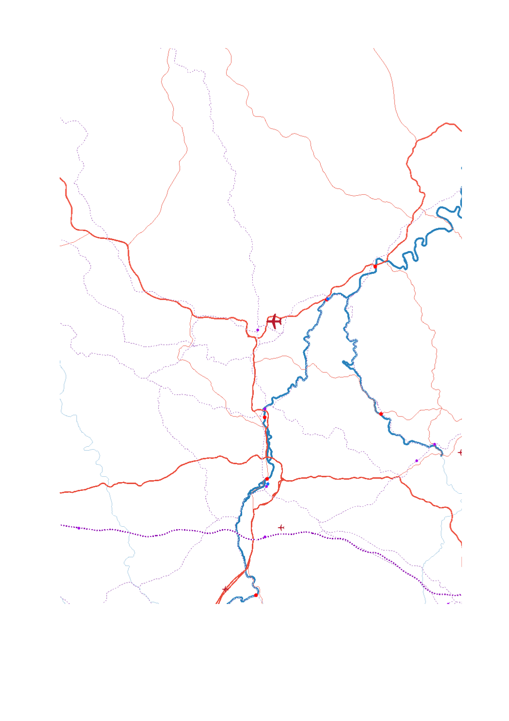
- Airport passengers 2017 - Trimodal hubs rail-road-water - Ports TEN-T Airport passengers 2017 - High-speed railway lines - Railway lines TEN-T - Main roads (core network TEN-T - Secondary roads (comprehensive network TEN-T) - Navigable waterways - Maritime links - Sources: GISCO 2017; SIG-GR / GIS-GR 2017; European Environment Agency - 2012; OSM-2017; European Commission 2017; EUROSTAT 2018. Harmonization: CREAT-UCL 2018
-
- Number of nights spent and nights/population ratio in 2016 - Territorial level: NUTS 2 - Sources: Eurostat - European Commission 2016, EuroGeographics 2013. Harmonization: Lepur - ULiège
-
Population (%) aged 30-34 with tertiary educational attainment in 2019 - Territorial entities: NUTS 2 - Data source: European Commission, Eurostat/GISCO 2021. Harmonization: GIS-GR 2022
-
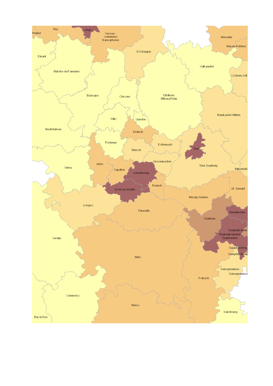
- Population density 2017 (inhabitants per km²), Lorraine: 2015 - Territorial entities: arrondissements (Wallonie), zones d'emploi (Lorraine), cantons (Luxembourg), Kreise (Saarland, Rheinland-Pfalz) - Statistical data sources: INSEE Grand Est; DG Statistique - Statistics Belgium; Eurostat; STATEC. Harmonization: IBA / OIE 2018 - Geodata sources: GeoBasis-DE / BKG 2017; IGN France 2017; NGI-Belgium 2017; ACT Luxembourg 2017. Harmonization: SIG-GR / GIS-GR 2018
-
Share (%) of GDP going to Research and Development (R&D) in 2013 - Territorial entities: NUTS 2 - Data source: Eurostat - European Commission 2013; EuroGeographics 2013. Harmonization: Lepur - ULiège 2018
-
Final product of the b-solutions project GeoConnectGR: lakes and reservoirs - Harmonized geodata of the hydrographic network of the Greater Region (scale 1:25.000 - 1:50.000) - Sources: LVGL Saarland, LVermGeo Rheinland-Pfalz, NGI Belgium, IGN France, ACT Luxembourg - Harmonization: Federal Agency for Cartography and Geodesy (BKG) based on the data model Core Reference Data (CRD) developed by EuroGeographics - This data is published for non-commercial uses under the licence CC BY-NC 4.0: https://creativecommons.org/licenses/by-nc/3.0/legalcode
-
- Increase and decrease in working age population (20-64 years) 2000-2016 - Change in working age population (20-64 years) 2000-2016 (%, Lorraine: 1999-2014) - Territorial entities: arrondissements (Wallonie), cantons (Lorraine, Luxembourg), Kreise (Saarland, Rheinland-Pfalz) - Statistical data sources: INSEE Grand Est, Statistisches Landesamt Rheinland-Pfalz, Statistisches Amt Saarland, STATEC, IWEPS. Calculations: LISER 2018 - Geodata sources: ACT Luxembourg 2017, IGN France 2017, GeoBasis-DE / BKG 2017, NGI-Belgium 2017. Harmonization: SIG-GR / GIS-GR 2018
-
- Number of under 20-year-olds in 2016 - Share of under 20-year-olds in the total population 2016 (Lorraine: 2014, Luxembourg: 2017) - Territorial entities: arrondissements (Wallonie), cantons (Lorraine, Luxembourg), Kreise (Saarland, Rheinland-Pfalz) - Statistical data sources: INSEE Grand Est, Statistisches Landesamt Rheinland-Pfalz, Statistisches Amt Saarland, STATEC, IWEPS. Calculations: LISER 2018 - Geodata sources: ACT Luxembourg 2017, IGN France 2017, GeoBasis-DE / BKG 2017, NGI-Belgium 2017. Harmonization: SIG-GR / GIS-GR 2018
-
- Population density 2016 (inhabitants per km²) per municipality - Statistical data sources: INSEE Grand Est, IWEPS, Statistisches Landesamt Rheinland-Pfalz, Statistisches Amt Saarland, STATEC. Harmonization: LISER 2018 - Geodata sources: ACT Luxembourg 2017, IGN France 2017, GeoBasis-DE / BKG 2017, NGI-Belgium 2017. Harmonization: SIG-GR / GIS-GR 2018