 geocatalogue.geoportail.lu
Housing
Type of resources
Available actions
Keywords
Contact for the resource
Provided by
Groups
Representation types
Update frequencies
status
Scale
-
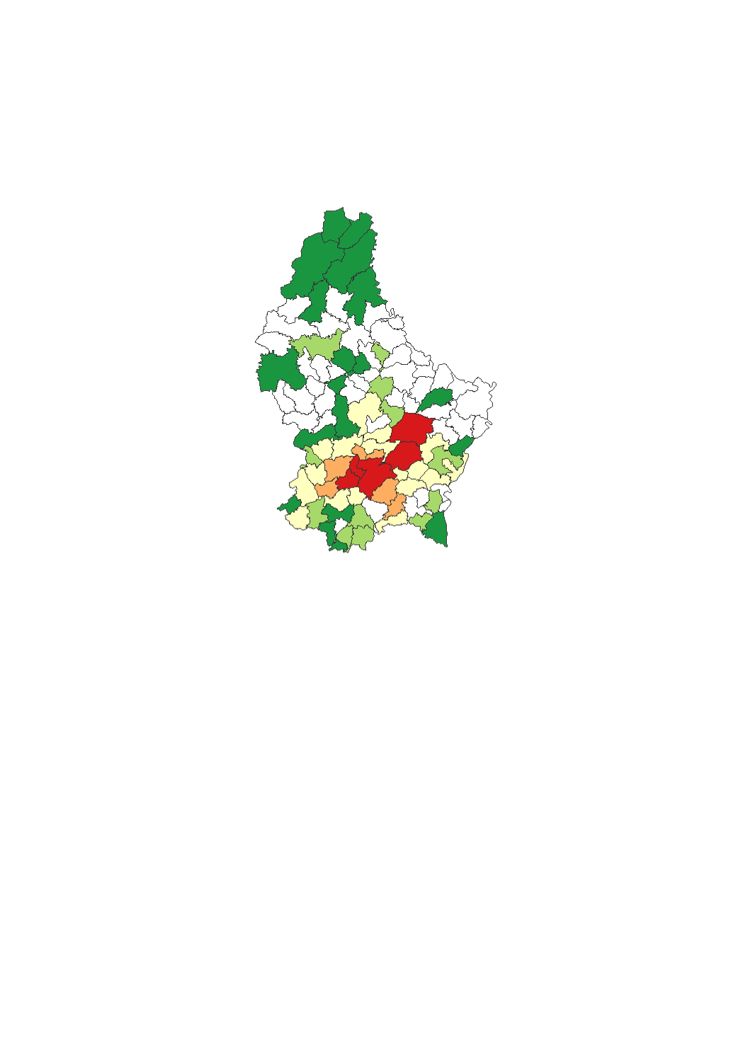
The land area in which rebuilding occurred corresponds to the land plots on which a building existing in 2010 was demolished and replaced by a new building by 2016 (regardless of whether it includes dwellings or not), within the residential and the mixed-used areas in the municipalities' general land use plans (PAG). These areas were captured by comparing the orthophoto-images. The data sources are the digitalized cadastral parcels and the orthophoto-images from the "Administration du Cadastre et de la Topographie", as well as the PAG of the municipalities.
-
This layer contains the transaction prices for the apartments under construction (VEFA - "ventes en état futur d'achèvement") as recorded in the notarial deeds. The prices are expressed at municipal level in euros per square meter and refer to the average price over a one-year period. The number of transactions reported corresponds to the number of sales after selections and processing. The statistics are presented with a 3% VAT rate (within the limit of the total tax benefit capped at 50 000 euros per dwelling). The prices are calculated from data provided by the "Administration de l'Enregistrement et des Domaines".
-
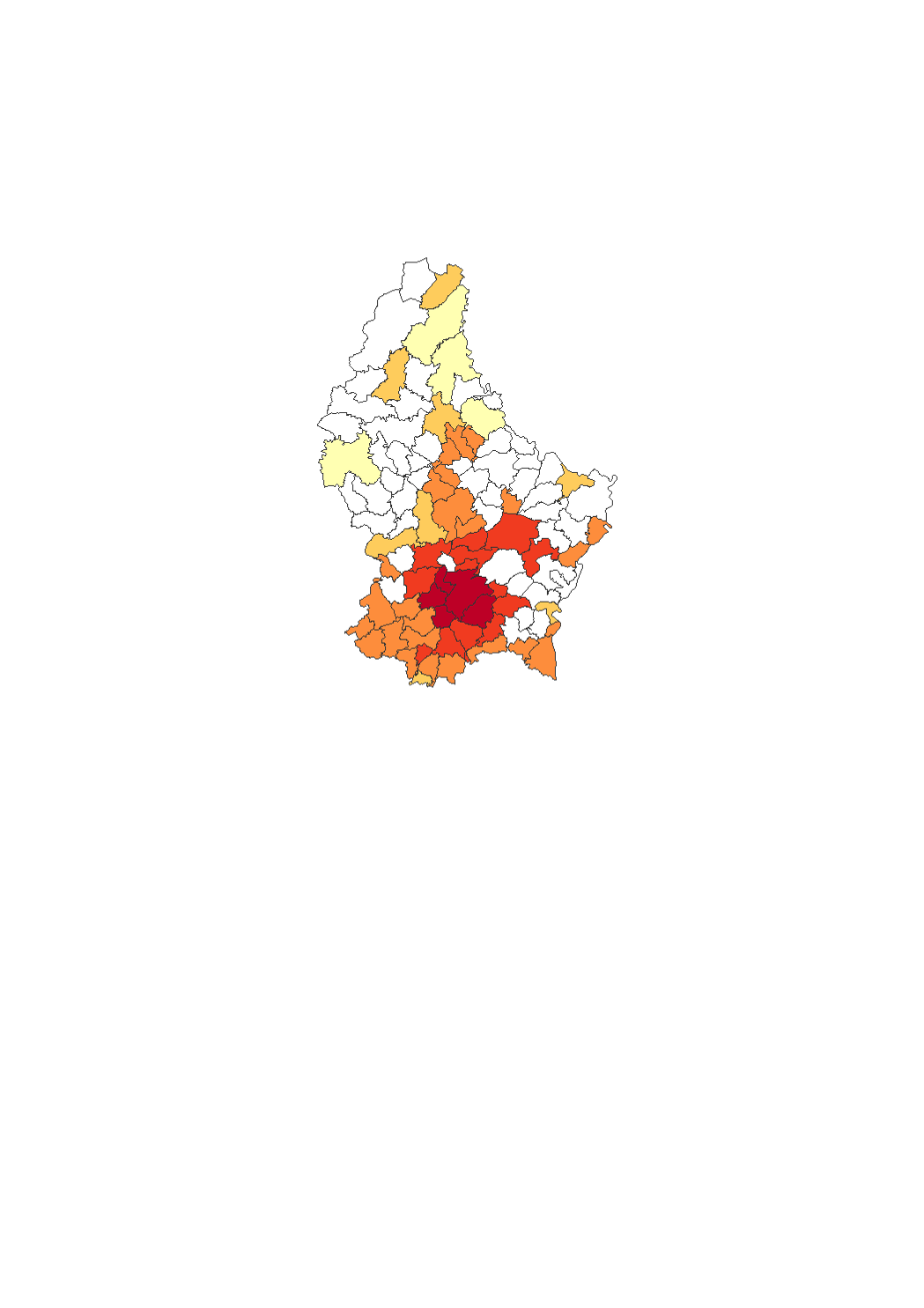
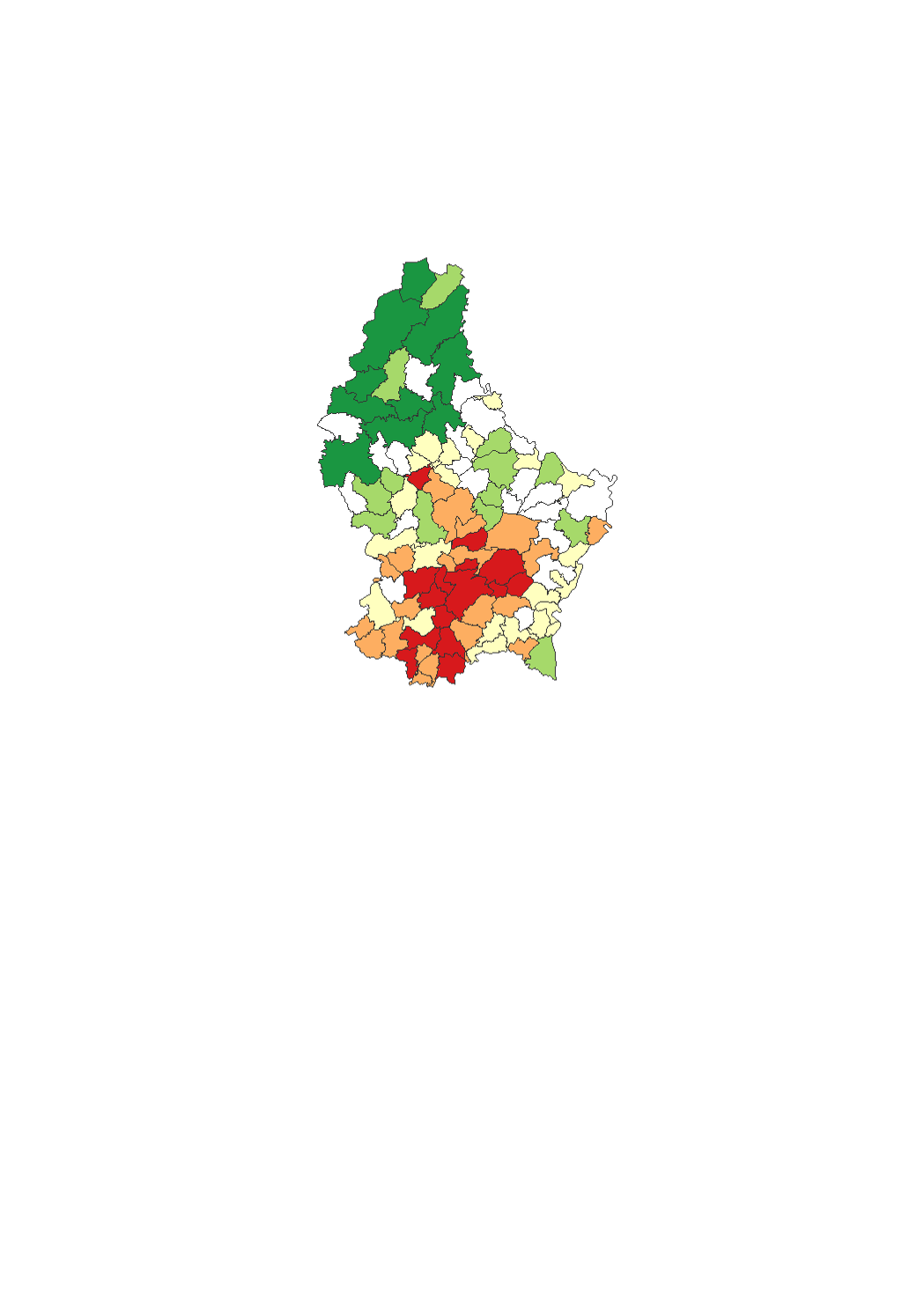
This layer contains the transaction prices recorded in the notarial deeds of the sold land plots which are located within the residential and mixed-used areas and which are free of any construction (in euros/are). The median price corresponds to the value at which 50% of the transactions are lower and 50% higher. Given the limited number of transactions per year in a very large number of municipalities, median municipal prices are represented over a three-year period. The reported number of transactions corresponds to the number of sales after selections and processing. The prices are calculated from data provided by the "Administration de l'Enregistrement et des Domaines".
-
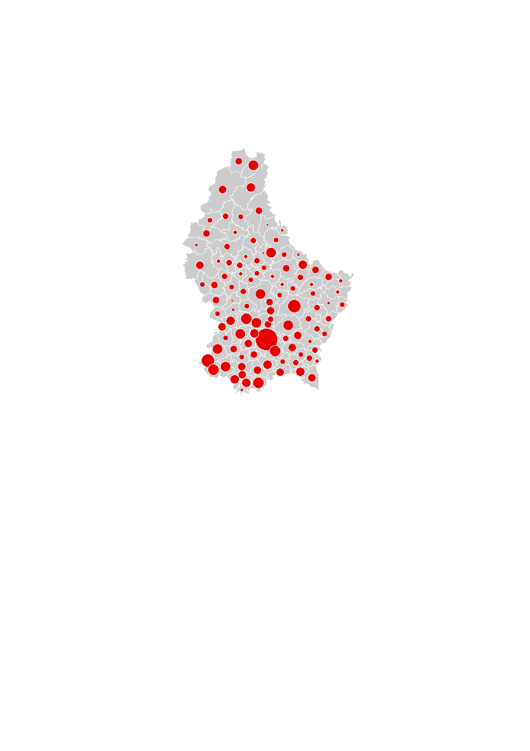
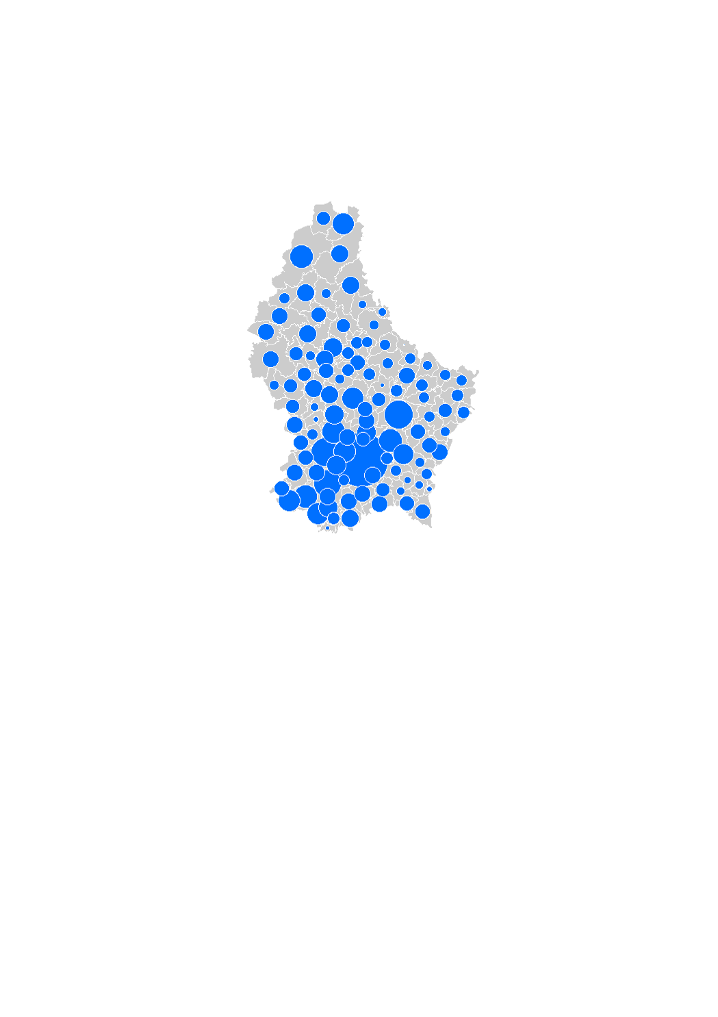
This layer contains the transaction prices for the existing apartments as recorded in the notarial deeds. The prices are expressed at municipal level in euros per square meter and refer to the average price over a one-year period. The number of transactions reported corresponds to the number of sales after selections and processing. The prices are calculated from data provided by the "Administration de l'Enregistrement et des Domaines".
-
The land area used for residential production corresponds to the land plots which were vacant at the beginning of the observation period and on which stood a building at the end of the observation period within the residential and the mixed-used areas in the municipalities' general land use plans (PAG). Thus, only the areas on which a building was constructed (regardless of whether it includes dwellings or not) are taken into account in the land consumption, without considering the plots on which roads, car parks etc. were build. These areas were captured by comparing the orthophoto-images. The data sources are the digitalized cadastral parcels and the orthophoto-images from the "Administration du Cadastre et de la Topographie", as well as the PAG of the municipalities.
-
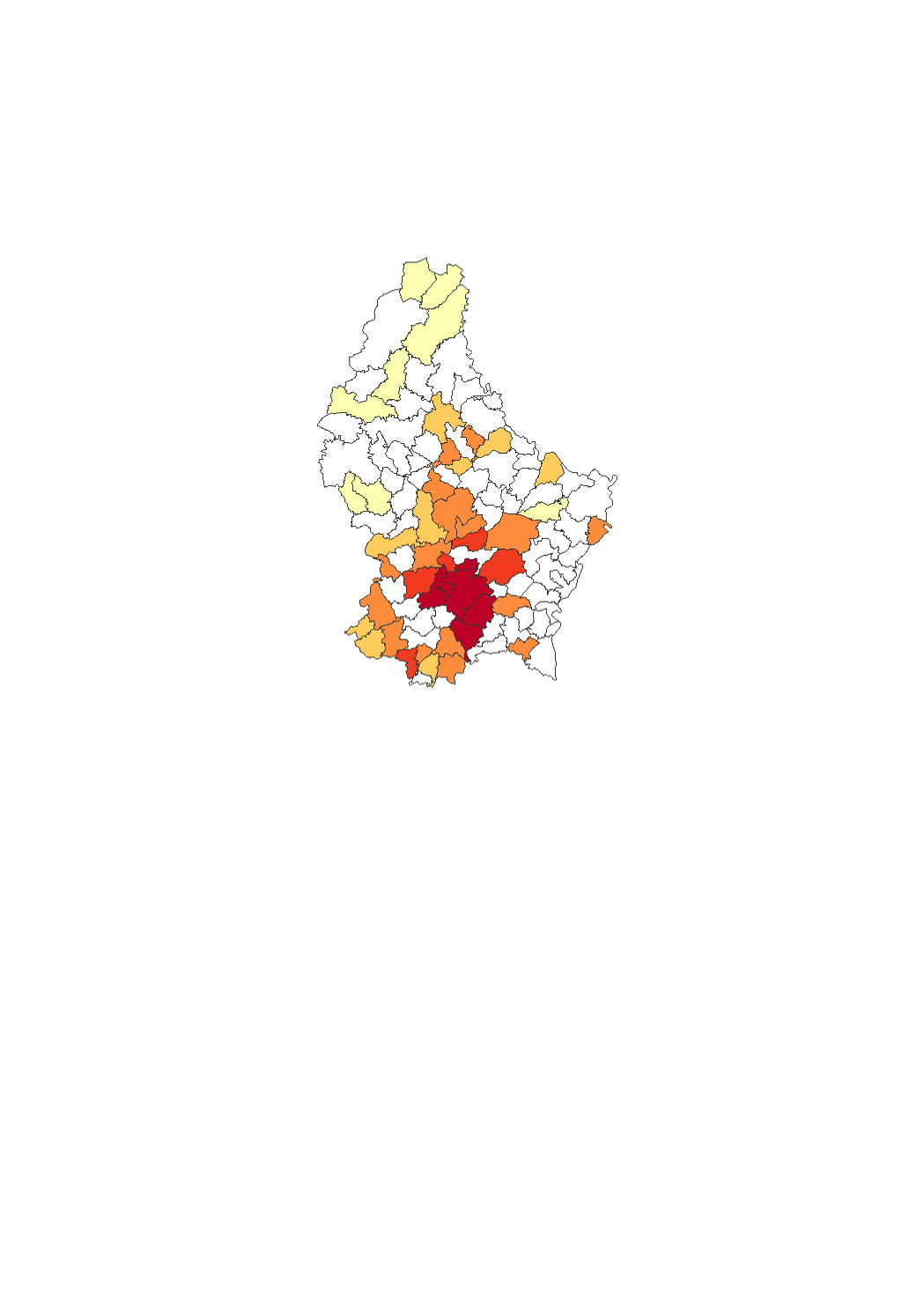
This layer contains the rents of the apartments as they are advertised in the real estate ads. Thus, only new rents are taken into account and not current contracts. Rents are expressed at municipal level in euros per square meter and refer to the average rent over a one-year period. The number of observations reported corresponds to the number of offers after selections and processing. Rents are calculated from data of real estate advertisements published in the daily and specialized press and on the Internet.
-

The land available for housing corresponds to all the vacant land within the residential areas and to 75% of vacant land within the mixed-used areas in the municipalities' general land use plans (PAG) (in hectares). This is a theoretical potential, independently of the will of the owners to develop the land. The data sources are the digitalized cadastral parcels and the orthophoto-images from the "Administration du Cadastre et de la Topographie", as well as the PAG and PAP of the municipalities digitalized in collaboration with the Ministry of Interior.
-
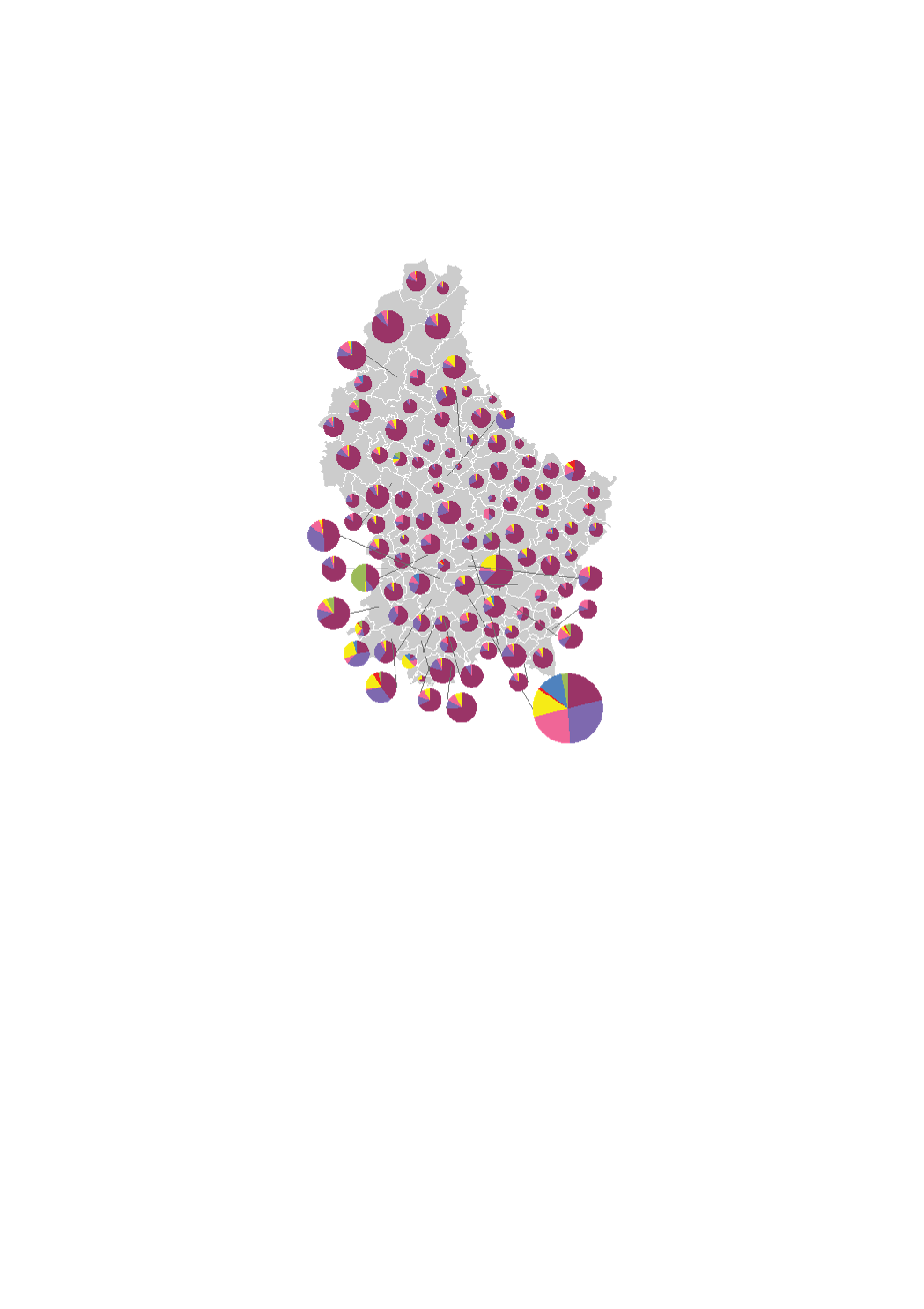
The land available for housing by type of owner corresponds to all the vacant land within the residential areas and to 75% of vacant land within the mixed-used areas in the municipalities' general land use plans (PAG) (in hectares). The type of owners are on the one hand private owners (individuals, legal entities, co-ownerships) and on the other hand public actors (municipalities, State, Funds, SNHBM). This is a theoretical potential, independently of the will of the owners to develop the land. The data sources are the digitalized cadastral parcels, the orthophoto-images and the type of owner from the "Administration du Cadastre et de la Topographie", as well as the PAG and PAP of the municipalities digitalized in collaboration with the Ministry of Interior.
-
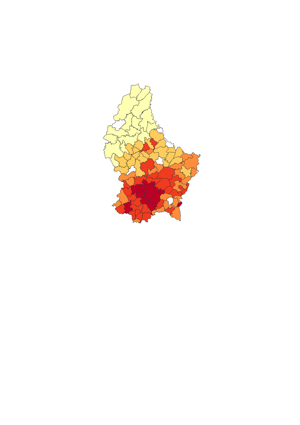
This layer contains the rents of the houses as they are advertised in the real estate ads. Thus, only new rents are taken into account and not current contracts. Rents are expressed at municipal level in euros and refer to the average rent over a one-year period. The number of observations reported corresponds to the number of offers after selections and processing. Rents are calculated from data of real estate advertisements published in the specialized press and on the Internet.