 geocatalogue.geoportail.lu
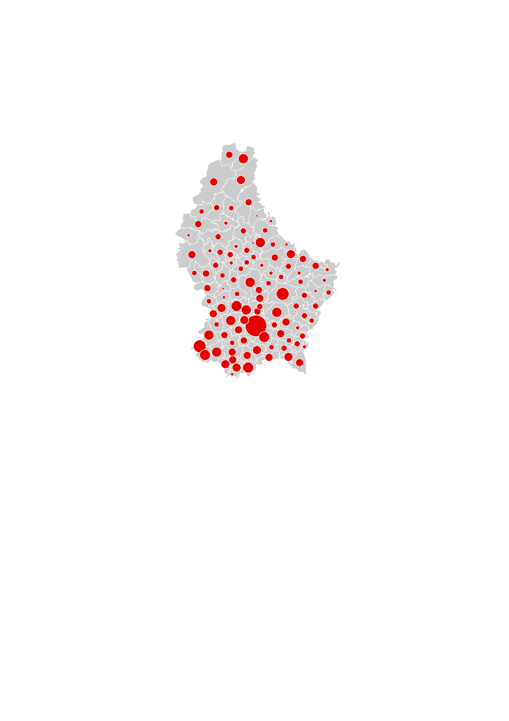
Land area in which rebuilding occurred (2016-2022)
The land area in which rebuilding occurred corresponds to the land plots on which a building existing in 2010 was demolished and replaced by a new building by 2016 (regardless of whether it includes dwellings or not), within the residential and the mixed-used areas in the municipalities' general land use plans (PAG). These areas were captured by comparing the orthophoto-images.
The data sources are the digitalized cadastral parcels and the orthophoto-images from the "Administration du Cadastre et de la Topographie", as well as the PAG of the municipalities.
Simple
- Citation identifier
- / ea8570b2-f85b-4445-a5d1-a63ac01fa2c1
- Presentation form
- Digital map
- Status
- On going
- Maintenance and update frequency
- As needed
-
Entités au Grand-Duché de Luxembourg
-
-
Grand-Duché du Luxembourg
-
- Keywords
-
-
rebuilding, residential land
-
- Keywords
-
-
geoportail.lu
-
-
geoportail.lu themes
-
-
Housing
-
-
geoportail.lu structure
-
-
Housing>Land consumption / rebuilding
-
- Access constraints
- Other restrictions
- Spatial representation type
- Vector
- Denominator
- 0
- Character set
- UTF8
))
- Reference system identifier
- EPSG / http://www.opengis.net/def/crs/EPSG/0/2169
- OnLine resource
-
Protocol Linkage Name OGC:WMS-1.3.0-http-get-map
https://wms.geoportail.lu/public_map_layers/service 1747
https://map.geoportail.lu/theme/main?version=3&zoom=8&X=667917&Y=6394482&lang=fr&layers=1747&opacities=1 Land area in which rebuilding occurred (2010-2016)
Metadata
- File identifier
- ea8570b2-f85b-4445-a5d1-a63ac01fa2c1 XML
- Metadata language
- Français
- Character set
- UTF8
- Hierarchy level
- Dataset
- Hierarchy level name
-
dataset
- Date stamp
- 2023-10-02T13:32:32
- Metadata standard name
-
ISO 19115:2003/19139
- Metadata standard version
-
1.0
- Metadata author
-
Organisation name Individual name Electronic mail address Role LISER
Observatoire de l'Habitat du Ministère du Logement
Point of contact
- Other language
-
Language Character encoding Luxembourgish; Letzeburgesch UTF8 English UTF8 German UTF8 French UTF8
)))