 geocatalogue.geoportail.lu
2023
Type of resources
Available actions
Topics
Keywords
Contact for the resource
Provided by
Groups
Years
Representation types
Update frequencies
status
Scale
-
Biosphere reserves in 2022: buffer zones - Data sources: Ministère de l’Environnement, du Climat et du Développement durable (LU), Ministère de l’Énergie et de l’Aménagement du territoire (LU), Biosphärenzweckverband, LVGL, Ministerium für Umwelt und Verbraucherschutz Saarland, Parc naturel régional des Vosges du Nord, Naturschutzverwaltung Rheinland-Pfalz. Harmonization: SIG-GR / GIS-GR 2022
-
Presence of the Stag beetle (Lucanus cervus) - Illustration as grid cells 10x10km - Data sources: MNHN Luxemburg, MNHN France, Ministerium für Umwelt und Verbraucherschutz Saarland, Landesamt für Umwelt (LfU) Rheinland-Pfalz, SPW/ARNE/DEMNA, Natagora and collaborators
-

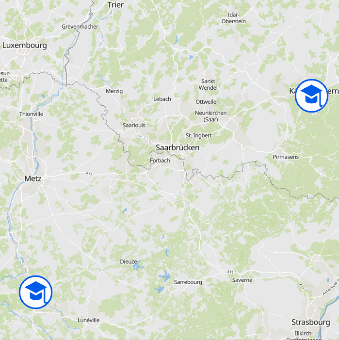
UniGR cross-border study programme: EEIGM - École Européenne d'Ingénieurs en Génie des Matériaux (M.Sc.) - Source: UniGR
-
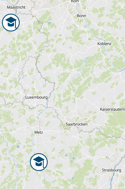
UniGR cross-border study programme: Industrial Engineering (B.Sc.) - Source: UniGR
-
UniGR cross-border study programme: AMASE - Erasmus Mundus Master in Advanced Material Science and Engineering (M.Sc.) - Source: UniGR
-
UniGR cross-border study programme: Industrial Engineering (M.Sc.) - Source: UniGR
-
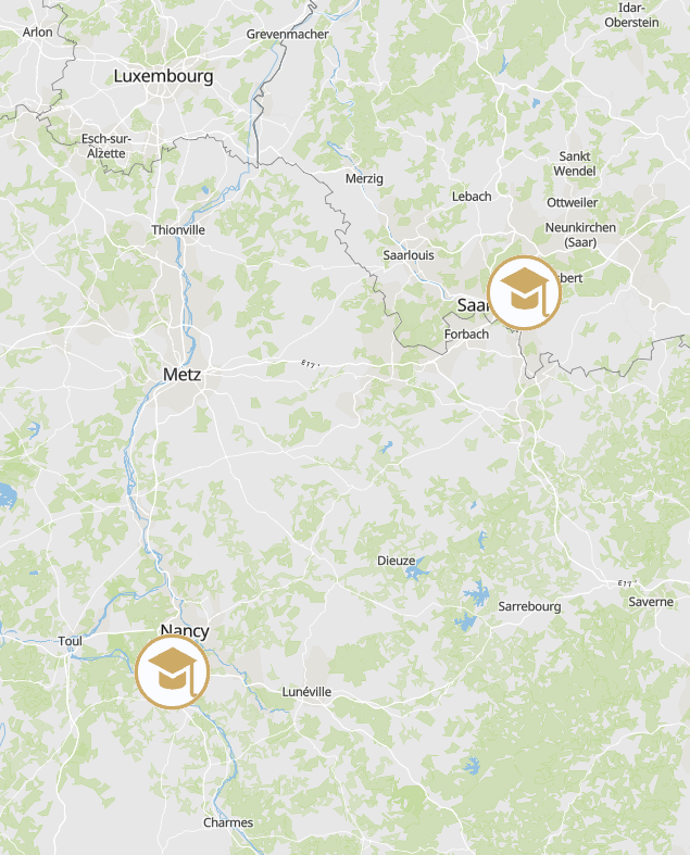
UniGR cross-border study programme: EMERALD: Erasmus Mundus Master in Georesources Engineering - Source: UniGR
-
UniGR cross-border study programme: Erasmus Mundus Master in Language and Communication Technologies (MA) - Source: UniGR
-
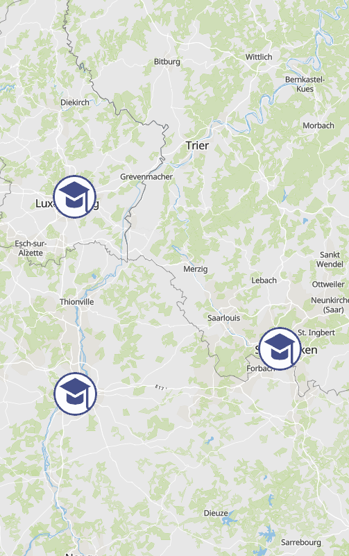
UniGR cross-border study programme: European Construction Management (B.Sc.) - Source: UniGR
-
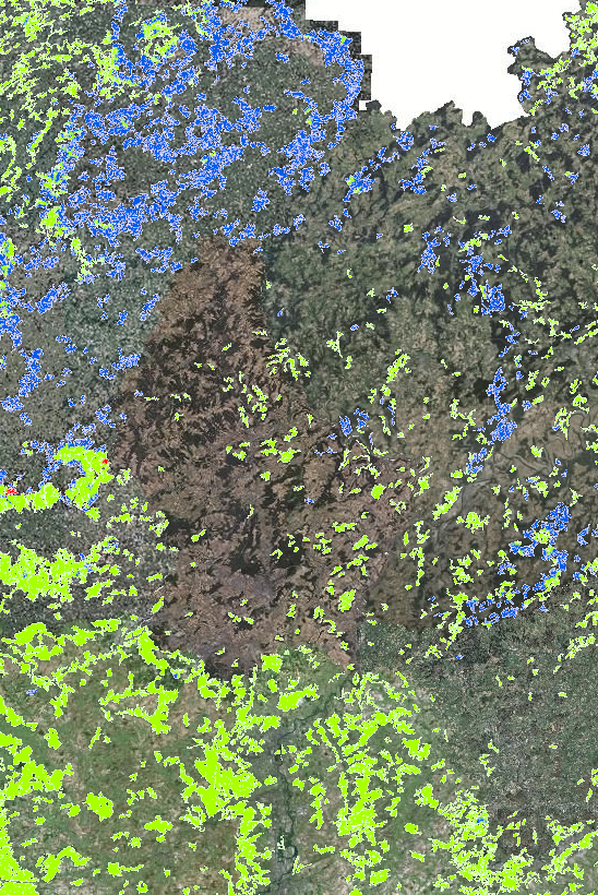
Forest types in the Greater Region 2021 (Lorraine: 2020) - Source: INTERREG VA project Regiowood II (https://www.regiowood2.info/en) - Data: Sentinel-2 from summer 2020 (Grand-Est), spring 2021 (Rhineland-Palatinate, Saarland, Luxembourg) and early summer 2021 (Wallonia). Although the classification is based on different methodologies in different regions, the final result is a consistent cross-border map. The accuracy of the classification is 88%. - Classifications methods: - France:: SPOT4-5 images acquired in 2005 from the vegetation layer of the BD Topo (IGN). Data processing: ICube-SERTIT University of Strasbourg (https://sertit.unistra.fr) - Belgium: aerial image coverage from 2009, 2012 and 2016, LiDAR coverage 2014. Data processing: Gembloux Agro-Bio Tech University of Liège (https://www.gembloux.ulg.ac.be/gestion-des-ressources-forestieres) - Rhineland-Palatinate and Saarland: use of cadastral data (ATKIS). Data processing: Umweltfernerkundung & Geoinformatik University of Trier (https://www.uni-trier.de/universitaet/fachbereiche-faecher/fachbereich-vi/faecher/erdbeobachtung-und-klimaprozesse/umweltfernerkundung-und-geoinformatik) - Luxembourg: use of the dataset "arrondissements forestiers" from ANF. Data processing: Umweltfernerkundung & Geoinformatik University of Trier (https://www.uni-trier.de/universitaet/fachbereiche-faecher/fachbereich-vi/faecher/erdbeobachtung-und-klimaprozesse/umweltfernerkundung-und-geoinformatik) Please note that the date of the "Aerial Imagery" background map data may differ from the Regiowood data depending on the sub-entity of the Greater Region.