 geocatalogue.geoportail.lu
Keyword
pedology
Type of resources
Available actions
Topics
Keywords
Contact for the resource
Provided by
Groups
Representation types
Update frequencies
status
Scale
From
1
-
2
/
2
-
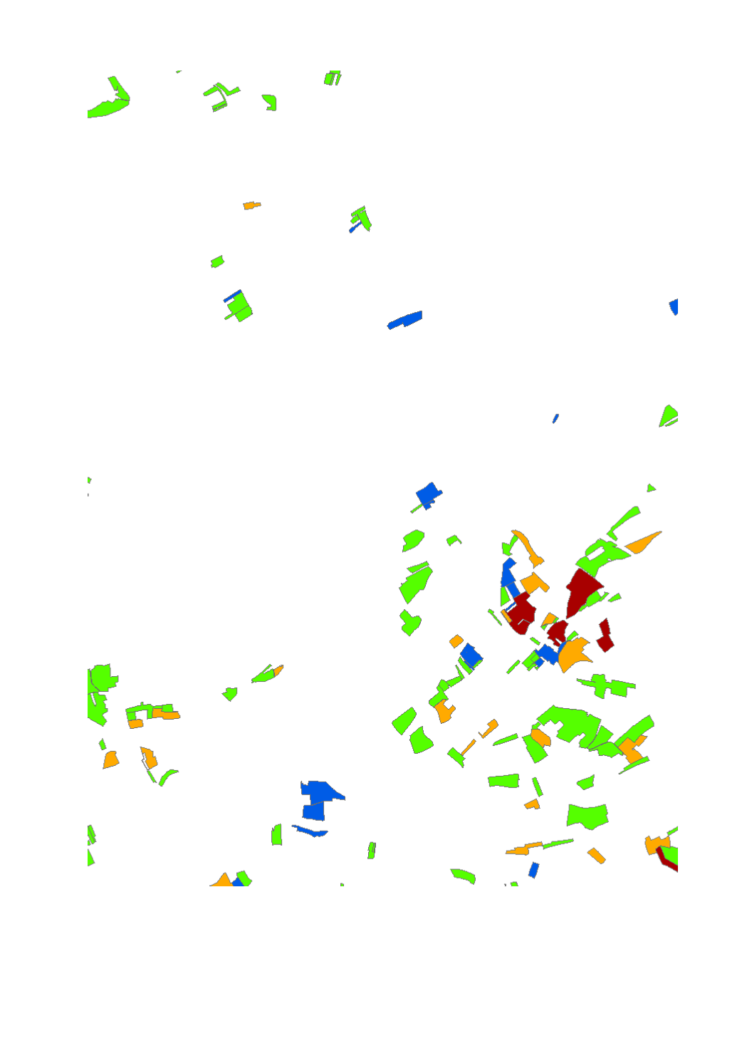
This layer shows the classification of the erosion risk in arable land for the cropping year 2023-2024. The risk categories are: "very low","low","medium","high".
-
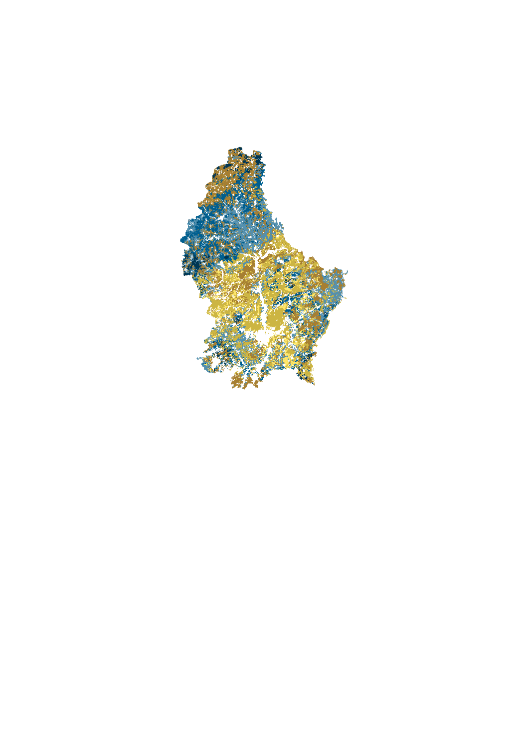
Modeling of the content of topsoil organic carbon (%) in croplands (0-25 cm), permanent grasslands (0-10 cm), vineyards (0-30 cm) and forests (0-20 cm). Based on soil analysis data collected between 2012-2014 (agriculture, vineyards) and 1998-2001 (forest).