 geocatalogue.geoportail.lu
50000
Type of resources
Available actions
Topics
Keywords
Contact for the resource
Provided by
Groups
Years
Representation types
Update frequencies
status
Scale
-
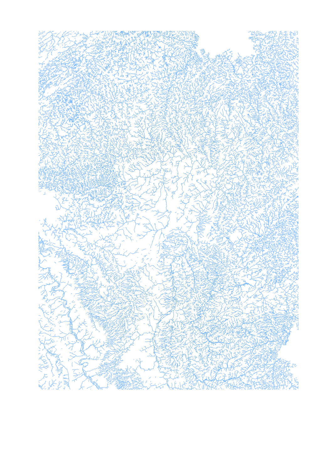
Final product of the b-solutions project GeoConnectGR: linear watercourses - Harmonized geodata of the hydrographic network of the Greater Region (scale 1:25.000 - 1:50.000) - Sources: LVGL Saarland, LVermGeo Rheinland-Pfalz, NGI Belgium, IGN France, ACT Luxembourg - Harmonization: Federal Agency for Cartography and Geodesy (BKG) based on the data model Core Reference Data (CRD) developed by EuroGeographics - This data is published for non-commercial uses under the licence CC BY-NC 4.0: https://creativecommons.org/licenses/by-nc/3.0/legalcode
-
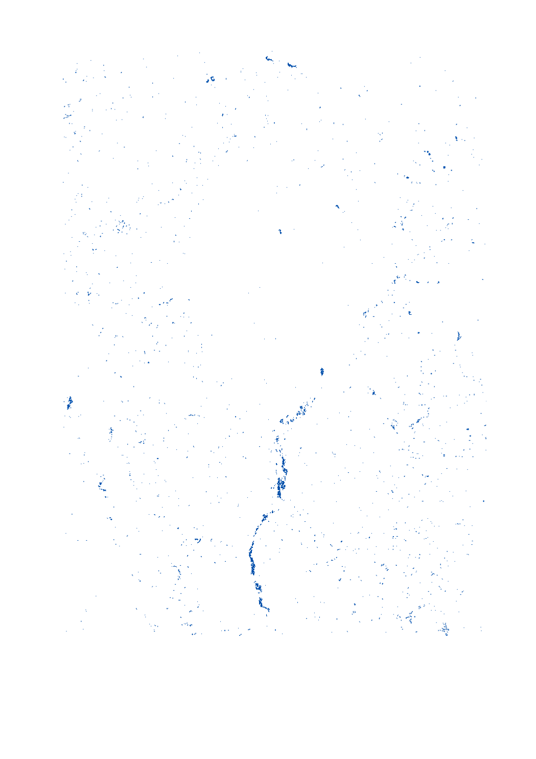
Final product of the b-solutions project GeoConnectGR: lakes and reservoirs - Harmonized geodata of the hydrographic network of the Greater Region (scale 1:25.000 - 1:50.000) - Sources: LVGL Saarland, LVermGeo Rheinland-Pfalz, NGI Belgium, IGN France, ACT Luxembourg - Harmonization: Federal Agency for Cartography and Geodesy (BKG) based on the data model Core Reference Data (CRD) developed by EuroGeographics - This data is published for non-commercial uses under the licence CC BY-NC 4.0: https://creativecommons.org/licenses/by-nc/3.0/legalcode
-
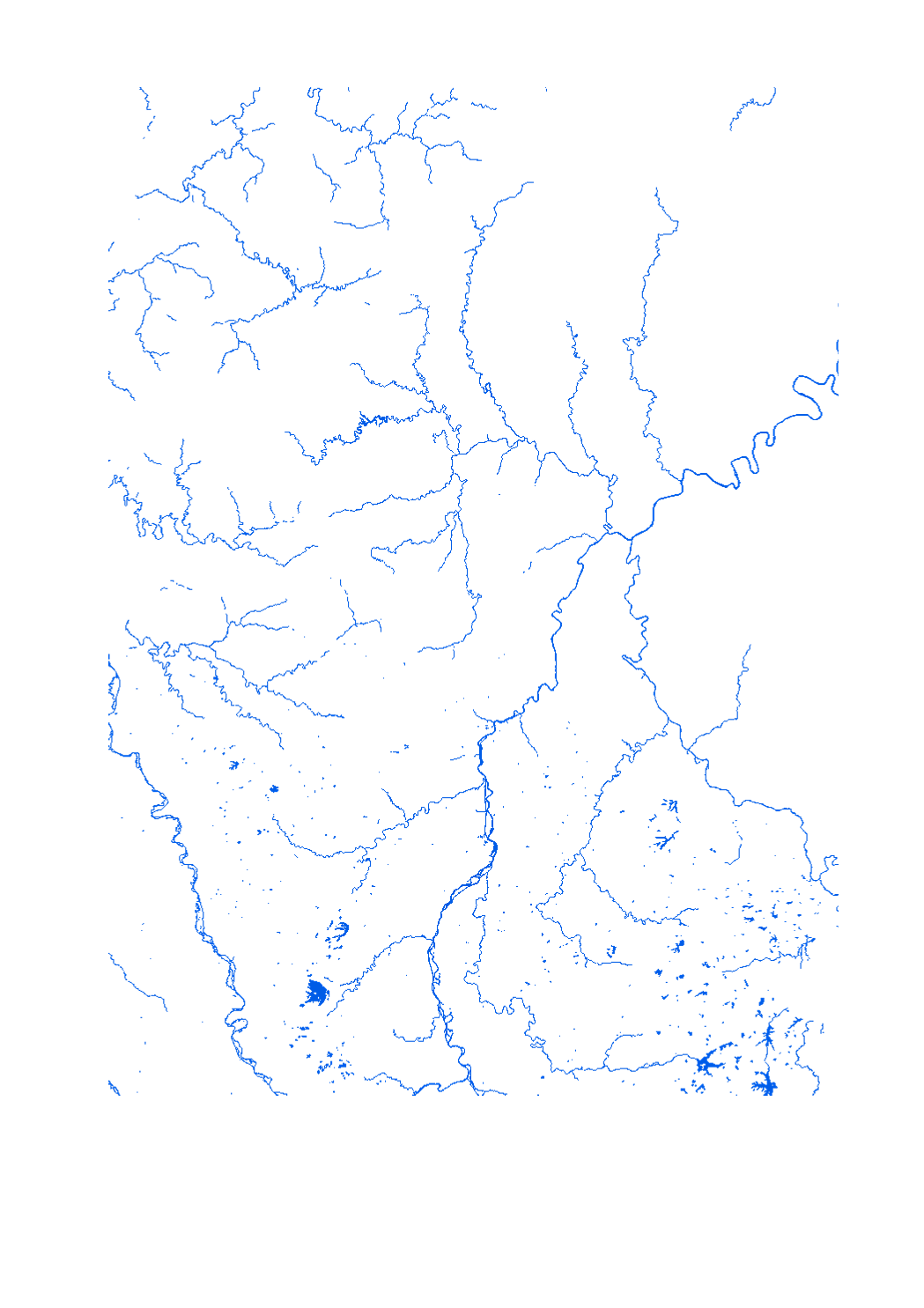
Final product of the b-solutions project GeoConnectGR - Harmonized geodata of the hydrographic network of the Greater Region (scale 1:25.000 - 1:50.000) - Sources: LVGL Saarland, LVermGeo Rheinland-Pfalz, NGI Belgium, IGN France, ACT Luxembourg - Harmonization: Federal Agency for Cartography and Geodesy (BKG) based on the data model Core Reference Data (CRD) developed by EuroGeographics - This data is published for non-commercial uses under the licence CC BY-NC 4.0: https://creativecommons.org/licenses/by-nc/3.0/legalcode