 geocatalogue.geoportail.lu
ShapefileTODO
Type of resources
Available actions
Provided by
Groups
Years
Formats
Representation types
Update frequencies
status
Scale
-

A topographic map is intended to be a representation of the terrain. It differs from thematic maps (city maps, road maps etc.) by the richness of its content, its high precision and above all the representation of the topography by the contour lines. The cadastre and topography administration publishes topographic maps at the scales of 1:5,000, 1:20,000, 1:50,000, 1:100,000 and 1:250,000.
-
Surface temperature or plant temperature on August 22, 2023 in the IVV vineyard in Remich in °C. The temperature map was generated using a drone-based thermal camera.
-
CWSI (=crop water stress index) for the IVV vineyard in Remich. The CWSI is an index that can reflect the water stress of plants. High index values mean higher stress levels for the plants.
-

This layer shows the NDVI calculated using the spectral information from a hyperspectral camera (Headwall – Nano) recorded with a drone over the vineyard on July 30, 2020. NDVI (= Normalized Difference Vegetation Index) belongs to the vegetation indices, which can map the vitality of plants by using spectral information in the red and near-infrared. It has a defined value range and can be easily interpreted as healthy vegetation has values from 0.6 to 1 maximum.
-

This layer displays the latest aerial image (orthophoto) available. An orthophoto represents a mosaic composed of digital aerial photographs geometrically rectified (orthorectified) and georeferenced in the LUREF national coordinate system. The digital orthophotos of the Grand Duchy are managed in the BD-L-ORTHO database which covers the entire territory of the Grand Duchy of Luxembourg and are accessible both on the national geoportal and on the open data portal (data.public.lu). Since 2016, ACT has carried out an annual survey of the entire country. Other aerial images are available under General public> Land cover> Aerial and satellite images.
-
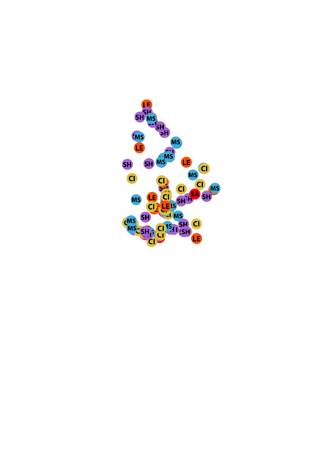
Cette carte montre les structures d’hébergement pour personnes âgées et personnes handicapées au Luxembourg
-
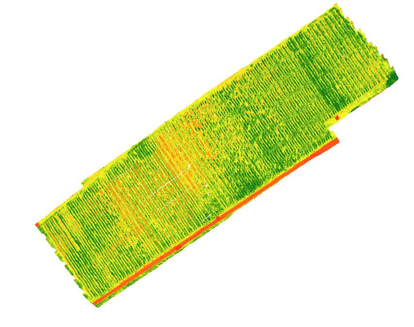
This layer shows the NDVI calculated using the spectral information from a hyperspectral camera (Headwall – Nano) recorded with a drone over the vineyard on September 3, 2019. NDVI (= Normalized Difference Vegetation Index) belongs to the vegetation indices, which can map the vitality of plants by using spectral information in the red and near-infrared. It has a defined value range and can be easily interpreted as healthy vegetation has values from 0.6 to 1 maximum.
-
This layer shows the NDVI calculated using the spectral information from a hyperspectral camera (Headwall – Nano) recorded with a drone over the vineyard on August 29, 2022. NDVI (= Normalized Difference Vegetation Index) belongs to the vegetation indices, which can map the vitality of plants by using spectral information in the red and near-infrared. It has a defined value range and can be easily interpreted as healthy vegetation has values from 0.6 to 1 maximum.
-
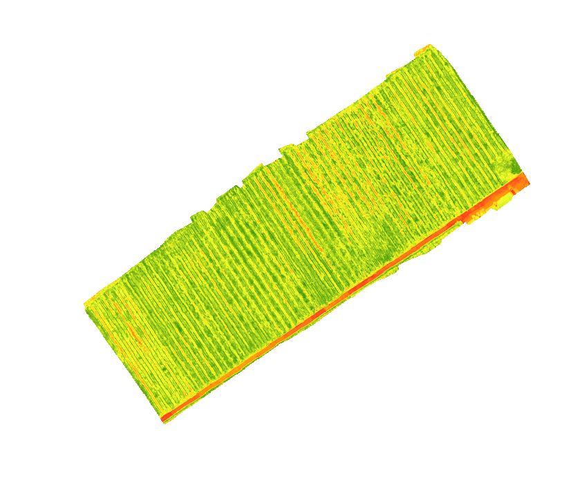
This layer shows the NDVI calculated using the spectral information from a hyperspectral camera (Headwall – Nano) recorded with a drone over the vineyard on September 13, 2021. NDVI (= Normalized Difference Vegetation Index) belongs to the vegetation indices, which can map the vitality of plants by using spectral information in the red and near-infrared. It has a defined value range and can be easily interpreted as healthy vegetation has values from 0.6 to 1 maximum.
-
This layer shows the NDVI calculated using the spectral information from a hyperspectral camera (Headwall – Nano) recorded with a drone over the vineyard on August 23, 2023. NDVI (= Normalized Difference Vegetation Index) belongs to the vegetation indices, which can map the vitality of plants by using spectral information in the red and near-infrared. It has a defined value range and can be easily interpreted as healthy vegetation has values from 0.6 to 1 maximum.