 geocatalogue.geoportail.lu
2025
Type of resources
Available actions
Topics
Keywords
Contact for the resource
Provided by
Groups
Years
Representation types
Update frequencies
status
Service types
Scale
-
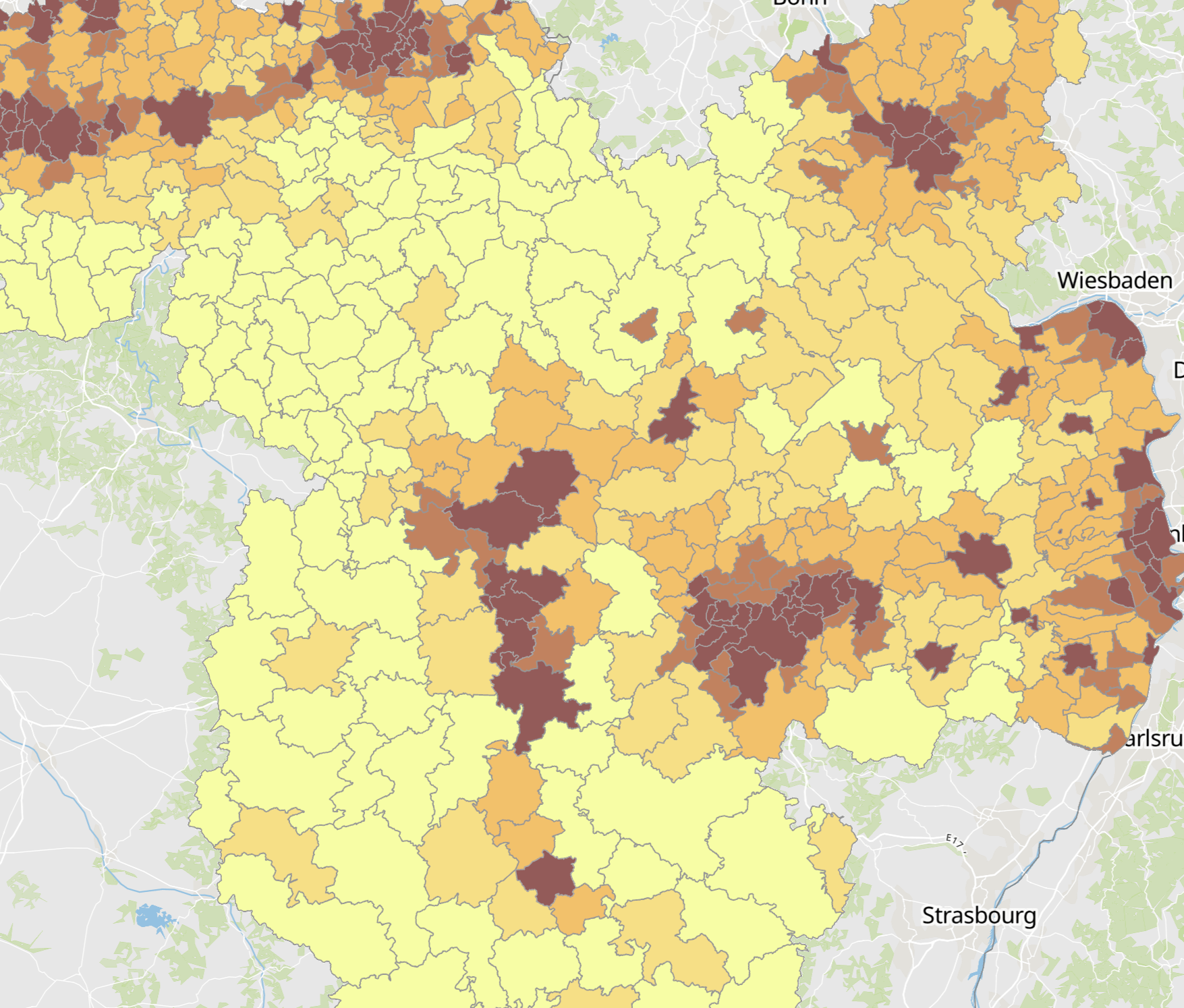
- Population density 2024 (inhabitants per km²). Reference date: 01.01.2024 (Luxembourg and Wallonia), 31.12.2023 (Rhineland-Palatinate and Saarland), 01.01.2022 (Lorraine) - Territorial entities: municipalities (Saarland, Wallonie), cantons (Luxembourg), EPCI (Lorraine), Verbandsgemeinden and verbandsfreie Städte und Gemeinden (Rheinland-Pfalz) - Statistical data sources: DATer, INSEE Grand Est, IWEPS, Région Grand Est, STATEC, Statistisches Landesamt Rheinland-Pfalz, Statistisches Landesamt Saarland. Harmonization: SIG-GR / GIS-GR 2025 - Geodata sources: GeoBasis-DE / BKG, IGN France, NGI-Belgium, ACT Luxembourg. Harmonization: SIG-GR / GIS-GR 2025
-
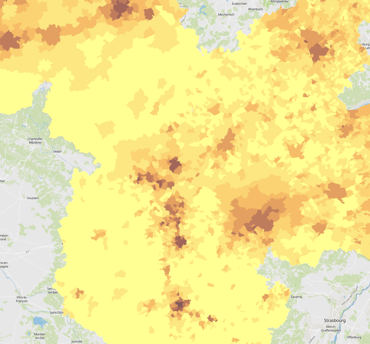
- Population density 2024 (inhabitants per km²) per municipality. Reference date: 01.01.2024 (Luxembourg and Wallonia), 31.12.2023 (Rhineland-Palatinate and Saarland), 01.01.2022 (Lorraine) - Statistical data sources: DATer, INSEE Grand Est, IWEPS, Région Grand Est, STATEC, Statistisches Landesamt Rheinland-Pfalz, Statistisches Amt Saarland. Harmonization: SIG-GR / GIS-GR 2025 - Geodata sources: GeoBasis-DE / BKG, IGN France, NGI-Belgium, ACT Luxembourg. Harmonization: SIG-GR / GIS-GR 2025
-
This Layer contains the MGRS grid (Military Grid Reference System) based on the UTM grid.
-
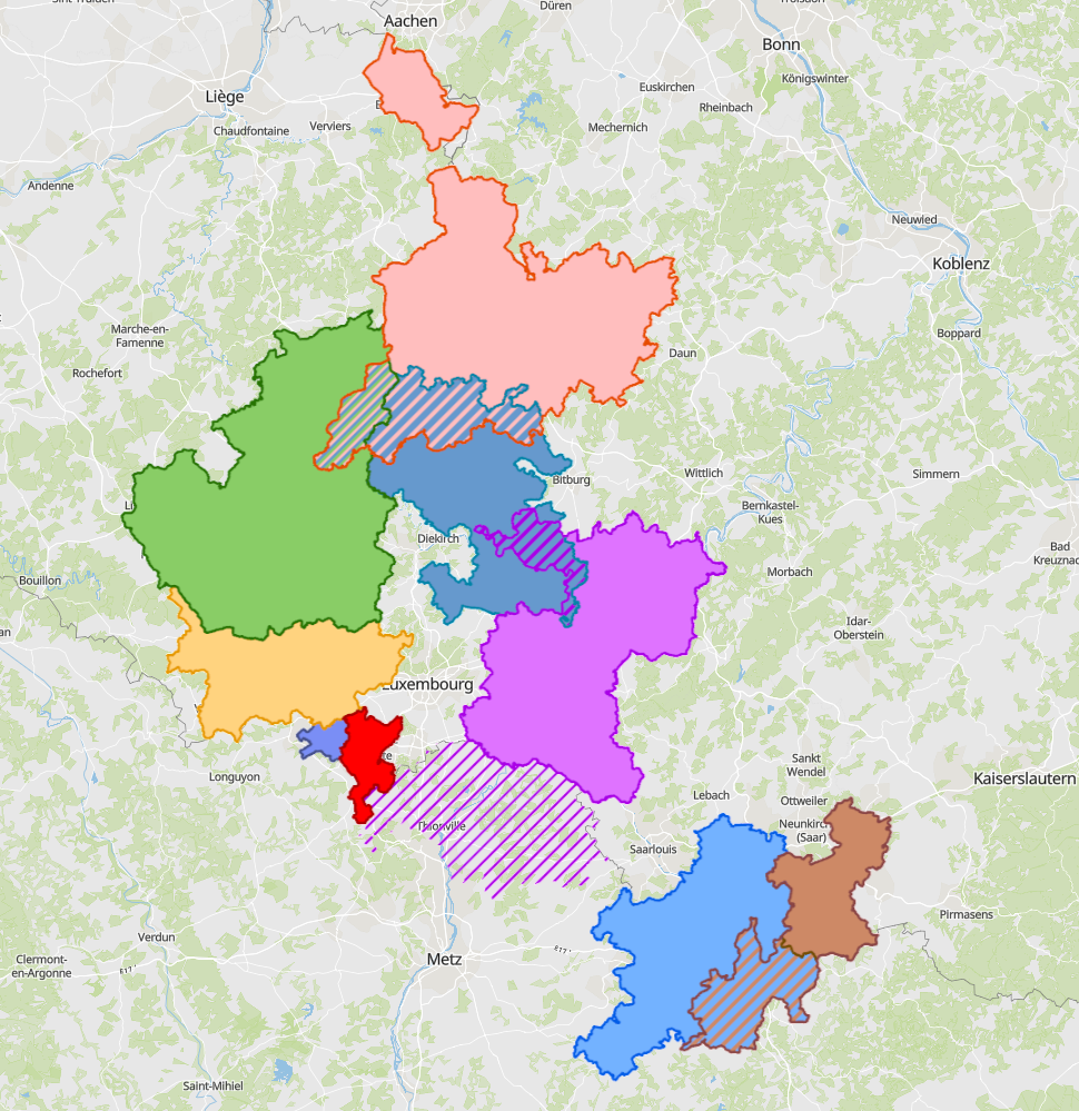
- Cross-border functional areas defined within the Interreg programme of the Greater Region in 2025. - Sources: Entwicklungskonzept Oberes Moseltal (EOM), Eurodistrict SaarMoselle, GECT Alzette-Belval, MLOGAT-DATer, Idelux, Eifel-Ostbelgien-Eislek (EOE), Mëllerdall-Our-Südeifel (MOSE), TNT Chiers Alzette, Parc archéologique européen - Europäischer Kulturpark Bliesbruck-Reinheim. Harmonisation: SIG-GR 2025
-
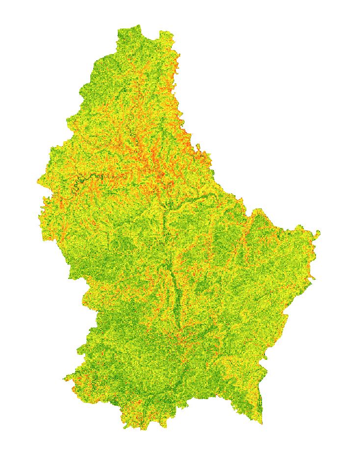
Colorized raster of the slope in degrees based on the digital elevation model of 2024 with a resolution of 50cm.
-
GISGR Webservice containing the WMS of all the layers shown on gis-gr.eu
-
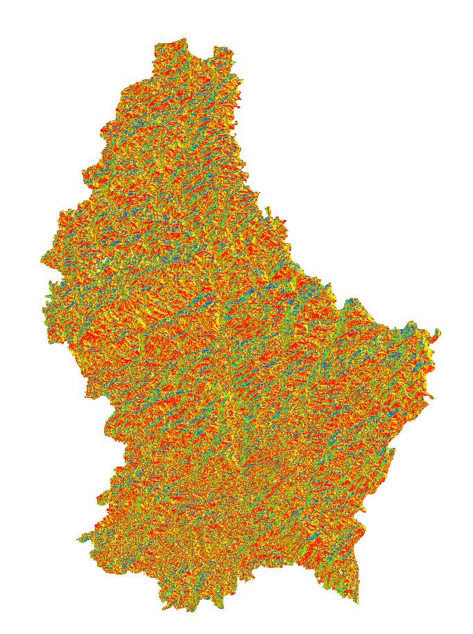
Colorized raster of the aspect based on the digital elevation model of 2024 with a resolution of 50cm.
-
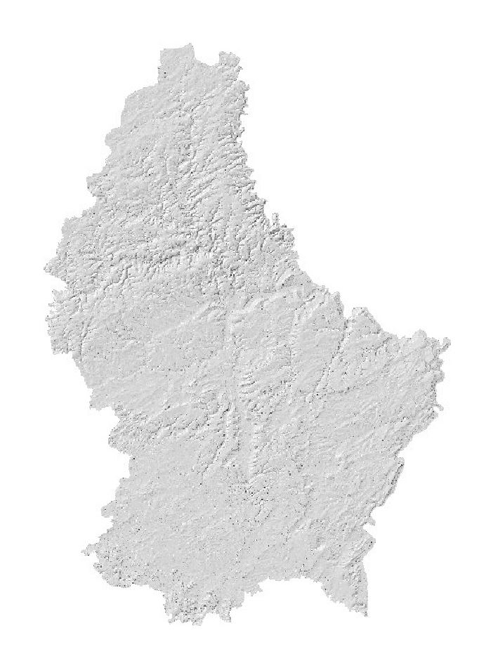
Hillshade based on the digital elevation model of 2024 with a ground resolution of 50cm.
-

Hillshade based on the digital surface model of 2024 with a ground resolution of 50cm.
-

Agricultural reference parcels of Luxembourg 2025