 geocatalogue.geoportail.lu
Planning recommendation map
Type of resources
Available actions
Keywords
Contact for the resource
Provided by
Groups
Years
Representation types
Update frequencies
status
Scale
-
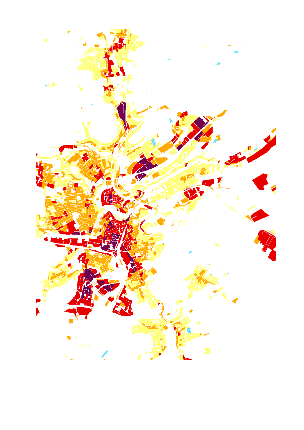
Layer description: This data is part of the climate analysis map of Luxembourg. Shown is the bioclimatic situation in settlement and traffic areas (load area). The subject of the evaluation is the summertime human bioclimatic stress situation in the impact area at night. The higher the load, the greater the need for proactive adaptation measures. Explanation: The present geodata are taken from the regional climate analysis of Luxembourg (GEO-NET & LIST 2021) which was published with the report “KLIMAÖKOLOGISCHE SITUATION IN LUXEMBURG - Modellbasierte regionale Klimaanalyse / (La situation au Luxembourg en matière d’écologie climatique)” by the Administration for Environment. Source: -> https://environnement.public.lu/fr/klima-an-energie/changement-climatique/klimaanalyse.html -> https://data.public.lu/fr/datasets/klimaokologische-situation-in-luxemburg-la-situation-au-luxembourg-en-matiere-decologie-climatique/ Abstracts: The Luxembourg regional climate, which is formed during a low-exchange radiative weather pattern in summer, was investigated using high-resolution computer-based modelling. In total, the model area is described with 8,272,693 grid cells, with information on terrain height, land use, structural height and degree of sealing stored for each grid cell. The urban climate model FITNAH-3D according to Groß (1992) forms the basic framework for the modelling. The input data and model results are based on a horizontal spatial resolution of 25 m x 25 m. The model results are presented in maps. The model results are presented in cartographic representations of the nocturnal temperature field, the nocturnal cold air flow field (4 a.m. in each case) and the thermal load during the day (2 p.m.) and concretised in the form of a climate analysis map. The main product of the work process is a planning recommendation map with an associated catalogue of measures. On the one hand, the map makes visible the graduated need for action to improve thermal comfort in summer in all living/working and recreational areas (“load area”) of the population in Luxembourg. On the other hand, the planning recommendation map also assigns a value to all green and open spaces in the country ("compensation area") with regard to the climate-ecological functions they provide. Notes: - The geodata are only to be used in the context of the specific considerations of the above-mentioned report (e.g.: basic data as of 2018, specific meteorological framework conditions). - The composition of the layers is based on the corresponding maps from the above-mentioned report. Even though these layers can be combined with any other layers from other thematic areas in the geoportal, it should be noted that these representations can easily lead to misinterpretations. - Detailed explanations of this layer and the modelling methodology can be found in the sources mentioned above. - The assessments of the planning recommendation map are based on the climate-ecological functions without taking into account the concerns of other sectoral plans, i.e. the planning recommendation maps represent weighting material obtained from a climate perspective.