 geocatalogue.geoportail.lu
Keyword
Water>Floods directive [FD]>Project RGD Flood risk maps 2021
Type of resources
Available actions
Keywords
Contact for the resource
Provided by
Groups
Years
Representation types
Update frequencies
status
Scale
From
1
-
3
/
3
-
Flood risk map based on the floods directive 2007/60/EC, showing the different affected uses by an 100-year flood event.
-
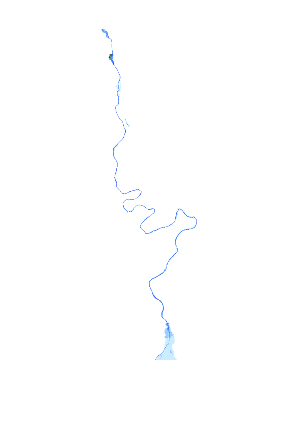
Flood risk map based on the floods directive 2007/60/EC, showing the different affected uses by an 10-year flood event.
-

Flood risk map based on the floods directive 2007/60/EC, showing the different affected uses by an extreme flood event.