 geocatalogue.geoportail.lu
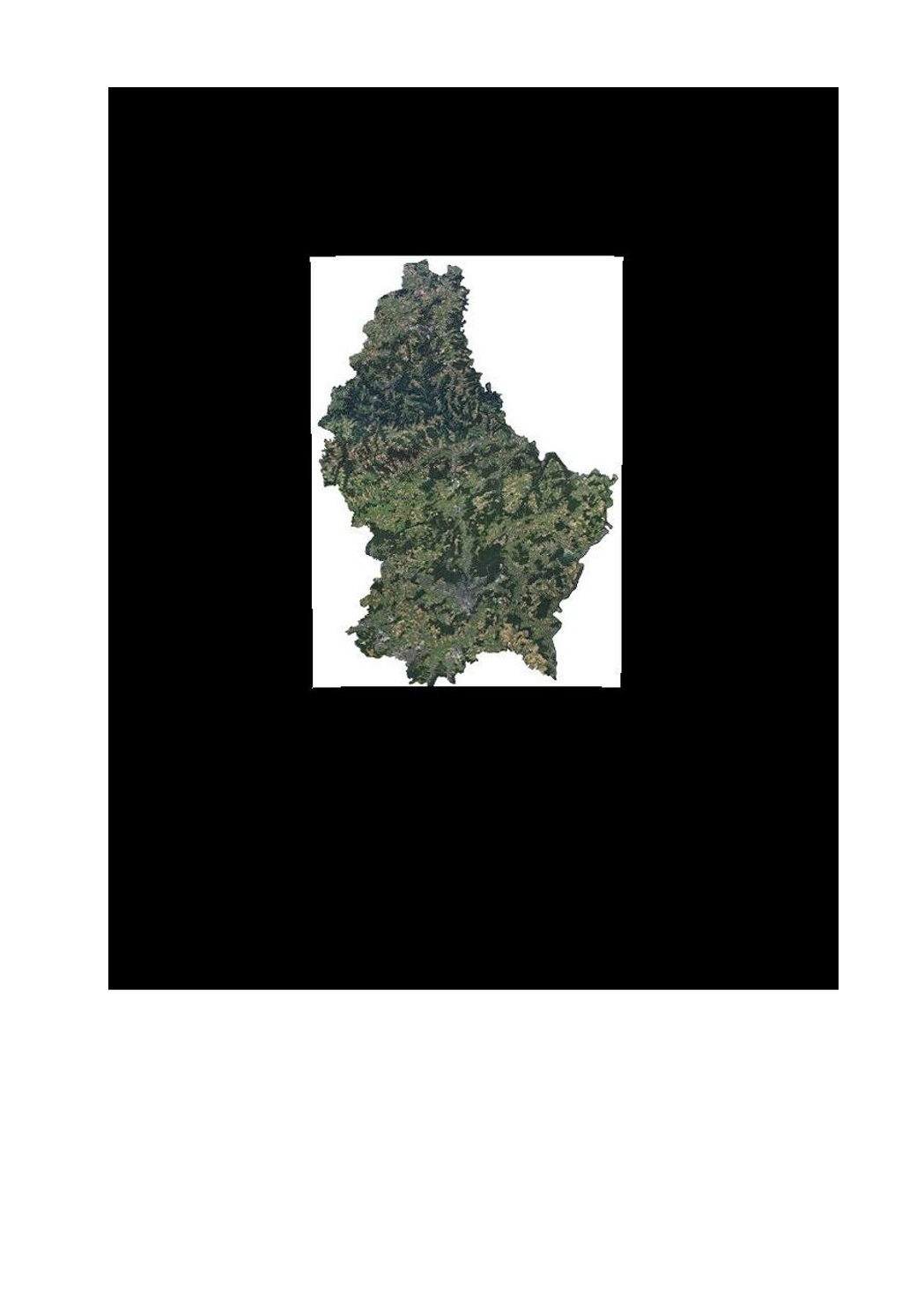
Orthophoto 2016 of the administration du cadastre et de la topographie
This layer contains the official orthophotos covering the national territory of Luxemburg, and that have been produced following a surveying flight in summer 2016 under the responsibility of the administration du cadastre et de la topographie.
Simple
- Date (Creation)
- 2016-06-25T00:00:00
- Date (Revision)
- 2016-12-28T00:00:00
- Identifier
- / bba79b6d-4205-4ce4-98e4-7b7922afcd55
- Presentation form
- Digital map
- Status
- On going
Point of contact
Administration du Cadastre et de la Topographie
-
Service du géoportail et de l'ILDG (ACT)
1, Rue Charles Darwin
,
Luxembourg
,
L-1433
,
Luxembourg
24754401
Point of contact
No information provided.
- Maintenance and update frequency
- As needed
- Entités au Grand-Duché de Luxembourg
-
- Grand-Duché du Luxembourg
- Keywords
-
- Keywords
-
- Orthophoto
- Image
- aerial
- geodata
- 2016
- geoportail.lu
- geoportail.lu themes
-
- Main
- Water
- geoportail.lu structure
-
- Main>Land surface>Orthophoto-images
- Water>Geographical location>Aerial and satellite photographs
- Use constraints
- Other restrictions
- Other constraints
- Creative Commons 1.0 Universal (CC0 1.0) Public Domain Dedication
- Spatial representation type
- Vector
- Denominator
- 5000
- Character set
- UTF8
- Topic category
-
- Imagery base maps earth cover
- Geoscientific information
N
S
E
W
))
- Reference system identifier
- EPSG / http://www.opengis.net/def/crs/EPSG/0/2169
- OnLine resource
-
745
(
OGC:WMS-1.3.0-http-get-map
)
Orthophoto 2016
- OnLine resource
-
ortho_2016
(
OGC:WMS-1.3.0-http-get-map
)
ortho_2016
- OnLine resource
-
Orthophoto 2016
ortho_2016
- File identifier
- bba79b6d-4205-4ce4-98e4-7b7922afcd55 XML
- Metadata language
- Français
- Character set
- UTF8
- Hierarchy level
- Dataset
- Hierarchy level name
- dataset
- Date stamp
- 2021-02-04T23:06:08
- Metadata standard name
- ISO 19115:2003/19139
- Metadata standard version
- 1.0
Point of contact
Administration du Cadastre et de la Topographie
-
Service du géoportail et de l'ILDG (ACT)
1, Rue Charles Darwin
,
Luxembourg
,
L-1433
,
Luxembourg
24754401
Overviews
Spatial extent
N
S
E
W
Provided by

Associated resources
Not available