 geocatalogue.geoportail.lu
Detailed programme of measures HY 2021 (all)
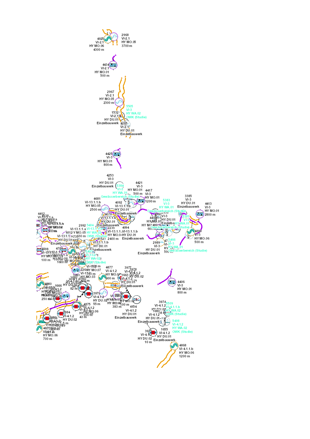
The types of measures related to hydromorphology (HY) which are defined in the catalogue of measures of the third river basin management plan, were assigned to the individual water bodies. The objective of this assignation is to identify for each water body those measures that will help to reduce the pressures and deficits present in the water body, thereby improving its status or maintaining its good status. The hydromorphological measures include the restoration of the ecological continuity, the improvement of the riverbed structure as well as the restoration of a near-natural hydrological regime.
Simple
- Identifier
- / 4b00cf8c-d4e6-486d-8bda-d385302792f6
- Presentation form
- Digital map
- Status
- Completed
Custodian
Administration de la gestion de l'eau
-
1, avenue du Rock'n'Roll
,
Esch-sur-Alzette
,
L-4361
,
Luxembourg
- Entités au Grand-Duché de Luxembourg
-
- Grand-Duché du Luxembourg
- Keywords
-
- Water framework directive (directive 2000/60/EC), hydromorphological measures, River Basin Management Plan 2021, Programme of measures 2021, HY
- Keywords
-
- geoportail.lu
- geoportail.lu themes
-
- Water
- Main
- geoportail.lu structure
-
- Water>Water framework directive [WFD]>River Basin Management Plan 2021
- Main>Environment, Biology and Geology>Water framework directive [WFD]>River Basin Management Plan 2021
- Access constraints
- Other restrictions
- Spatial representation type
- Vector
- Denominator
- 0
- Character set
- UTF8
N
S
E
W
))
- Maintenance and update frequency
- once
- Reference system identifier
- EPSG / http://www.opengis.net/def/crs/EPSG/0/2169
- OnLine resource
-
Detailed programme of measures HY 2021 (all)
Geoportail
- OnLine resource
-
2496
(
OGC:WMS-1.3.0-http-get-map
)
Programme de mesures détaillé HY 2021 (toutes)
- File identifier
- 4b00cf8c-d4e6-486d-8bda-d385302792f6 XML
- Metadata language
- Français
- Character set
- UTF8
- Hierarchy level
- Dataset
- Hierarchy level name
- dataset
- Date stamp
- 2022-12-20T14:25:39
- Metadata standard name
- ISO 19115:2003/19139
- Metadata standard version
- 1.0
Point of contact
Administration de la gestion de l'eau
-
Administration de la gestion de l'eau
(
)
1, avenue du Rock'n'Roll
,
Esch-sur-Alzette
,
L-4361
,
Luxembourg
24556 1
Overviews
Spatial extent
N
S
E
W
Provided by

Associated resources
Not available