 geocatalogue.geoportail.lu
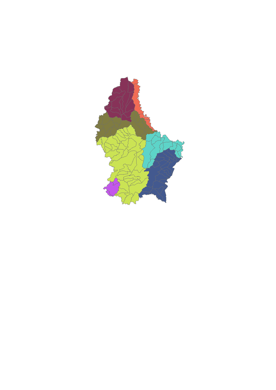
Study zones
Luxembourg's surface water bodies have been grouped into so-called "study zones", which essentially correspond to the country's major catchment areas. Seven study zones have been designated in total.
Simple
- Date (Publication)
- 2015-12-22T00:00:00
- Citation identifier
- / be15dd7d-df57-44e1-b724-0929cf05eef9
- Presentation form
- Digital map
- Status
- Completed
- Point of contact
-
Organisation name Individual name Electronic mail address Role Administration de la gestion de l'eau
Division de la protection des eaux
Point of contact
- Maintenance and update frequency
- As needed
-
Entités au Grand-Duché de Luxembourg
-
-
Grand-Duché du Luxembourg
-
- Keywords
-
-
Study zones, Surface water bodies
-
- Keywords
-
-
geoportail.lu
-
-
geoportail.lu themes
-
-
Water
-
Main
-
-
geoportail.lu structure
-
-
Water>Water framework directive [WFD]>River Basin Management Plan 2009
-
Water>Water framework directive [WFD]>River Basin Management Plan 2015
-
Main>Environment, Biology and Geology>Water framework directive [WFD]>River Basin Management Plan 2015
-
Main>Environment, Biology and Geology>Water framework directive [WFD]>River Basin Management Plan 2009
-
- Access constraints
- Other restrictions
- Other constraints
-
no restriction
- Spatial representation type
- Vector
- Denominator
- 5000
- Language
- Deutsch
- Character set
- UTF8
- Topic category
-
- Environment
- Inland waters
))
- Reference system identifier
- EPSG / http://www.opengis.net/def/crs/EPSG/0/2169
- OnLine resource
-
Protocol Linkage Name OGC API-Features
https://features.geoportail.lu/collections/644/146 OGC API - Features
- OnLine resource
-
Protocol Linkage Name OGC:WMS-1.3.0-http-get-map
https://wms.geoportail.lu/public_map_layers/service 619
https://map.geoportail.lu/theme/main?version=3&zoom=8&X=667917&Y=6394482&lang=fr&layers=644&opacities=1 Catchment areas 2009
- OnLine resource
-
Protocol Linkage Name https://map.geoportail.lu/theme/main?version=3&zoom=8&X=667917&Y=6394482&lang=fr&layers=619&opacities=1 Study zones 2015
Metadata
- File identifier
- be15dd7d-df57-44e1-b724-0929cf05eef9 XML
- Metadata language
- Français
- Character set
- UTF8
- Hierarchy level
- Dataset
- Hierarchy level name
-
dataset
- Date stamp
- 2025-12-04T14:04:39.457727Z
- Metadata standard name
-
ISO 19115:2003/19139
- Metadata standard version
-
1.0
- Metadata author
-
Organisation name Individual name Electronic mail address Role Administration de la gestion de l'eau
Administration de la gestion de l'eau
Point of contact
- Other language
-
Language Character encoding Luxembourgish; Letzeburgesch UTF8 English UTF8 German UTF8 French UTF8
)))