 geocatalogue.geoportail.lu
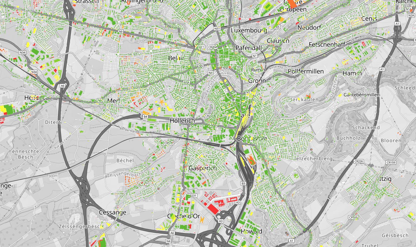
Construction period of the buildings
Construction period of the buildings (1999-2004,2004-2006, 2006-2010, 2010-2013, 2013-2015, 2015-2018)
Sources:
• 1999: BD-Topo
• 2004: Remote sensing, Aerial-image
• 2006: BD-Topo
• 2010: Remote sensing, Aerial-image
• 2013: BD-Topo
• 2015: LIS-L Land-Cover
• 2018: LIS-L Land-Cover (+LiDAR)
Simple
- Identifier
- / 7c138282-86de-4adb-91c2-467b06786821
- Presentation form
- Digital map
- Status
- On going
- Maintenance and update frequency
- As needed
- Entités au Grand-Duché de Luxembourg
-
- Grand-Duché du Luxembourg
- Keywords
-
- Construction period, buildings
- Keywords
-
- geoportail.lu
- geoportail.lu themes
-
- Urban planning
- geoportail.lu structure
-
- Urban planning>Territorial analysis>Buildings
- Access constraints
- Other restrictions
- Spatial representation type
- Vector
- Denominator
- 0
- Character set
- UTF8
N
S
E
W
))
- Reference system identifier
- EPSG / http://www.opengis.net/def/crs/EPSG/0/2169
- OnLine resource
-
2214
(
OGC:WMS-1.3.0-http-get-map
)
Période de construction des bâtiments
- OnLine resource
- https://data.public.lu/fr/datasets/lis-l-land-cover-2018/#_ ( WWW:LINK-1.0-http--link )
- OnLine resource
- Construction period of the buildings ( UKST )
- File identifier
- 7c138282-86de-4adb-91c2-467b06786821 XML
- Metadata language
- Français
- Character set
- UTF8
- Hierarchy level
- Dataset
- Hierarchy level name
- dataset
- Date stamp
- 2022-01-17T19:14:27
- Metadata standard name
- ISO 19115:2003/19139
- Metadata standard version
- 1.0
Point of contact
Département de l'aménagement du territoire
-
Ministère de l’Environnement, du Climat et du Développement durable & Ministère de l’Énergie et de l’Aménagement du territoire
(
)
4, Place de l'Europe
,
Luxembourg
,
L-1499
,
Luxembourg
247 86924
Overviews
Spatial extent
N
S
E
W
Provided by

Associated resources
Not available