 geocatalogue.geoportail.lu
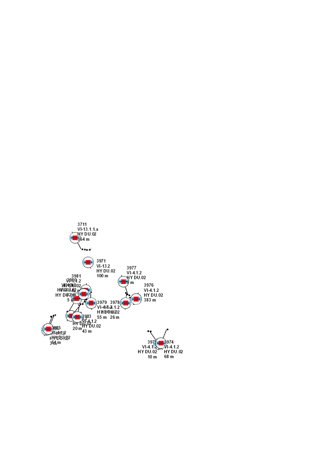
Restoration of the ecological continuity – culverts
Restoration of the ecological continuity for fish, macroinvertebrates, sediments and terrestrial animals by culverts, through its permanent suppression, or through its adaptation in order to reach natural conditions of substrate, depth, flow rate, luminosity and riverbank structure.
Simple
- Citation identifier
- / 569bf0ea-c428-4171-aba6-8f2ace180a10
- Presentation form
- Digital map
- Status
- Completed
- Point of contact
-
Organisation name Individual name Electronic mail address Role Administration de la gestion de l'eau
Division de l'hydrologie
Custodian
- Maintenance and update frequency
- As needed
-
Entités au Grand-Duché de Luxembourg
-
-
Grand-Duché du Luxembourg
-
- Keywords
-
-
Water Framework Directive, WFD, hydromorphological measures, management plan, programme of measures 2021, HY DU, ecological continuity, fish, culvert
-
- Keywords
-
-
geoportail.lu
-
-
geoportail.lu themes
-
-
Water
-
Main
-
-
geoportail.lu structure
-
-
Water>Water framework directive [WFD]>River Basin Management Plan 2021
-
Main>Environment, Biology and Geology>Water framework directive [WFD]>River Basin Management Plan 2021
-
- Access constraints
- Other restrictions
- Spatial representation type
- Vector
- Denominator
- 0
- Character set
- UTF8
))
- Reference system identifier
- EPSG / http://www.opengis.net/def/crs/EPSG/0/2169
- OnLine resource
-
Protocol Linkage Name WWW:LINK-1.0-http--link
https://data.public.lu/fr/datasets/cartographie-des-passages-buses-canalises-couverts-2021/ Restoration of the ecological continuity – culverts (2021)
OGC API-Features
https://features.geoportail.lu/collections/2093 OGC API - Features
- OnLine resource
-
Protocol Linkage Name OGC:WMS-1.3.0-http-get-map
https://wms.geoportail.lu/public_map_layers/service 2093
https://map.geoportail.lu/theme/eau?version=3&zoom=8&X=667917&Y=6394482&lang=fr&layers=2093&opacities=1 HY DU.02 2021 Restoration of the ecological continuity – culverts
Metadata
- File identifier
- 569bf0ea-c428-4171-aba6-8f2ace180a10 XML
- Metadata language
- Français
- Character set
- UTF8
- Hierarchy level
- Dataset
- Hierarchy level name
-
dataset
- Date stamp
- 2025-10-15T05:46:49Z
- Metadata standard name
-
ISO 19115:2003/19139
- Metadata standard version
-
1.0
- Metadata author
-
Organisation name Individual name Electronic mail address Role Administration de la gestion de l'eau
Administration de la gestion de l'eau
Point of contact
- Other language
-
Language Character encoding Luxembourgish; Letzeburgesch UTF8 English UTF8 German UTF8 French UTF8
)))