 geocatalogue.geoportail.lu
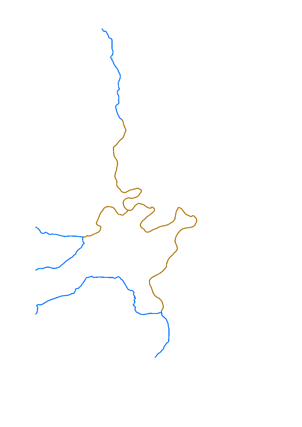
Surface water bodies 2021 (Watercourses)
Representation of the watercourse within a surface water body. Designation of natural surface water bodies and heavily modified water bodies (HMWB).
Surface waters which have been physically altered by human activity that they cannot achieve good ecological status as defined by the water framework directive (DIR 2000/60/CE) and that no technical feasibility or cost-effective option exist to stop that human activity, are designated as heavily modified water bodies.
These water bodies have the good ecological potential as the environmental objective. They have nevertheless to achieve good chemical status.
Simple
- Date (Creation)
- 2021-05-03T00:00:00
- Citation identifier
- / 311cc30b-8092-4816-9f86-87d5f2995706
- Presentation form
- Digital map
- Status
- On going
- Point of contact
-
Organisation name Individual name Electronic mail address Role Administration de la gestion de l'eau
Division de la protection des eaux
Point of contact
- Maintenance and update frequency
- As needed
-
Entités au Grand-Duché de Luxembourg
-
-
Grand-Duché du Luxembourg
-
- Keywords
-
-
surface water body, natural water body, heavily modified water body, ecological potential, ecological status, water framework directive, directive 2000/60/CE, HMWB, chemical status
-
- Keywords
-
-
geoportail.lu
-
-
geoportail.lu themes
-
-
Water
-
Main
-
-
geoportail.lu structure
-
-
Water>Water framework directive [WFD]>River Basin Management Plan 2009
-
Water>Water framework directive [WFD]>River Basin Management Plan 2015
-
Main>Environment, Biology and Geology>Water framework directive [WFD]>River Basin Management Plan 2021
-
Main>Environment, Biology and Geology>Water framework directive [WFD]>River Basin Management Plan 2021
-
- Access constraints
- Other restrictions
- Other constraints
-
Pas de limitations
- Spatial representation type
- Vector
- Denominator
- 5000
- Language
- Deutsch
- Character set
- UTF8
- Topic category
-
- Environment
- Inland waters
))
- Reference system identifier
- EPSG / http://www.opengis.net/def/crs/EPSG/0/2169
- OnLine resource
-
Protocol Linkage Name OGC:WMS-1.3.0-http-get-map
https://wms.geoportail.lu/public_map_layers/service 2091
UKST
https://map.geoportail.lu/theme/eau?version=3&zoom=10&X=667917&Y=6394482&lang=en&layers=2091&opacities=1&rotation=0&features=&time=&bgLayer=basemap_2015_global&serial= Masse d’eau de surface 2021 (cours d’eau)
WWW:LINK-1.0-http--link
https://data.public.lu/fr/datasets/masses-deau-de-surface-2021-cours-deau/ OGC API-Features
https://features.geoportail.lu/collections/2091 OGC API - Features
Metadata
- File identifier
- 311cc30b-8092-4816-9f86-87d5f2995706 XML
- Metadata language
- Français
- Character set
- UTF8
- Hierarchy level
- Dataset
- Hierarchy level name
-
dataset
- Date stamp
- 2025-10-13T11:18:56Z
- Metadata standard name
-
ISO 19115:2003/19139
- Metadata standard version
-
1.0
- Metadata author
-
Organisation name Individual name Electronic mail address Role Administration de la gestion de l'eau
Administration de la gestion de l'eau
Point of contact
- Other language
-
Language Character encoding Luxembourgish; Letzeburgesch UTF8 English UTF8 German UTF8 French UTF8
)))