 geocatalogue.geoportail.lu
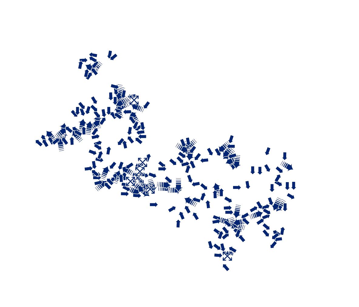
Cold air streams
This layer contains point information about the location and wind direction of cold air corridors, cold air inflows, and park winds.
Simple
- Identifier
- / 2cd7ed39-227c-4557-87be-79d55bc6192a
- Presentation form
- Digital map
- Status
- On going
- Maintenance and update frequency
- As needed
- Entités au Grand-Duché de Luxembourg
-
- Grand-Duché du Luxembourg
- Keywords
-
- Climate analysis, Cold air flows, Cold air, Wind
- Keywords
-
- geoportail.lu
- intranet
- geoportail.lu themes
-
- Urban planning
- Main
- geoportail.lu structure
-
- Urban planning>Regional>South Region>Climate analysis maps
- Access constraints
- Other restrictions
- Spatial representation type
- Vector
- Denominator
- 0
- Character set
- UTF8
N
S
E
W
))
- Reference system identifier
- EPSG / http://www.opengis.net/def/crs/EPSG/0/2169
- OnLine resource
- Cold air streams ( UKST )
- OnLine resource
-
2920
(
OGC:WMS-1.3.0-http-get-map
)
Courants d'air froid
- File identifier
- 2cd7ed39-227c-4557-87be-79d55bc6192a XML
- Metadata language
- Français
- Character set
- UTF8
- Hierarchy level
- Dataset
- Hierarchy level name
- dataset
- Date stamp
- 2024-10-08T12:59:50
- Metadata standard name
- ISO 19115:2003/19139
- Metadata standard version
- 1.0
Ministère du Logement et de l'Aménagement du territoire
-
Pit Back
https://data.public.lu/fr/organizations/
4, place de l'Europe
,
Luxembourg
,
L-1499
,
Luxembourg
247-86936
https://data.public.lu/fr/organizations/
Overviews
Spatial extent
N
S
E
W
Provided by

Associated resources
Not available