 geocatalogue.geoportail.lu
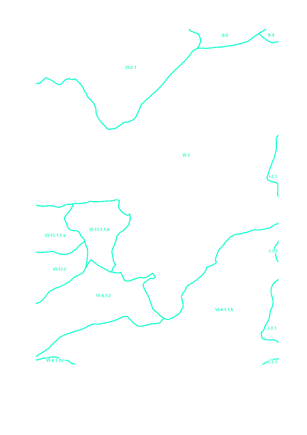
Surface water bodies 2021 (Catchment areas)
The surface water of Luxembourg are subdivided in 106 water bodies. The identification of water bodies is based on geographical and hydrological determinants. 3 surface water bodies are integrated in the river basin of the "Chiers", part of the river basin district of the Meuse. 103 surface water bodies are integrated in the river basin of the "Moselle", part of the river basin district of the Rhine.
Simple
- Date (Creation)
- 2004-12-31T00:00:00
- Citation identifier
- / c50b2bc7-aeb7-4d3e-9349-09eb3ec0f927
- Presentation form
- Digital map
- Status
- Completed
- Point of contact
-
Organisation name Individual name Electronic mail address Role Administration de la gestion de l'eau
Division de la protection des eaux
Point of contact
- Maintenance and update frequency
- As needed
-
Entités au Grand-Duché de Luxembourg
-
-
Grand-Duché du Luxembourg
-
- Keywords
-
-
surface water body, river basin, Chiers, river basin district, Meuse, Moselle, Rhine
-
- Keywords
-
-
geoportail.lu
-
-
geoportail.lu themes
-
-
Water
-
Main
-
-
geoportail.lu structure
-
-
Water>Water framework directive [WFD]>River Basin Management Plan 2021
-
Main>Environment, Biology and Geology>Water framework directive [WFD]>River Basin Management Plan 2021
-
- Access constraints
- Other restrictions
- Other constraints
-
Pas de limitations
- Spatial representation type
- Vector
- Denominator
- 5000
- Language
- Deutsch
- Character set
- UTF8
- Topic category
-
- Environment
- Inland waters
))
- Reference system identifier
- EPSG / http://www.opengis.net/def/crs/EPSG/0/2169
- OnLine resource
-
Protocol Linkage Name OGC:WMS-1.3.0-http-get-map
https://wms.geoportail.lu/public_map_layers/service 2090
WWW:LINK-1.0-http--link
https://map.geoportail.lu/theme/eau?version=3&zoom=8&X=667917&Y=6394482&lang=fr&layers=2090&opacities=1 Masse d’eau de surface 2021 (bassin versant)
WWW:LINK-1.0-http--link
https://data.public.lu/en/datasets/68e7094c335c4005479941b2/ OGC API-Features
https://features.geoportail.lu/collections/2090 OGC API - Features
Metadata
- File identifier
- c50b2bc7-aeb7-4d3e-9349-09eb3ec0f927 XML
- Metadata language
- Français
- Character set
- UTF8
- Hierarchy level
- Dataset
- Hierarchy level name
-
dataset
- Date stamp
- 2025-10-13T11:04:40Z
- Metadata standard name
-
ISO 19115:2003/19139
- Metadata standard version
-
1.0
- Metadata author
-
Organisation name Individual name Electronic mail address Role Administration de la gestion de l'eau
Administration de la gestion de l'eau
Point of contact
- Other language
-
Language Character encoding Luxembourgish; Letzeburgesch UTF8 English UTF8 German UTF8 French UTF8
)))