 geocatalogue.geoportail.lu
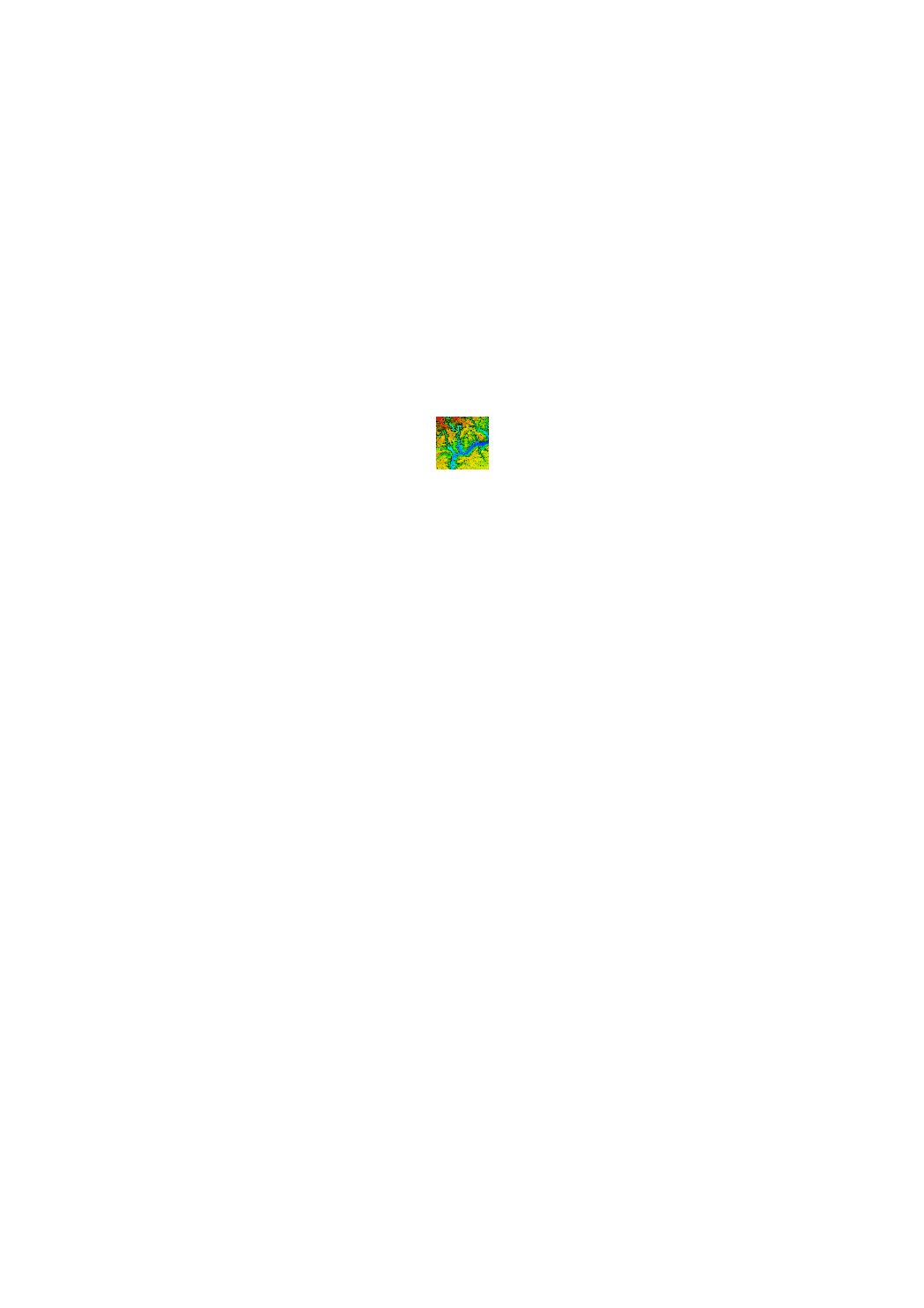
Modèle numérique de terrain de la région Nordstad (2017)
Digitalen Héichtemodell vun der Regioun Nordstad (2017)
Digital Elevation Model of the Nordstad region (2017)
Digitales Höhenmodell der Region Nordstad (2017)
L'ACT a lancé un prototype de survol LIDAR en 2017 en vue d'une planification d'un tel survol pour tout le pays en 2018/2019. Un des éléments issus de ce prototype est un modèle numérique de terrain à haute résolution. Date du survol: 9 avril 2017
De Kadaster huet 2017 ee Prototyp vun enger LIDAR Iwwerfléiung duerchgefouert, als Virbereedung vun enger landeswäiter Iwwerfléiung 2018/2019. Eent vun de Resultater vun deem Prototyp ass en héichopléisenden digitalen Héichtemodell. Datum vun der Iwwerfléiung: 9. Abrëll 2017
In 2017, the ACT has executed a prototype project of a LIDAR flight in preparation of a country wide flight in 2018/2019. One of the results of this prototype is a high resolution digital elevation model. Date of the overflight: 9 april 2017
Die Katasterverwaltung hat 2017 einen Prototypen einer LIDAR - Überfliegung durchgeführt, dies in Vorbereitung einer landesweiten Überfliegung in 2018/2019. Eines der Resultate dieses Prototyps ist ein hochauflösendes digitales Höhenmodell. Datum der Überfliegung: 9. April 2017
Simple
-
Date (Création)Date (Creation)Datumsangaben (Erstellung)Date (Création)
- 2017-04-04T00:00:00
-
IdentificateurCitation identifierIdentifikatorIdentificateur
- / 1adab94e-d80a-4e19-a808-28f52f633186
-
Forme de la présentationPresentation formPräsentationsformForme de la présentation
-
Carte numériqueDigital mapDigitale KarteCarte numérique
-
EtatStatusBearbeitungsstatusEtat
-
Mise à jour continueOn goingKontinuierliche AktualisierungMise à jour continue
- Point of contact
-
Organisation name Individual name Electronic mail address Role Administration du Cadastre et de la Topographie
Administration du Cadastre et de la Topographie
Point de contactPoint of contactAnsprechpartnerPoint de contact
-
Fréquence de mise à jourMaintenance and update frequencyÜberarbeitungsintervallFréquence de mise à jour
-
Lorsque nécessaireAs neededBei BedarfLorsque nécessaire
-
Entités au Grand-Duché de Luxembourg
-
-
Grand-Duché du Luxembourg
Grand-Duché du Luxembourg
Grand-Duché du Luxembourg
Grand-Duché du Luxembourg
-
- Keywords
-
- Keywords
-
-
MNT
DHM
DTM
DHM
-
modèle numérique de terrain
digitalen Héichtemodell
Digital elevation model
digitales Höhenmodell
-
Nordstad
LiDAR
Nordstad
Nordstad
-
LiDAR
LiDAR
LiDAR
-
geoportail.lu
geoportail.lu
geoportail.lu
geoportail.lu
-
-
geoportail.lu themes
-
-
Grand Public
Allgemeng
Main
Allgemein
-
-
geoportail.lu structure
-
-
Grand Public>Modèles altimétriques numériques (BD-L-LiDAR)>Prototype LiDAR 2017 (Région Nordstad)
Grand Public>Modèles altimétriques numériques (BD-L-LiDAR)>Prototype LiDAR 2017 (Région Nordstad)>LiDAR Prototyp 2017 (Regioun Nordstad)
Main>Digital elevation model (BD-L-LiDAR)>LiDAR Prototype 2017 (Nordstad region)
Allgemein>Digitales Höhenmodell (BD-L-LiDAR)>LiDAR Prototyp 2017 (Region Nordstad)
-
Grand Public>Couverture du sol>Modèles altimétriques numériques (BD-L-LiDAR)>Prototype LiDAR 2017 (Région Nordstad)
Grand Public>Couverture du sol>Modèles altimétriques numériques (BD-L-LiDAR)>Prototype LiDAR 2017 (Région Nordstad)>LiDAR Prototyp 2017 (Regioun Nordstad)
Main>Land surface>Digital elevation model (BD-L-LiDAR)>LiDAR Prototype 2017 (Nordstad region)
Allgemein>Oberflächendarstellung>Digitales Höhenmodell (BD-L-LiDAR)>LiDAR Prototyp 2017 (Region Nordstad)
-
-
Contraintes d'utilisationUse constraintsNutzungseinschränkungenContraintes d'utilisation
-
Autres restrictionsOther restrictionsBenutzerdefinierte EinschränkungenAutres restrictions
- Other constraints
-
Creative Commons 1.0 Universal (CC0 1.0) Public Domain Dedication
-
Type de représentation spatialeSpatial representation typeRäumliche DarstellungsartType de représentation spatiale
-
VecteurVectorVektorVecteur
-
Dénominateur de l'échelleDenominatorMaßstabszahlDénominateur de l'échelle
- 0
-
Encodage des caractèresCharacter setZeichensatzEncodage des caractères
-
Utf8UTF8Utf8Utf8
-
Catégorie ISOTopic categoryISO-ThematikCatégorie ISO
-
-
AltimétrieElevationHöhenangabenAltimétrie
-
))
-
Nom du système de référenceReference system identifierIdentifikator des ReferenzsystemsNom du système de référence
- EPSG / http://www.opengis.net/def/crs/EPSG/0/2169
- OnLine resource
-
Protocol Linkage Name OGC:WMS-1.3.0-http-get-map
https://wms.geoportail.lu/public_map_layers/service 1378
1378
1378
1378
WWW:LINK-1.0-http--link
https://data.public.lu/fr/datasets/lidar-projet-pilote-dun-releve-3d-du-territoire-luxembourgeois/
- OnLine resource
-
Protocol Linkage Name https://map.geoportail.lu/theme/main?version=3&zoom=8&X=667917&Y=6394482&lang=fr&layers=1378&opacities=1 Modèle numérique de terrain
Digitalen Héichtemodell
Digital Height Model of the Nordstad region
Digitales Höhenmodell
Metadata
-
Identifiant de la ficheFile identifierMetadatensatzidentifikatorIdentifiant de la fiche
- 1adab94e-d80a-4e19-a808-28f52f633186 XML
-
LangueMetadata languageSpracheLangue
- Français
-
Jeu de caractèresCharacter setZeichensatzJeu de caractères
-
Utf8UTF8Utf8Utf8
-
Type de ressourceHierarchy levelHierarchieebeneType de ressource
-
Jeu de donnéesDatasetDatenbestandJeu de données
- Hierarchy level name
-
dataset
-
Date des métadonnéesDate stampDatumDate des métadonnées
- 2022-05-02T13:44:02
- Metadata standard name
-
ISO 19115:2003/19139
- Metadata standard version
-
1.0
- Metadata author
-
Organisation name Individual name Electronic mail address Role Administration du Cadastre et de la Topographie
Administration du Cadastre et de la Topographie
Point de contactPoint of contactAnsprechpartnerPoint de contact
- Other language
-
Language Character encoding LëtzebuergeschLuxembourgish; LetzeburgeschLuxemburgischLuxembourgeoisUtf8UTF8Utf8Utf8EngleschEnglishEnglischAnglaisUtf8UTF8Utf8Utf8DäitschGermanDeutschAllemandUtf8UTF8Utf8Utf8FranséischFrenchFranzösischFrançaisUtf8UTF8Utf8Utf8
)))