 geocatalogue.geoportail.lu
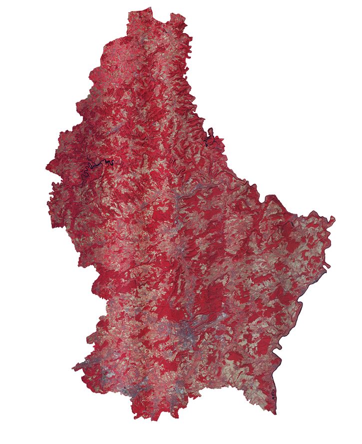
Infrared Orthophoto 2020 of the land registry and topography administration
This layer contains the official infrared orthophoto (infrared, red, green) covering the national territory of Luxembourg. The surveying flights took place on July 30 and 31, August 5, 6, and 7 and September 13, 14, 15 and 19, 2020, with a sun position of > 35°. The ground sampling distance is < 0,20 m. The perspective displacement is < 25 %. On the borders, a zone of 50 m behind the country border is included.
Simple
- Citation identifier
- / 134fb490-c022-476d-b484-dc652ae8c626
- Presentation form
- Digital map
- Status
- On going
- Point of contact
-
Organisation name Individual name Electronic mail address Role Administration du Cadastre et de la Topographie
Administration du Cadastre et de la Topographie
Point of contact
- Maintenance and update frequency
- As needed
-
Entités au Grand-Duché de Luxembourg
-
-
Grand-Duché du Luxembourg
-
- Keywords
-
- Keywords
-
-
orthophoto
-
aerial
-
photograph
-
geodata
-
2020
-
geoportail.lu
-
-
geoportail.lu themes
-
-
Main
-
-
geoportail.lu structure
-
-
Main>Land surface>Orthophoto-images>Orthophoto infrared
-
- Use constraints
- Other restrictions
- Other constraints
-
Creative Commons 1.0 Universal (CC0 1.0) Public Domain Dedication
- Spatial representation type
- Vector
- Denominator
- 0
- Character set
- UTF8
))
- Reference system identifier
- EPSG / http://www.opengis.net/def/crs/EPSG/0/2169
- OnLine resource
-
Protocol Linkage Name OGC:WMS-1.3.0-http-get-map
https://wms.geoportail.lu/public_map_layers/service 2089
WWW:LINK-1.0-http--link
https://data.public.lu/fr/datasets/orthophoto-officielle-du-grand-duche-de-luxembourg-edition-2020/ UKST
https://map.geoportail.lu/theme/main?version=3&zoom=10&X=696470&Y=6404833&lang=fr&rotation=0&layers=2089&opacities=1&bgLayer=basemap_2015_global&crosshair=false Orthophoto 2020 infrared
Metadata
- File identifier
- 134fb490-c022-476d-b484-dc652ae8c626 XML
- Metadata language
- Français
- Character set
- UTF8
- Hierarchy level
- Dataset
- Hierarchy level name
-
dataset
- Date stamp
- 2022-03-15T16:55:36
- Metadata standard name
-
ISO 19115:2003/19139
- Metadata standard version
-
1.0
- Metadata author
-
Organisation name Individual name Electronic mail address Role Administration du Cadastre et de la Topographie
Administration du Cadastre et de la Topographie
Point of contact
- Other language
-
Language Character encoding Luxembourgish; Letzeburgesch UTF8 English UTF8 German UTF8 French UTF8
)))