 geocatalogue.geoportail.lu
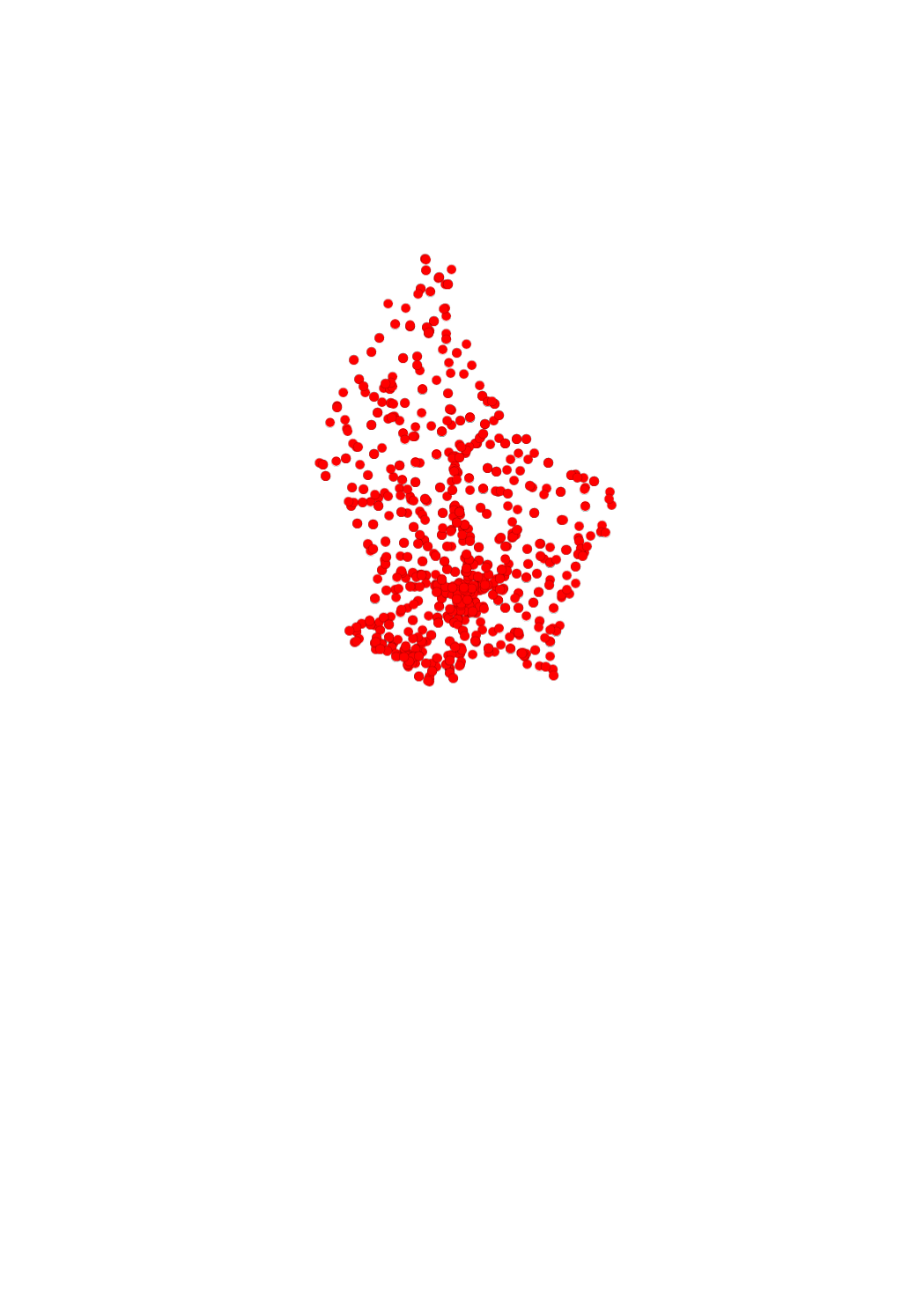
Hertzian cadastre - Base stations for public mobile communication networks >= 50 Watt
The cellular phone cadastre shows the location of the base stations for public mobile communication networks ≥ 50 Watt.
https://data.public.lu/fr/datasets/cadastre-gsm/
Simple
- Date (Creation)
- 2017-09-26T00:00:00
- Date (Revision)
- 2017-09-26T00:00:00
- Identifier
- / e4a24392-591c-4d20-a62b-f75a9191488d
- Presentation form
- Digital map
- Status
- On going
- Maintenance and update frequency
- As needed
- Entités au Grand-Duché de Luxembourg
-
- Grand-Duché du Luxembourg
- Keywords
-
- Keywords
-
- antennes GSM
- communications mobiles
- geoportail.lu
- geoportail.lu themes
-
- Cellular phone cadastre
- geoportail.lu structure
-
- Cellular phone cadastre>Cellular phone cadastre
- Use constraints
- Other restrictions
- Other constraints
- Creative Commons 1.0 Universal (CC0 1.0) Public Domain Dedication
- Spatial representation type
- Vector
- Denominator
- 0
- Character set
- UTF8
N
S
E
W
))
- Reference system identifier
- EPSG / http://www.opengis.net/def/crs/EPSG/0/2169
- OnLine resource
-
801
(
OGC:WMS-1.3.0-http-get-map
)
Stations de base pour réseaux publics de communications mobiles ≥ 50 Watt
- OnLine resource
-
Base stations for public mobile communication networks ≥ 50 Watt
mat_antennes_plus_50_watt
- File identifier
- e4a24392-591c-4d20-a62b-f75a9191488d XML
- Metadata language
- Français
- Character set
- UTF8
- Hierarchy level
- Dataset
- Hierarchy level name
- dataset
- Date stamp
- 2021-02-04T23:18:07
- Metadata standard name
- ISO 19115:2003/19139
- Metadata standard version
- 1.0
Overviews
Spatial extent
N
S
E
W
Provided by

Associated resources
Not available