 geocatalogue.geoportail.lu
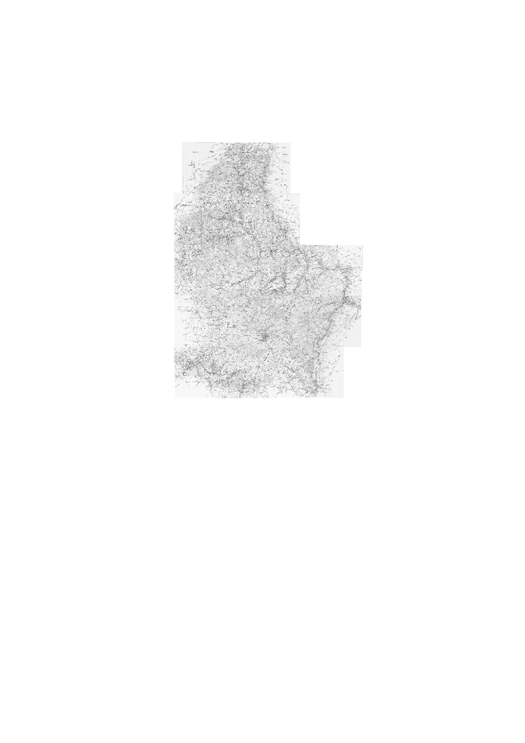
Topographical Map 1907
Historic topographic map edited by Hansen.
Simple
- Identifier
- / b88e6524-67d3-4e34-b998-6f30120e3718
- Presentation form
- Digital map
- Status
- On going
Resource provider
Administration du Cadastre et de la Topographie
-
Service du géoportail et de l'ILDG (ACT)
1, Rue Charles Darwin
,
Luxembourg
,
L-1433
,
Luxembourg
Point of contact
Administration du Cadastre et de la Topographie
-
Service du géoportail et de l'ILDG (ACT)
1, Rue Charles Darwin
,
Luxembourg
,
L-1433
,
Luxembourg
Distributor
Administration du Cadastre et de la Topographie
-
Administration du Cadastre et de la Topographie
1, Rue Charles Darwin
,
Luxembourg
,
L-1433
,
Luxembourg
Resource provider
Administration du Cadastre et de la Topographie
-
Administration du Cadastre et de la Topographie
1, Rue Charles Darwin
,
Luxembourg
,
L-1433
,
Luxembourg
- Maintenance and update frequency
- As needed
- Entités au Grand-Duché de Luxembourg
-
- Grand-Duché du Luxembourg
- Keywords
-
- map, topography, historic, HANSEN
- Keywords
-
- geoportail.lu
- geoportail.lu themes
-
- Tourism
- Main
- geoportail.lu structure
-
- Tourism>Topographical maps>Historical topographical Maps
- Main>Geographical location>Topographical maps>Historical topographical Maps
- Access constraints
- Other restrictions
- Other constraints
- This webservice can only be accessed on Luxembourg's State intranet network.
- Spatial representation type
- Vector
- Denominator
- 50000
- Metadata language
- Français
- Metadata language
- English
- Metadata language
- Deutsch
- Character set
- UTF8
- Topic category
-
- Geoscientific information
N
S
E
W
))
- Reference system identifier
- EPSG / http://www.opengis.net/def/crs/EPSG/0/2169
- Distribution format
-
-
JPEG
()
-
OTHER
()
-
PNG
()
-
JPEG
()
- OnLine resource
-
328
(
OGC:WMS-1.3.0-http-get-map
)
Carte topographique 1907
- OnLine resource
-
Topographical Map 1907
1907_CAHANSEN
- File identifier
- b88e6524-67d3-4e34-b998-6f30120e3718 XML
- Metadata language
- Français
- Character set
- UTF8
- Hierarchy level
- Dataset
- Hierarchy level name
- dataset
- Date stamp
- 2021-02-04T22:48:24
- Metadata standard name
- ISO 19115:2003/19139
- Metadata standard version
- 1.0
Point of contact
Administration du Cadastre et de la Topographie
-
Service du géoportail et de l'ILDG (ACT)
(
)
1, Rue Charles Darwin
,
Luxembourg
,
L-1433
,
Luxembourg
24754401
Overviews
Spatial extent
N
S
E
W
Provided by

Associated resources
Not available