 geocatalogue.geoportail.lu
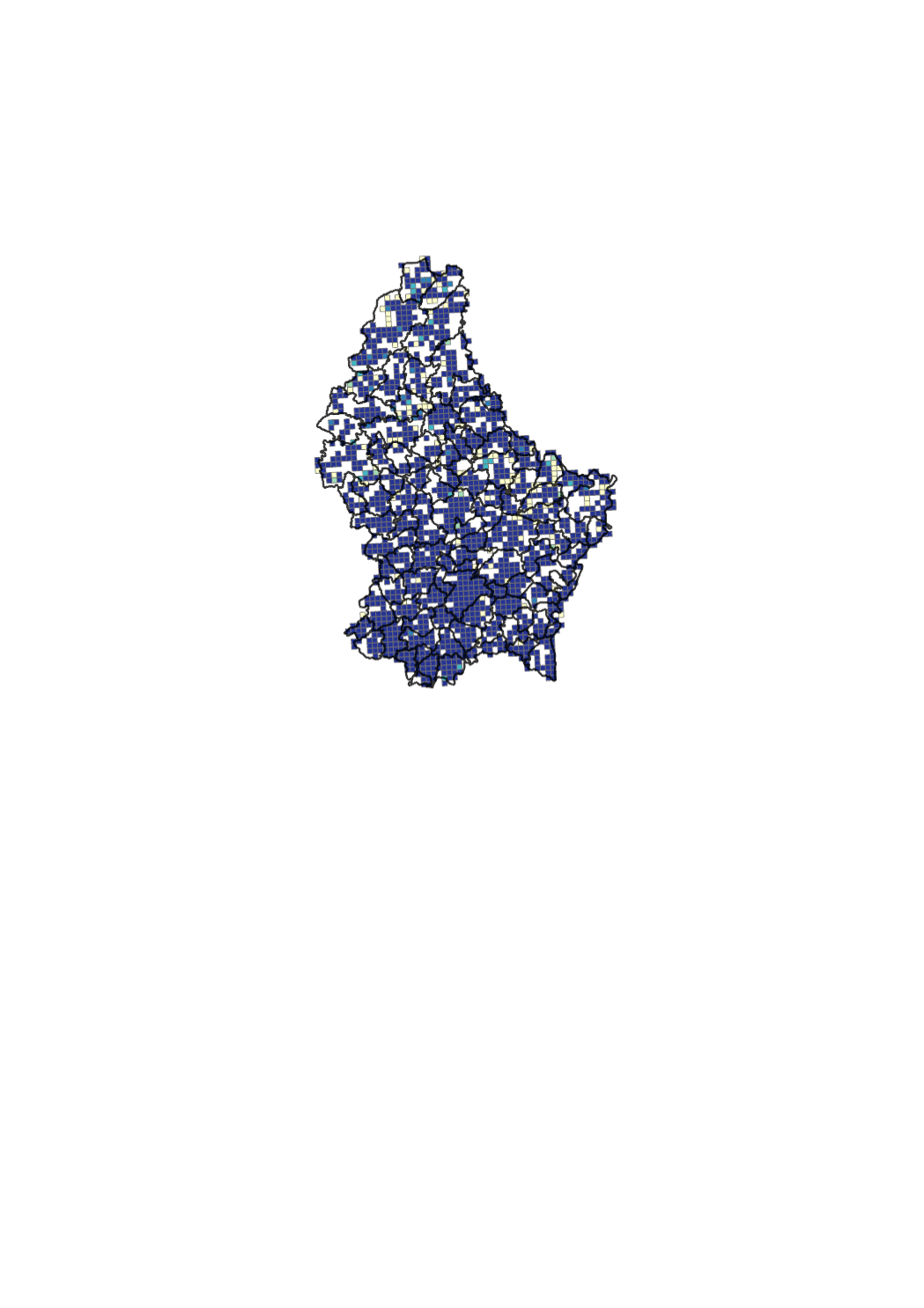
Broadband mapping for speeds between 100 Mbps and 1 Gbps
Ubiquitous access for citizens and companies to very high speed Internet is key for developing the national economy. Hence, the national strategy for very high-speed networks was elaborated in 2010 [http://www.gouvernement.lu/3938123/2010-strategie-ultrahaut-debit.pdf]. The general objective of the strategy is to position the Grand-Duchy of Luxembourg among the leading broadband countries and to enable citizens, companies and public players to reap the associated socio-economic benefits. The strategy is in line with Europe 2020, a strategy for smart, sustainable and inclusive growth, as well as the Digital Agenda for Europe (http://ec.europa.eu/digital-agenda). In the context of the Digital Agenda, the European Commission encourages broadband mapping exercises (http://www.broadbandmapping.eu/). The broadband mapping indicates the percentage of households that can get fix access to very high-speed Internet, independent of the technology (copper cable, coax cable, optical fibre). The map is based on data provided on a voluntary basis by certain network providers and on estimations based on such data. Speeds are advertised speeds and may vary from actual speeds. <a href='https://download.data.public.lu/resources/carte-de-la-couverture-internet-ultra-haut-debit/20180427-075634/couverture_DEC_2017.xlsx'>Link to the data</a> <a href='https://download.data.public.lu/resources/carte-de-la-couverture-internet-ultra-haut-debit/20180427-080207/2017_12_uhd_100MBit.pdf'>Link to the PDF map</a>
Simple
- Date (Creation)
- 2019-01-01T00:00:00
- Date (Revision)
- 2019-01-01T00:00:00
- Identifier
- / ad74e4da-3b37-4379-83d8-16a6de4677c7
- Presentation form
- Digital map
- Status
- On going
Point of contact
Institut Luxembourgeois de Régulation
-
Elisabeth Weber
17, rue du Fossé
,
Luxembourg
,
L - 1536
,
Luxembourg
28228-422
Point of contact
No information provided.
- Maintenance and update frequency
- As needed
- Entités au Grand-Duché de Luxembourg
-
- Grand-Duché du Luxembourg
- Keywords
-
- Keywords
-
- Internet coverage
- very high-speed
- national strategy for very high-speed networks
- Digital Agenda for Europe
- Digital Lëtzebuerg
- geoportail.lu
- geoportail.lu themes
-
- Main
- geoportail.lu structure
-
- Main>Infrastructure and communication>Broadband internet
- Use constraints
- Other restrictions
- Other constraints
- Creative Commons 1.0 Universal (CC0 1.0) Public Domain Dedication
- Spatial representation type
- Vector
- Denominator
- 0
- Metadata language
- English
- Metadata language
- ltz
- Metadata language
- Deutsch
- Metadata language
- Français
- Character set
- UTF8
- Topic category
-
- Utilities communication
N
S
E
W
))
- Reference system identifier
- EPSG / http://www.opengis.net/def/crs/EPSG/0/2169
- OnLine resource
-
Coverage ≥ 100 Mbit/s & < 1 Gbit/s
uhd2
- File identifier
- ad74e4da-3b37-4379-83d8-16a6de4677c7 XML
- Metadata language
- Français
- Character set
- UTF8
- Hierarchy level
- Dataset
- Hierarchy level name
- dataset
- Date stamp
- 2021-02-04T22:12:30
- Metadata standard name
- ISO 19115:2003/19139
- Metadata standard version
- 1.0
Point of contact
Institut Luxembourgeois de Régulation
-
Elisabeth Weber
17, rue du Fossé
,
Luxembourg
,
L - 1536
,
Luxembourg
28228-422
Overviews
Spatial extent
N
S
E
W
Provided by

Associated resources
Not available