 geocatalogue.geoportail.lu
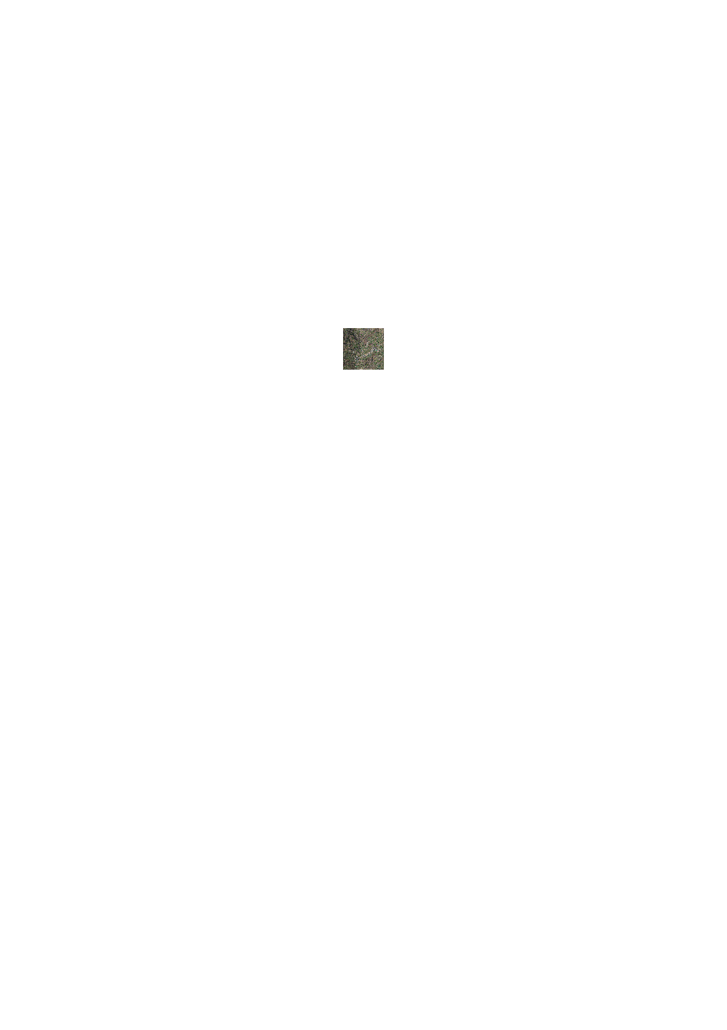
Orthophoto haute résolution de la région Nordstad (2017)
Héichopléisend Orthophoto vun der Regioun Nordstad (2017)
High resolution orthophoto of the Nordstad region (2017)
Hochaufgelöstes Orthophoto der Region Nordstad (2017)
L'ACT a lancé un prototype de survol LIDAR en 2017 en vue d'une planification d'un tel survol pour tout le pays en 2018/2019. Un des éléments issus de ce prototype est une orthophoto "technique" d'une résolution au sol de 10cm. Date du survol: 9 avril 2017
De Kadaster huet 2017 ee Prototyp vun enger LIDAR Iwwerfléiung duerchgefouert, als Virbereedung vun enger landeswäiter Iwwerfléiung 2018/2019. Eent vun de Resultater vun deem Prototyp ass eng "technesch" Orthophoto matt enger Buedemopléisung vun 10cm. Datum vun der Iwwerfléiung: 9. Abrëll 2017
In 2017, the ACT has executed a prototype project of a LIDAR flight in preparation of a country wide flight in 2018/2019. One of the results of this prototype is a "technical" Orthophoto with a ground resolution of 10 cm. Date of the overflight: 9 april 2017
Die Katasterverwaltung hat 2017 einen Prototypen einer LIDAR - Überfliegung durchgeführt, dies in Vorbereitung einer landesweiten Überfliegung in 2018/2019. Eines der Resultate dieses Prototyps ist ein "technisches" Orthophoto mit einer Grundauflösung von 10cm. Datum der Überfliegung: 9. April 2017
Simple
-
Date (Création)Date (Création)Date (Creation)Datum (Erstellung)
- 2017-04-04T00:00:00
-
IdentificateurIdentificateurIdentifierIdentifikator
- / a2f1a418-6b8b-44e3-9982-1f37d2dbda7e
-
Forme de la présentationForme de la présentationPresentation formPräsentationsform
-
Carte numériqueCarte numériqueDigital mapDigitale Karte
-
EtatEtatStatusBearbeitungsstatus
-
Mise à jour continueMise à jour continueOn goingKontinuierliche Aktualisierung
Point de contact
Point de contact
Point of contact
Ansprechpartner
Administration du Cadastre et de la Topographie
-
Administration du Cadastre et de la Topographie
1, Rue Charles Darwin
,
Luxembourg
,
L-1433
,
Luxembourg
247-54400
-
Fréquence de mise à jourFréquence de mise à jourMaintenance and update frequencyÜberarbeitungsintervall
-
Lorsque nécessaireLorsque nécessaireAs neededBei Bedarf
- Entités au Grand-Duché de Luxembourg
-
-
Grand-Duché du LuxembourgGrand-Duché du LuxembourgGrand-Duché du LuxembourgGrand-Duché du Luxembourg
-
- Keywords
-
- Keywords
-
-
image aérienneLoftbildAerial imageLuftbild
-
nordstadNordstadNordstadNordstad
-
orthoOrthoOrthoOrtho
-
orthophotoOrthophotoOrthophotoOrthophoto
-
geoportail.lugeoportail.lugeoportail.lugeoportail.lu
-
- geoportail.lu themes
-
-
Grand PublicAllgemengMainAllgemein
-
- geoportail.lu structure
-
-
Grand Public>Modèles altimétriques numériques (BD-L-LiDAR)>Prototype LiDAR 2017 (Région Nordstad)Grand Public>Modèles altimétriques numériques (BD-L-LiDAR)>Prototype LiDAR 2017 (Région Nordstad)>LiDAR Prototyp 2017 (Regioun Nordstad)Main>Digital elevation model (BD-L-LiDAR)>LiDAR Prototype 2017 (Nordstad region)Allgemein>Digitales Höhenmodell (BD-L-LiDAR)>LiDAR Prototyp 2017 (Region Nordstad)
-
Grand Public>Couverture du sol>Modèles altimétriques numériques (BD-L-LiDAR)>Prototype LiDAR 2017 (Région Nordstad)Grand Public>Couverture du sol>Modèles altimétriques numériques (BD-L-LiDAR)>Prototype LiDAR 2017 (Région Nordstad)>LiDAR Prototyp 2017 (Regioun Nordstad)Main>Land surface>Digital elevation model (BD-L-LiDAR)>LiDAR Prototype 2017 (Nordstad region)Allgemein>Oberflächendarstellung>Digitales Höhenmodell (BD-L-LiDAR)>LiDAR Prototyp 2017 (Region Nordstad)
-
-
Contraintes d'utilisationContraintes d'utilisationUse constraintsNutzungseinschränkungen
-
Autres restrictionsAutres restrictionsOther restrictionsBenutzerdeifinierte Einschränkungen
- Other constraints
- Creative Commons 1.0 Universal (CC0 1.0) Public Domain Dedication
-
Type de représentation spatialeType de représentation spatialeSpatial representation typeRäumliche Darstellungsart
-
VecteurVecteurVectorVektor
-
Dénominateur de l'échelleDénominateur de l'échelleDenominatorMassstabszahl
- 0
-
Jeu de caractèresJeu de caractèresCharacter setZeichensatz
-
Utf8Utf8UTF8Utf8
-
Catégorie ISOCatégorie ISOTopic categoryThematik
-
-
Imagerie/Cartes de base/Occupation des terresImagerie/Cartes de base/Occupation des terresImagery base maps earth coverOberflächenbeschreibung
-
N
S
E
W
))
-
Nom du système de référenceNom du système de référenceReference system identifierIdentifikator des Referenzsystems
- EPSG / http://www.opengis.net/def/crs/EPSG/0/2169
-
Ressource en ligneRessource en ligneOnLine resourceOnline
-
1379 1379 1379 1379
(
OGC:WMS-1.3.0-http-get-map
)
Orthophoto 2017 (hiver)Orthophoto 2017 (hiver)Orthophoto 2017 (hiver)Orthophoto 2017 (hiver)
-
Ressource en ligneRessource en ligneOnLine resourceOnline
-
Orthophoto 2017 (hiver) Orthophoto 2017 (Wanter) Orthophoto 2017 (winter) Orthophoto 2017 (Winter)
lidar_ortho_2017_winter
-
Identifiant de la ficheIdentifiant de la ficheFile identifierMetadatensatzidentifikator
- a2f1a418-6b8b-44e3-9982-1f37d2dbda7e XML
-
LangueLangueMetadata languageSprache
- Français
-
Jeu de caractèresJeu de caractèresCharacter setZeichensatz
-
Utf8Utf8UTF8Utf8
-
Type de ressourceType de ressourceHierarchy levelHierarchieebene
-
Jeu de donnéesJeu de donnéesDatasetDatenbestand
- Hierarchy level name
- dataset
-
Date des métadonnéesDate des métadonnéesDate stampDatum
- 2021-02-04T22:23:44
- Metadata standard name
- ISO 19115:2003/19139
- Metadata standard version
- 1.0
Point de contact
Point de contact
Point of contact
Ansprechpartner
Administration du Cadastre et de la Topographie
-
Administration du Cadastre et de la Topographie
1, Rue Charles Darwin
,
Luxembourg
,
L-1433
,
Luxembourg
247-54400
Overviews
Spatial extent
N
S
E
W
Provided by

Associated resources
Not available