 geocatalogue.geoportail.lu
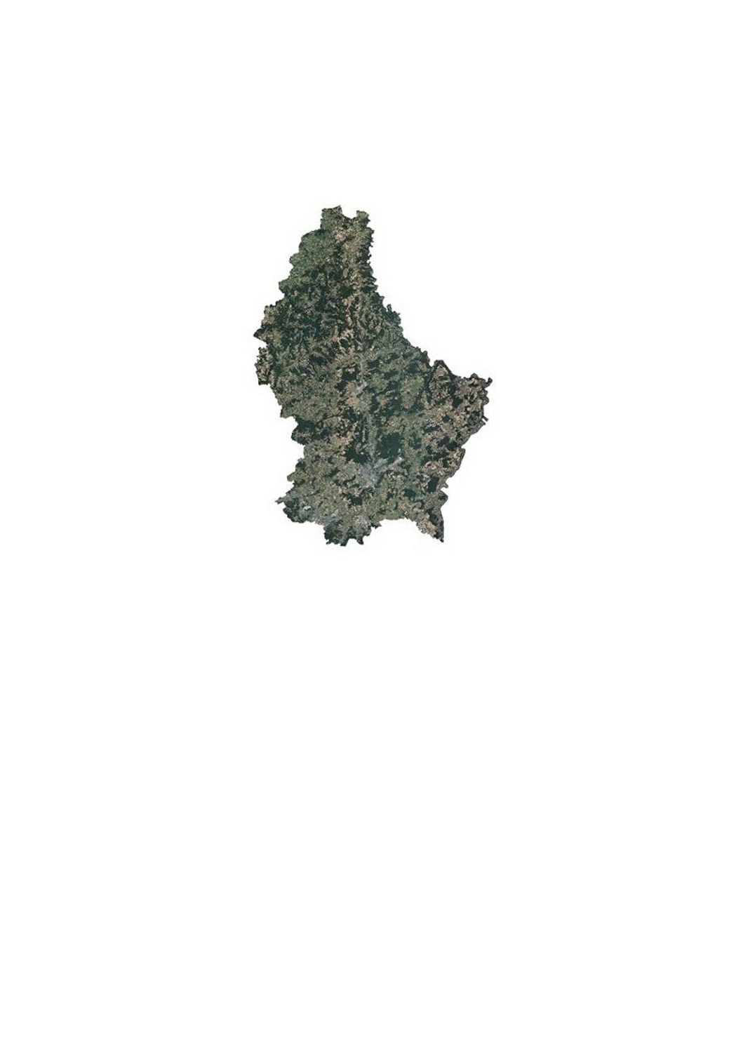
Orthophoto 2018 of the land registry and topography administration
This layer contains the official orthophotos covering the national territory of Luxembourg. The 4 surveying flights took place on 2, 8 and 27 July and 5 August 2018, with a sun position of > 35°. The ground sampling distance is <0,20m. The perspective displacement is in general <25%, except for Luxembourg-City, where it is <15% for a zone of 10x9km (90km2, centered on the coordinates 78000 east and 74500 north). On the borders, a zone of 50m behind the country border is included.
Simple
- Identifier
- / 6fde72c4-802f-4663-be74-5fa5901cb4f0
- Presentation form
- Digital map
- Status
- On going
Point of contact
Administration du Cadastre et de la Topographie
-
Administration du Cadastre et de la Topographie
1, Rue Charles Darwin
,
Luxembourg
,
L-1433
,
Luxembourg
247-54400
- Maintenance and update frequency
- As needed
- Entités au Grand-Duché de Luxembourg
-
- Grand-Duché du Luxembourg
- Keywords
-
- Keywords
-
- orthophoto
- aerial
- photograph
- geodata
- 2018
- geoportail.lu
- geoportail.lu themes
-
- Main
- Water
- geoportail.lu structure
-
- Main>Land surface>Orthophoto-images
- Water>Geographical location>Aerial and satellite photographs
- Use constraints
- Other restrictions
- Other constraints
- Creative Commons 1.0 Universal (CC0 1.0) Public Domain Dedication
- Spatial representation type
- Vector
- Denominator
- 0
- Character set
- UTF8
N
S
E
W
))
- Reference system identifier
- EPSG / http://www.opengis.net/def/crs/EPSG/0/2169
- OnLine resource
-
1527
(
OGC:WMS-1.3.0-http-get-map
)
Orthophoto 2018
- OnLine resource
-
ortho_2018
(
OGC:WMS-1.3.0-http-get-map
)
ortho_2018
- OnLine resource
-
Orthophoto 2018
ortho_2018
- File identifier
- 6fde72c4-802f-4663-be74-5fa5901cb4f0 XML
- Metadata language
- Français
- Character set
- UTF8
- Hierarchy level
- Dataset
- Hierarchy level name
- dataset
- Date stamp
- 2021-02-04T23:00:25
- Metadata standard name
- ISO 19115:2003/19139
- Metadata standard version
- 1.0
Point of contact
Administration du Cadastre et de la Topographie
-
Administration du Cadastre et de la Topographie
1, Rue Charles Darwin
,
Luxembourg
,
L-1433
,
Luxembourg
247-54400
Overviews
Spatial extent
N
S
E
W
Provided by

Associated resources
Not available