 geocatalogue.geoportail.lu
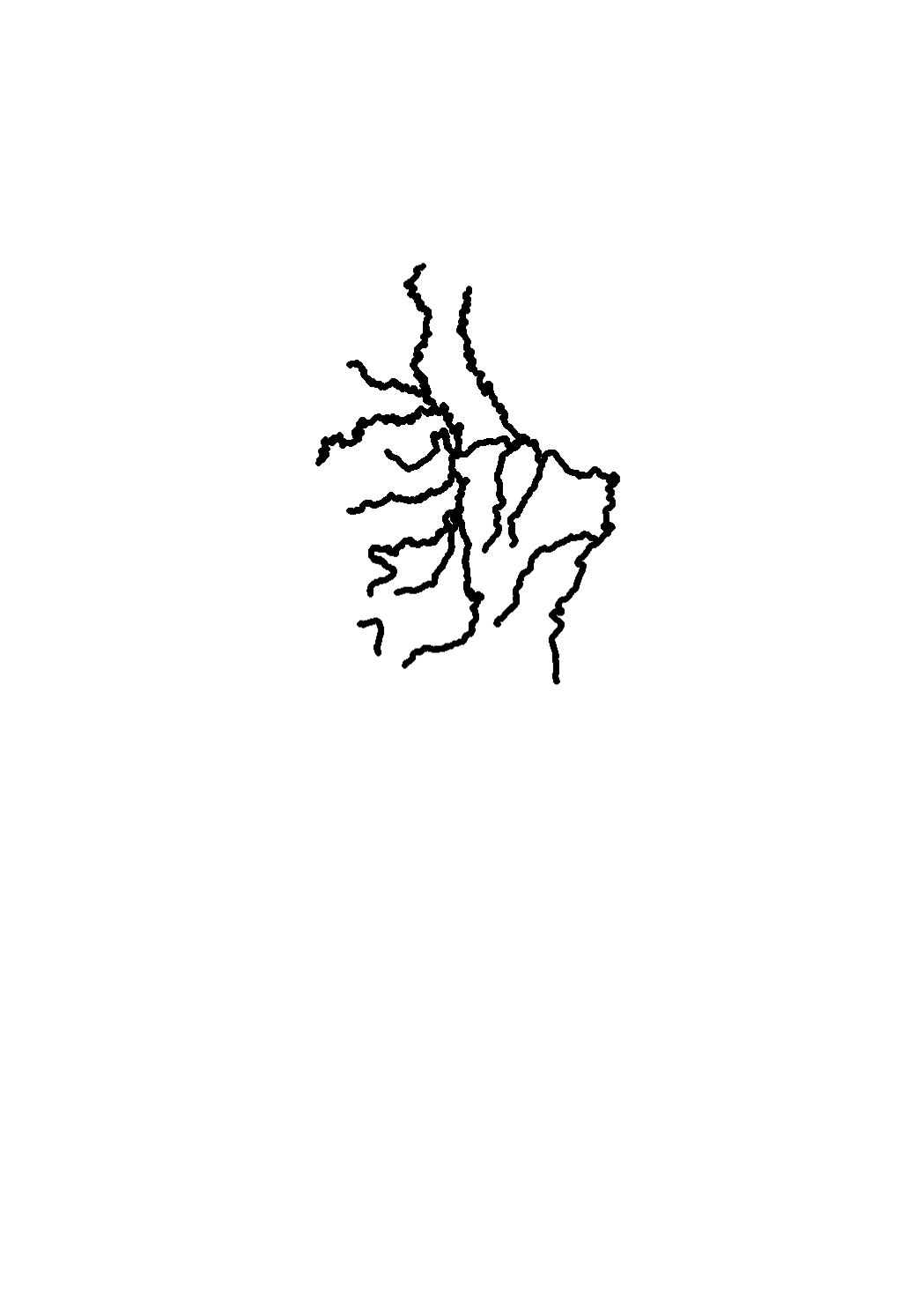
Watercourses kilometrage
Measurement of kilometers of the watercourses of Luxembourg beginning at their affluent point and going up to the source or to the point, where the surface water enters Lux
Simple
- Date (Creation)
- 2017-01-27T00:00:00
- Identifier
- / 4002b1cf-08b5-421a-bc92-40271d62f03c
- Presentation form
- Digital map
- Status
- On going
- Maintenance and update frequency
- As needed
- Entités au Grand-Duché de Luxembourg
-
- Grand-Duché du Luxembourg
- Keywords
-
- water courses, kilometers, source, affluent, distance
- Keywords
-
- geoportail.lu
- geoportail.lu themes
-
- Water
- Main
- geoportail.lu structure
-
- Water>Surface waters>Stream Network
- Main>Land surface>Surface waters>Stream Network
- Access constraints
- Other restrictions
- Spatial representation type
- Vector
- Denominator
- 0
- Metadata language
- Français
- Character set
- UTF8
N
S
E
W
))
- Reference system identifier
- EPSG / http://www.opengis.net/def/crs/EPSG/0/2169
- OnLine resource
-
750
(
OGC:WMS-1.3.0-http-get-map
)
Kilométrage des cours d'eau
- OnLine resource
-
Watercourses kilometrage
eau_new_Kilometrierung der Gewässer
- File identifier
- 4002b1cf-08b5-421a-bc92-40271d62f03c XML
- Metadata language
- Français
- Character set
- UTF8
- Hierarchy level
- Dataset
- Hierarchy level name
- dataset
- Date stamp
- 2021-02-04T23:22:19
- Metadata standard name
- ISO 19115:2003/19139
- Metadata standard version
- 1.0
Point of contact
Administration de la gestion de l'eau
-
Division de l'hydrologie
(
)
24556 7200
1, avenue du Rock'n'Roll
,
Esch-sur-Alzette
,
L-4361
,
Luxembourg
24556 200
24556 7200
Overviews
Spatial extent
N
S
E
W
Provided by

Associated resources
Not available