 geocatalogue.geoportail.lu
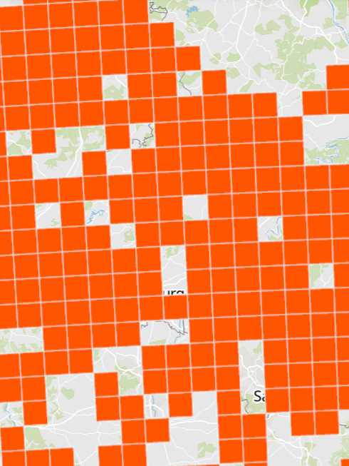
Presence of the Natterer's Bat (Myotis nattereri)
Presence of the Natterer's Bat (Myotis nattereri)
- Illustration as grid cells 10x10km
- Data sources: MNHN Luxemburg, MNHN France, Ministerium für Umwelt und Verbraucherschutz Saarland, Landesamt für Umwelt (LfU) Rheinland-Pfalz, SPW/ARNE/DEMNA, Natagora and collaborators
Simple
- Date (Creation)
- 2023-08-22T00:00:00
- Identifier
- / e5857009-5963-4f59-b967-51d805ca7235
- Presentation form
- Digital map
- Status
- Completed
- Maintenance and update frequency
- As needed
- Keywords
-
- nature, environment, Myotis nattereri, NatuData, biodiversity
- Entités dans la Grande Région
-
- Greater Region
- gis-gr.eu themes
-
- Environment
- gis-gr.eu structure
-
- Environment>Biodiversity
- Keywords
-
- gis-gr.eu
- Access constraints
- Other restrictions
- Spatial representation type
- Vector
- Denominator
- 250000
- Metadata language
- Français
- Metadata language
- English
- Metadata language
- Deutsch
- Character set
- UTF8
- Topic category
-
- Environment
- Biota
))
- Reference system identifier
- EPSG / http://www.opengis.net/def/crs/EPSG/0/3857
- Distribution format
-
-
SHAPE
()
-
PDF
()
-
JPEG
()
-
SHAPE
()
- OnLine resource
-
Myotis_nattereri
(
OGC:WMS-1.3.0-http-get-capabilities
)
Myotis_nattereri
- OnLine resource
- Interactive map ( WWW:LINK-1.0-http--samples )
- OnLine resource
-
Natudata_mammals:Myotis_nattereri
(
OGC:WFS
)
Myotis_nattereri
- OnLine resource
- Open data ( WWW:LINK-1.0-http--link )
- File identifier
- e5857009-5963-4f59-b967-51d805ca7235 XML
- Metadata language
- Français
- Character set
- UTF8
- Hierarchy level
- Dataset
- Hierarchy level name
- dataset
- Date stamp
- 2025-01-14T10:16:21
- Metadata standard name
- ISO 19115:2003/19139
- Metadata standard version
- 1.0
Overviews
Spatial extent
Provided by
