 geocatalogue.geoportail.lu
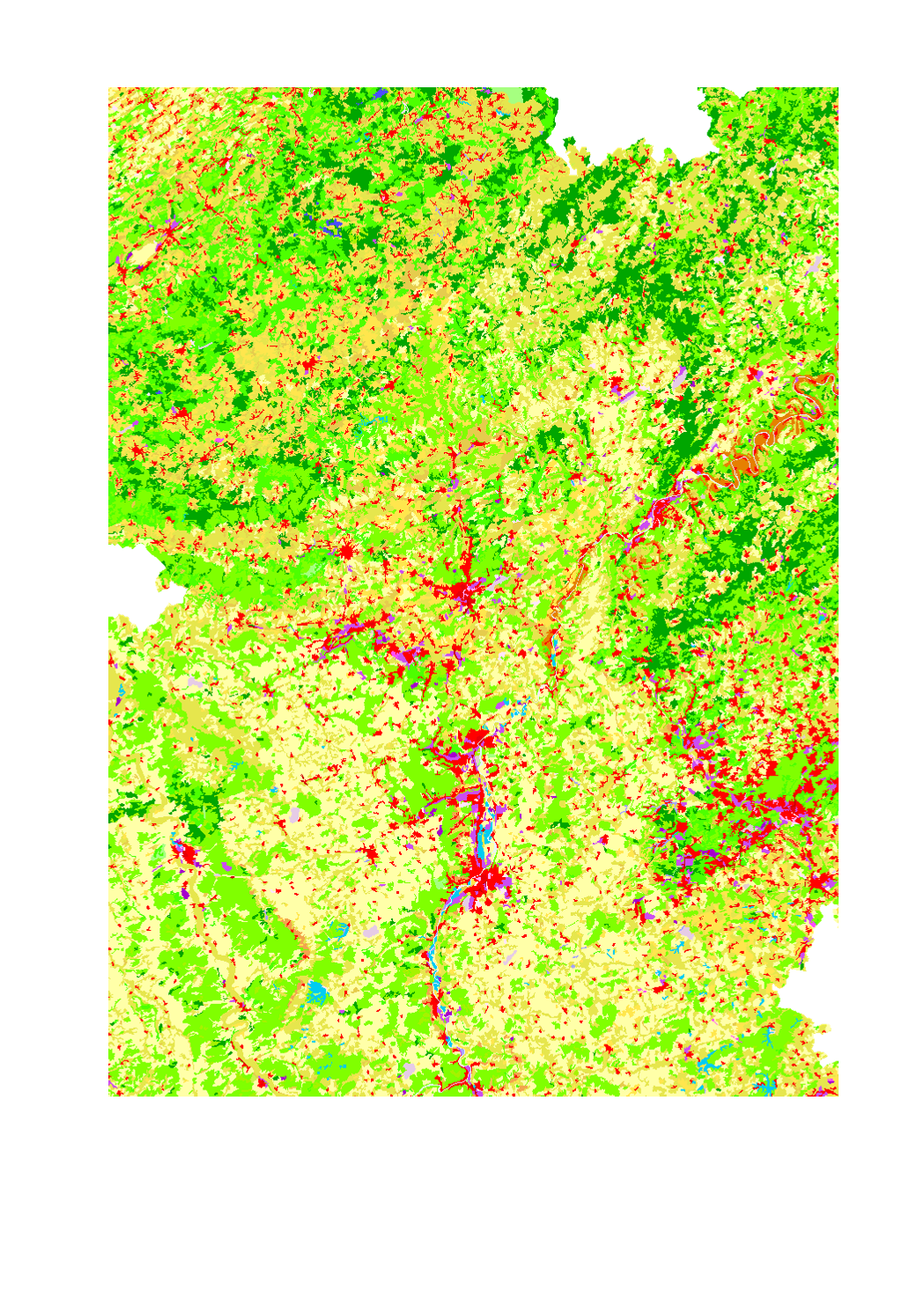
Corine Land Cover 2012
Land use in the Greater Region according to Corine Land Cover 2012
- Source: EEA - Corine Land Cover 2012 European seamless vector database: STATUS 2012 layer (CLC12)
Simple
- Date (Creation)
- 2017-04-12T00:00:00
- Citation identifier
- / b9e5a037-c0b5-4127-b568-f934e323d024
- Presentation form
- Digital map
- Status
- Completed
- Point of contact
-
Organisation name Individual name Electronic mail address Role SIG-GR - Ministère de l'Energie et de l'Aménagement du territoire - Département de l'aménagement du territoire
Thierry Hengen
Author
- Maintenance and update frequency
- Continual
- Keywords
-
-
soil, environment
-
-
Entités dans la Grande Région
-
-
Greater Region
-
-
gis-gr.eu themes
-
-
Land cover
-
-
gis-gr.eu structure
-
-
Land cover>Corine Land Cover
-
- Keywords
-
-
gis-gr.eu
-
- Access constraints
- Other restrictions
- Spatial representation type
- Vector
- Denominator
- 250000
- Language
- Deutsch
- Language
- Français
- Language
- English
- Character set
- UTF8
- Topic category
-
- Imagery base maps earth cover
))
- Reference system identifier
- EPSG / http://www.opengis.net/def/crs/EPSG/0/3857
- Distribution format
-
Name Version PDF
SHAPE
JPEG
- OnLine resource
-
Protocol Linkage Name WWW:LINK-1.0-http--samples
https://map.gis-gr.eu/theme/occupation_des_sols?version=3&zoom=8&X=667917&Y=6394482&lang=en&layers=1698&opacities=1&bgLayer=basemap_2015_global Interactive map
WWW:LINK-1.0-http--link
https://data.public.lu/en/datasets/corine-land-cover-2012 Open data
OGC:WMS-1.3.0-http-get-map
https://ws.geoportail.lu/wss/service/GR_land_cover_WMS/guest Corine_land_cover_2012
OGC:WFS
https://ws.geoportail.lu/wss/service/GR_land_cover_WFS/guest land_cover:Corine_land_cover_2012
Metadata
- File identifier
- b9e5a037-c0b5-4127-b568-f934e323d024 XML
- Metadata language
- Français
- Character set
- UTF8
- Hierarchy level
- Dataset
- Hierarchy level name
-
dataset
- Date stamp
- 2025-01-10T12:43:31
- Metadata standard name
-
ISO 19115:2003/19139
- Metadata standard version
-
1.0
- Metadata author
-
Organisation name Individual name Electronic mail address Role SIG-GR - Ministère de l'Energie et de l'Aménagement du territoire - Département de l'aménagement du territoire
Thierry Hengen
Point of contact
- Other language
-
Language Character encoding English UTF8 German UTF8 French UTF8
)))