 geocatalogue.geoportail.lu
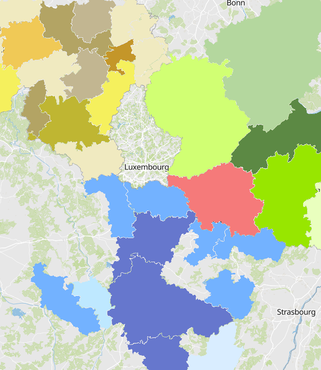
Regionale und interkommunale Raumplanungsdokumente (08/2020)
- Regionale und interkommunale Raumplanungsdokumente der Partner der Großregion (08/2020)
- Quellen: Région Grand Est 2020; DREAL Grand Est 2020; MDI Rheinland-Pfalz 2020; MIBS Saarland 2020
Simple
- Datumsangaben (Erstellung)
- 2020-10-15T00:00:00
- Identifikator
- / 936e8b01-d0b6-4a58-a245-9b0c39364faa
- Präsentationsform
- Digitale Karte
- Bearbeitungsstatus
- Abgeschlossen
- Kontakt für die Ressource
-
Organisation Person E-Mail Funktion SIG-GR - Ministère de l'Energie et de l'Aménagement du territoire - Département de l'aménagement du territoire
Thierry Hengen
Autor
- Überarbeitungsintervall
- Bei Bedarf
- Keywords
-
-
Raumplanung, regional, interkommunal
-
-
Entités dans la Grande Région
-
-
Großregion
-
-
gis-gr.eu themes
-
-
Raumplanung
-
-
gis-gr.eu structure
-
-
Raumplanung>Raumplanungsdokumente
-
- Keywords
-
-
gis-gr.eu
-
- Zugriffseinschränkungen
- Benutzerdefinierte Einschränkungen
- Räumliche Darstellungsart
- Vektor
- Maßstabszahl
- 0
- Sprache
- English
- Sprache
- Français
- Sprache
- Deutsch
- Zeichensatz
- Utf8
- ISO-Thematik
-
- Planungsunterlagen, Kataster
N
S
E
W
))
- Identifikator des Referenzsystems
- EPSG / http://www.opengis.net/def/crs/EPSG/0/3857
- Abgabeformat
-
Bezeichnung Version PDF
SHAPE
JPEG
- Online
Metadaten
- Metadatensatzidentifikator
- 810c30c0-b520-4ab7-9936-17c8cd0874a4 XML
- Sprache
- Français
- Zeichensatz
- Utf8
- Hierarchieebene
- Datenbestand
- Bezeichnung der Hierarchieebene
-
dataset
- Datum
- 2025-01-10T13:22:02
- Bezeichnung des Metadatenstandards
-
ISO 19115:2003/19139
- Version des Metadatenstandards
-
1.0
- Metadatenkontakt
-
Organisation Person E-Mail Funktion SIG-GR - Ministère de l'Energie et de l'Aménagement du territoire - Département de l'aménagement du territoire
Thierry Hengen
Ansprechpartner
- Sprachraum
-
Sprache Zeichensatz Englisch Utf8 Deutsch Utf8 Französisch Utf8
)))