 geocatalogue.geoportail.lu
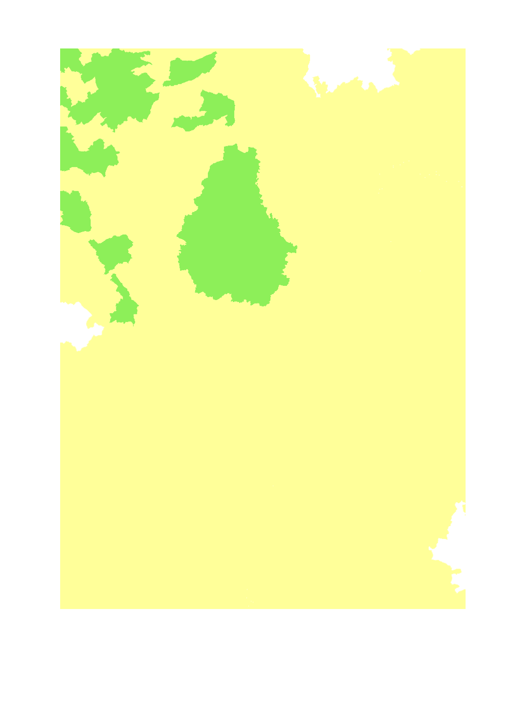
Densité de porcins par surface agricole utile
Pig density per agricultural area
Schweinedichte nach landwirtschaftlicher Nutzfläche
- Unités de gros bétail de porcins par hectare de surface agricole utile
- Niveau territorial: Lorraine: canton (2010), Luxembourg: canton (2015), Rhénanie-Palatintat: Landkreise et kreisfreie Städte (2017), Sarre: Landkreise (2016), Wallonie: commune (2015)
- Sources: SIG-GR 2018; DRAAF Grand Est 2017; ASTA Luxembourg 2017; Statistisches Landesamt Rheinland-Pfalz 2017; Statistisches Amt Saarland 2017; Direction générale statistique 2017; Groupe de travail "Agriculture et forêt" de la Grande Région
- Livestock units of pigs per ha of agricultural area
- Territorial entity: Lorraine: canton (2010), Luxembourg: canton (2015), Rhineland-Palatinate: Landkreise and kreisfreie Städte (2010), Saarland: Landkreise (2016), Wallonia: municipality (2015)
- Sources: SIG-GR 2018; DRAAF Grand Est 2017; ASTA Luxembourg 2017; Statistisches Landesamt Rheinland-Pfalz 2017; Statistisches Amt Saarland 2017; Direction générale statistique 2017; Groupe de travail "Agriculture et forêt" de la Grande Région
- Grossvieheinheiten Schweine pro Hektar landwirtschaftlicher Nutzfläche
- Territoriale Ebene: Lothringen: Kanton (2010), Luxemburg: Kanton (2015), Rheinland-Pfalz: Landkreise und kreisfreie Städte (2017), Saarland: Landkreise (2016), Wallonie: Gemeinde (2015)
- Grundlagen: GIS-GR 2018; DRAAF Grand Est 2017; ASTA Luxembourg 2017; Statistisches Landesamt Rheinland-Pfalz 2017; Statistisches Amt Saarland 2017; Direction générale statistique 2017; Arbeitsgruppe "Landwirtschaft und Forst" der Großregion
Simple
-
Citation identifierIdentifikatorIdentificateur
- / 8083cb04-9e59-49cb-a334-88a620a30c70
-
Presentation formPräsentationsformForme de la présentation
-
Digital mapDigitale KarteCarte numérique
-
StatusBearbeitungsstatusEtat
-
CompletedAbgeschlossenFinalisé
- Point of contact
-
Organisation name Individual name Electronic mail address Role SIG-GR - Ministère de l'Energie et de l'Aménagement du territoire - Département de l'aménagement du territoire
Thierry Hengen
AuthorAutorAuteur
-
Maintenance and update frequencyÜberarbeitungsintervallFréquence de mise à jour
-
As neededBei BedarfLorsque nécessaire
- Keywords
-
-
Agriculture, porcins, ugb
Agriculture, pigs, LU
Landwirtschaft, Schweine, GVE
-
-
Entités dans la Grande Région
-
-
Grande Région
Greater Region
Großregion
-
-
gis-gr.eu themes
-
-
Agriculture
Agriculture
Landwirtschaft
-
-
gis-gr.eu structure
-
-
Agriculture>Densité de bovins et porcins
Agriculture>Cattle and pig density
Landwirtschaft>Rinder- und Schweinedichte
-
- Keywords
-
-
gis-gr.eu
gis-gr.eu
gis-gr.eu
-
-
Access constraintsZugriffseinschränkungenContraintes d'accès
-
Other restrictionsBenutzerdefinierte EinschränkungenAutres restrictions
-
Spatial representation typeRäumliche DarstellungsartType de représentation spatiale
-
VectorVektorVecteur
-
DenominatorMaßstabszahlDénominateur de l'échelle
- 250000
-
LanguageSpracheLangue de la ressource
- English
-
LanguageSpracheLangue de la ressource
- Deutsch
-
LanguageSpracheLangue de la ressource
- Français
-
Character setZeichensatzEncodage des caractères
-
UTF8Utf8Utf8
-
Topic categoryISO-ThematikCatégorie ISO
-
-
FarmingLandwirtschaftAgriculture
-
))
-
Reference system identifierIdentifikator des ReferenzsystemsNom du système de référence
- EPSG / http://www.opengis.net/def/crs/EPSG/0/3857
- Distribution format
-
Name Version COV
JPEG
SHAPE
- OnLine resource
-
Protocol Linkage Name WWW:LINK-1.0-http--samples
https://map.gis-gr.eu/theme/agriculture?version=3&zoom=8&X=667917&Y=6394482&lang=en&layers=1800&opacities=1&bgLayer=basemap_2015_global Carte interactive
Interactive map
Interaktive Karte
WWW:LINK-1.0-http--link
https://data.public.lu/en/datasets/pig-density-per-agricultural-area/ Open data
OGC:WMS-1.3.0-http-get-map
https://ws.geoportail.lu/wss/service/GR_Agriculture_WMS/guest pig_density_per_agricultural_area
OGC:WFS
https://ws.geoportail.lu/wss/service/GR_Agriculture_WFS/guest Agriculture:pig_density_per_agricultural_area
Metadata
-
File identifierMetadatensatzidentifikatorIdentifiant de la fiche
- 8083cb04-9e59-49cb-a334-88a620a30c70 XML
-
Metadata languageSpracheLangue
- Français
-
Character setZeichensatzJeu de caractères
-
UTF8Utf8Utf8
-
Hierarchy levelHierarchieebeneType de ressource
-
DatasetDatenbestandJeu de données
- Hierarchy level name
-
dataset
-
Date stampDatumDate des métadonnées
- 2025-01-13T09:55:13
- Metadata standard name
-
ISO 19115:2003/19139
- Metadata standard version
-
1.0
- Metadata author
-
Organisation name Individual name Electronic mail address Role SIG-GR - Ministère de l'Energie et de l'Aménagement du territoire - Département de l'aménagement du territoire
Thierry Hengen
Point of contactAnsprechpartnerPoint de contact
- Other language
-
Language Character encoding EnglishEnglischAnglaisUTF8Utf8Utf8GermanDeutschAllemandUTF8Utf8Utf8FrenchFranzösischFrançaisUTF8Utf8Utf8
)))