 geocatalogue.geoportail.lu
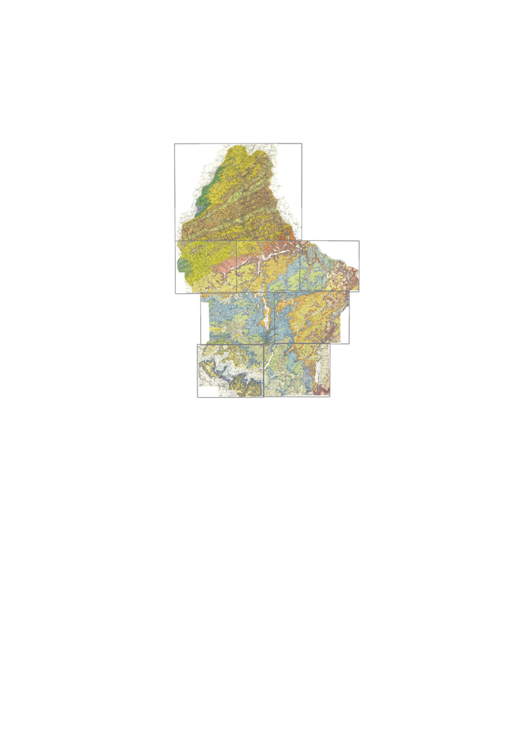
Geological map, old edition
Detailed map of surface geology, in colors, with legende; on simple topographic background. "Old edition", from 1947 to 1949. This dataset has 7 sheets at a scale of 1:25000 and 1 sheet at a scale of 1:50 000, 6 are available as originals and 2 as color copies: 1 - Ech/Alzette 1:25000 (color copy) 2 - Remich 1:25000 3 - Luxembourg 1:25000 (color copy) 4 - Grevenmacher 1:25000 5 - Redange 1:25000 6 - Diekirch 1:25000 7 - Echternach 1:25000 8 - Wiltz 1:50000 Annotation booklets are available for some sheets.
Simple
- Citation identifier
- / 807
- Presentation form
- Digital map
- Status
- On going
- Maintenance and update frequency
- As needed
-
Entités au Grand-Duché de Luxembourg
-
-
Grand-Duché du Luxembourg
-
- Keywords
-
-
Luxembourg; geological map; surface geology; Eisleck; Gutland; Devonian; Triassic; Jurassic; Liassic; Dogger
-
- Keywords
-
-
geoportail.lu
-
-
geoportail.lu themes
-
-
Main
-
-
geoportail.lu structure
-
-
Main>Environment, Biology and Geology>Geology
-
- Use limitation
-
Copyright SGL
- Access constraints
- Other restrictions
- Spatial representation type
- Vector
- Denominator
- 0
- Character set
- UTF8
- Topic category
-
- Geoscientific information
))
- Reference system identifier
- EPSG / http://www.opengis.net/def/crs/EPSG/0/2169
- OnLine resource
-
Protocol Linkage Name https://map.geoportail.lu/theme/main?version=3&zoom=8&X=667917&Y=6394482&lang=fr&layers=294&opacities=1 Geological map, old edition
- Statement
-
Geological field work
Metadata
- File identifier
- 807 XML
- Metadata language
- Français
- Character set
- UTF8
- Hierarchy level
- Dataset
- Hierarchy level name
-
dataset
- Date stamp
- 2021-02-04T23:14:42
- Metadata standard name
-
ISO 19115:2003/19139
- Metadata standard version
-
1.0
- Other language
-
Language Character encoding French UTF8 Luxembourgish; Letzeburgesch UTF8 English UTF8 German UTF8
)))