 geocatalogue.geoportail.lu
Fish 2015
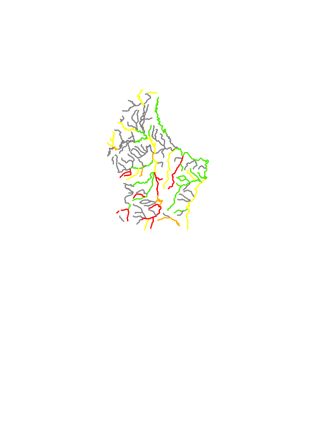
According to the water framework directive (Directive 2000/60/CE), the biological parameter fish are monitored in surface water bodies in order to determine the ecological status. Fish react sensitively to the continuity and the hydrological flow of surface water. Fish are therefor sampled in the SWB which have deficits here. The methodology applied for sampling is the standard NF EN 14962:2006 "water quality − guidance on the scope and selection of fish sampling methods".
Simple
- Date (Creation)
- 2004-12-31T00:00:00
- Date (Publication)
- 2015-12-22
- Citation identifier
- / f44a6aa7-6dcc-4d99-9033-c13ef23ebef4
- Presentation form
- Digital map
- Status
- Completed
- Point of contact
-
Organisation name Individual name Electronic mail address Role Administration de la gestion de l'eau
Division de la protection des eaux
Point of contact
- Maintenance and update frequency
- As needed
-
Entités au Grand-Duché de Luxembourg
-
-
Grand-Duché du Luxembourg
-
- Keywords
-
-
surface water body, river basin, Chiers, river basin district, Meuse, Moselle, Rhine, Water Framework Directive (DIR 2000/60/CE), ecological status, biological quality elements, fish
-
- Keywords
-
-
geoportail.lu
-
-
geoportail.lu themes
-
-
Water
-
Main
-
-
geoportail.lu structure
-
-
Water>Water framework directive [WFD]>River Basin Management Plan 2015>Water bodies [WB] status 2015>Surface waters 2015>Quality elements of the ecological status 2015
-
Main>Environment, Biology and Geology>Water framework directive [WFD]>River Basin Management Plan 2015>Water bodies [WB] status 2015>Surface waters 2015>Quality elements of the ecological status 2015
-
- Access constraints
- Other restrictions
- Other constraints
-
Pas de limitations
- Spatial representation type
- Vector
- Denominator
- 5000
- Language
- Français
- Character set
- UTF8
- Topic category
-
- Inland waters
- Environment
))
- Reference system identifier
- EPSG / http://www.opengis.net/def/crs/EPSG/0/2169
- OnLine resource
-
Protocol Linkage Name OGC:WMS-1.3.0-http-get-map
https://wms.geoportail.lu/public_map_layers/service 646
WWW:LINK-1.0-http--link
https://data.public.lu/fr/datasets/fish-2015-1/ Open data
OGC API-Features
https://features.geoportail.lu/collections/646 OGC API - Features
- OnLine resource
-
Protocol Linkage Name https://map.geoportail.lu/theme/main?version=3&zoom=8&X=667917&Y=6394482&lang=fr&layers=646&opacities=1 Fish 2015
Metadata
- File identifier
- f44a6aa7-6dcc-4d99-9033-c13ef23ebef4 XML
- Metadata language
- Français
- Character set
- UTF8
- Hierarchy level
- Dataset
- Hierarchy level name
-
dataset
- Date stamp
- 2025-12-04T14:25:55.151775Z
- Metadata standard name
-
ISO 19115:2003/19139
- Metadata standard version
-
1.0
- Metadata author
-
Organisation name Individual name Electronic mail address Role Administration de la gestion de l'eau
Administration de la gestion de l'eau
Point of contact
- Other language
-
Language Character encoding Luxembourgish; Letzeburgesch UTF8 English UTF8 German UTF8 French UTF8
)))