 geocatalogue.geoportail.lu
Carte de guerre allemande 1:25k 1939
Däitsch Krichskaart 1:25k 1939
German War map 1:25k 1939
Deutsche Kriegskarte 1:25k 1939
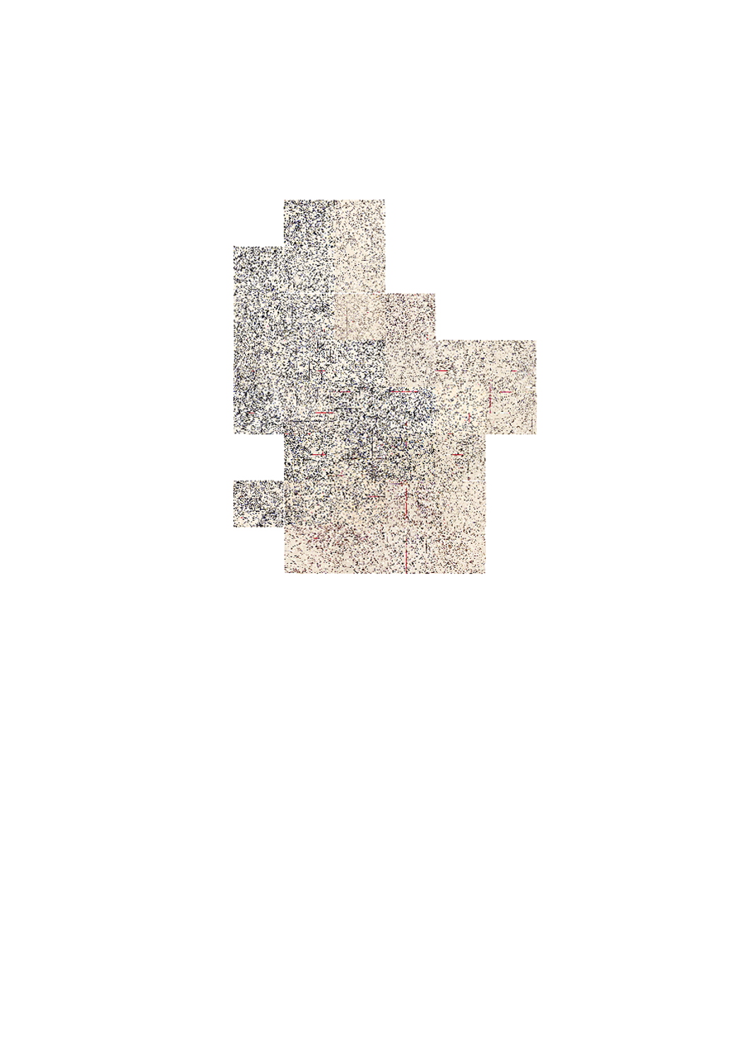
Carte utilisée par les allemands pendant la deuxième guerre mondiale. La carte a été éditée en Septembre 1939 et représente un mélange entre les cartes existantes du pays (Hansen) et des cartes allemandes. Des points de triangulation ainsi que des lignes de coordonnées en système luxembourgeois ont été rajoutées après-coup.
Kaart, di während dem zweeten Weltkrisch vun den Däitschen benotzt guff. D'Kaart guff am September 1939 erstallt an besteet aus ener Mëschung vun lëtzebuerger Kaartematerial (Hansen) an däitsche Kaarten. Spéider guffen Triangulatiounspunkten souwéi lëtzebuergesch Koordinatenlinnen drop gezeechent.
Karte, die während dem zweiten Weltkrieg von den Deutschen benutzt wurde. Die Karte wurde im September 1939 erstellt und stellt eine Mischung aus bestehendem Kartenmaterial des Luxemburger Territoriums (Hansen) und deutschem Kartenmaterial dar. Später wurden Triangulationspunkte und luxemburger Koordinatenlinien hinzugefügt.
Map that has been used by the Germans during WWII. The map has been edited in September 1939 and represents a mix of existing mapsof Luxembourg (Hansen) and german maps. Later, triangulations points as well as luxembourgish coordinate reference lines have been added
Simple
-
IdentificateurIdentificateurCitation identifierIdentifikator
- / e78c1d0a-ef3d-4552-9bba-f72a1d1d3173
-
Forme de la présentationForme de la présentationPresentation formPräsentationsform
-
Carte numériqueCarte numériqueDigital mapDigitale Karte
-
EtatEtatStatusBearbeitungsstatus
-
Mise à jour continueMise à jour continueOn goingKontinuierliche Aktualisierung
- Point of contact
-
Organisation name Individual name Electronic mail address Role Administration du Cadastre et de la Topographie
Administration du Cadastre et de la Topographie
GestionnaireGestionnaireCustodianVerwalter
-
Fréquence de mise à jourFréquence de mise à jourMaintenance and update frequencyÜberarbeitungsintervall
-
Lorsque nécessaireLorsque nécessaireAs neededBei Bedarf
-
Entités au Grand-Duché de Luxembourg
-
-
Grand-Duché du Luxembourg
Grand-Duché du Luxembourg
Grand-Duché du Luxembourg
Grand-Duché du Luxembourg
-
- Keywords
-
-
carte, 1939, war
Kaart, 1939, Krich
Karte, 1939, Krieg
Map, 1939, War
-
- Keywords
-
-
geoportail.lu
geoportail.lu
geoportail.lu
geoportail.lu
-
-
geoportail.lu themes
-
-
Tourisme
Tourismus
Tourism
Tourismus
-
Grand Public
Allgemeng
Main
Allgemein
-
-
geoportail.lu structure
-
-
Tourisme>Cartes topographiques>Cartes topographiques historiques
Tourisme>Cartes topographiques>Cartes topographiques historiques>Historësch topografesch Kaarten
Tourism>Topographical maps>Historical topographical Maps
Tourismus>Topographische Karten>Historische topographische Karten
-
Grand Public>Données de base>Cartes topographiques>Cartes topographiques historiques
Grand Public>Données de base>Cartes topographiques>Cartes topographiques historiques>Historësch topografesch Kaarten
Main>Geographical location>Topographical maps>Historical topographical Maps
Allgemein>Basisdaten>Topographische Karten>Historische topographische Karten
-
-
Contraintes d'accèsContraintes d'accèsAccess constraintsZugriffseinschränkungen
-
Autres restrictionsAutres restrictionsOther restrictionsBenutzerdefinierte Einschränkungen
-
Type de représentation spatialeType de représentation spatialeSpatial representation typeRäumliche Darstellungsart
-
VecteurVecteurVectorVektor
-
Dénominateur de l'échelleDénominateur de l'échelleDenominatorMaßstabszahl
- 25000
-
Langue de la ressourceLangue de la ressourceLanguageSprache
- Deutsch
-
Encodage des caractèresEncodage des caractèresCharacter setZeichensatz
-
Utf8Utf8UTF8Utf8
-
Catégorie ISOCatégorie ISOTopic categoryISO-Thematik
-
-
Cadastre, aménagementCadastre, aménagementPlanning cadastrePlanungsunterlagen, Kataster
-
))
-
Nom du système de référenceNom du système de référenceReference system identifierIdentifikator des Referenzsystems
- EPSG / http://www.opengis.net/def/crs/EPSG/0/2169
- OnLine resource
-
Protocol Linkage Name OGC:WMS-1.3.0-http-get-map
https://wms.geoportail.lu/public_map_layers/service 220
220
220
220
https://map.geoportail.lu/theme/main?version=3&zoom=8&X=667917&Y=6394482&lang=fr&layers=220&opacities=1 Carte de guerre allemande 1:25k 1939
Däitsch Krichskaart 1:25k 1939
German War map 1:25k 1939
Deutsche Kriegskarte 1:25k 1939
Metadata
-
Identifiant de la ficheIdentifiant de la ficheFile identifierMetadatensatzidentifikator
- e78c1d0a-ef3d-4552-9bba-f72a1d1d3173 XML
-
LangueLangueMetadata languageSprache
- Français
-
Jeu de caractèresJeu de caractèresCharacter setZeichensatz
-
Utf8Utf8UTF8Utf8
-
Type de ressourceType de ressourceHierarchy levelHierarchieebene
-
Jeu de donnéesJeu de donnéesDatasetDatenbestand
- Hierarchy level name
-
dataset
-
Date des métadonnéesDate des métadonnéesDate stampDatum
- 2021-02-04T22:42:47
- Metadata standard name
-
ISO 19115:2003/19139
- Metadata standard version
-
1.0
- Metadata author
-
Organisation name Individual name Electronic mail address Role Administration du Cadastre et de la Topographie
Administration du Cadastre et de la Topographie
Point de contactPoint de contactPoint of contactAnsprechpartner
- Other language
-
Language Character encoding FrançaisFranséischFrenchFranzösischUtf8Utf8UTF8Utf8LuxembourgeoisLëtzebuergeschLuxembourgish; LetzeburgeschLuxemburgischUtf8Utf8UTF8Utf8AnglaisEngleschEnglishEnglischUtf8Utf8UTF8Utf8AllemandDäitschGermanDeutschUtf8Utf8UTF8Utf8
)))