 geocatalogue.geoportail.lu
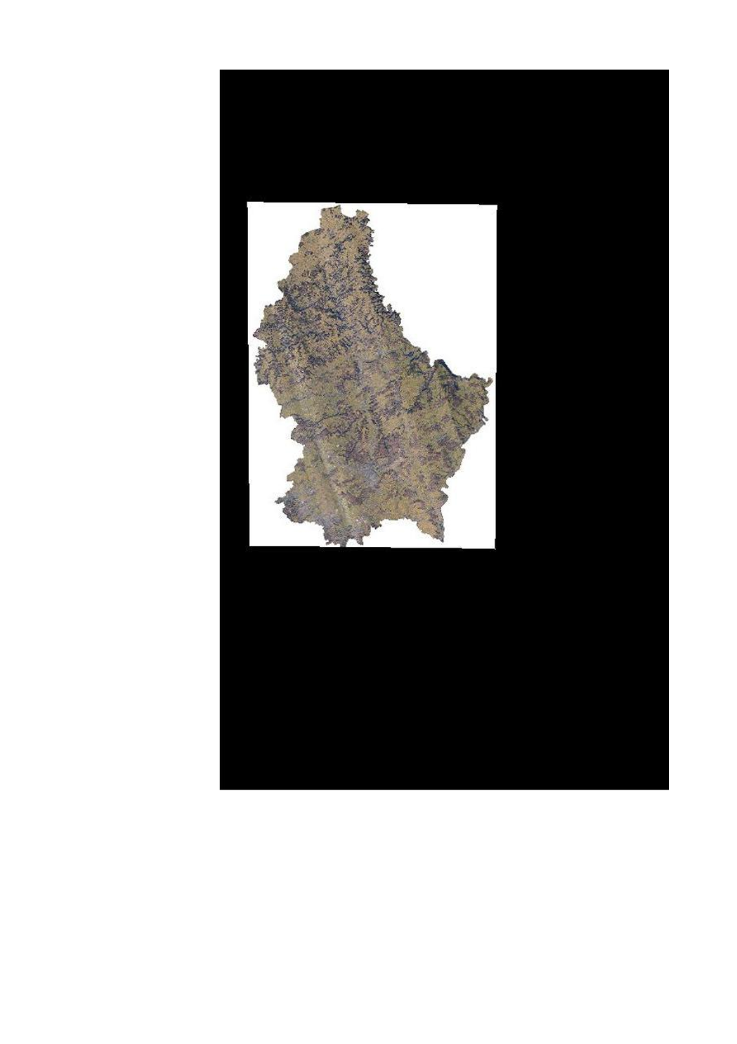
Technical orthophoto (winter 2019)
In february 2019, the ACT has executed a LIDAR flight for the whole country. Issued from the same flight, this aerial image (orthophoto) is primary for technical use.
Simple
- Citation identifier
- / d6cc500f-b802-4be2-a49c-73f3eb2d131e
- Presentation form
- Digital map
- Status
- On going
- Point of contact
-
Organisation name Individual name Electronic mail address Role Administration du Cadastre et de la Topographie
Administration du Cadastre et de la Topographie
Point of contact
- Maintenance and update frequency
- As needed
-
Entités au Grand-Duché de Luxembourg
-
-
Grand-Duché du Luxembourg
-
- Keywords
-
-
LiDAR, orthophoto, technical orthophoto, aerial image, winter, 2019
-
- Keywords
-
-
geoportail.lu
-
- Keywords
-
-
geoportail.lu themes
-
-
Main
-
Water
-
-
geoportail.lu structure
-
-
Main>Digital elevation model (BD-L-LiDAR)>LiDAR 2019
-
Main>Land surface>Orthophoto-images
-
Water>Geographical location>Aerial and satellite photographs
-
Main>Land surface>Digital elevation model (BD-L-LiDAR)>LiDAR 2019
-
- Use constraints
- Other restrictions
- Other constraints
-
Creative Commons 1.0 Universal (CC0 1.0) Public Domain Dedication
- Spatial representation type
- Vector
- Denominator
- 0
- Character set
- UTF8
))
- Reference system identifier
- EPSG / http://www.opengis.net/def/crs/EPSG/0/2169
- OnLine resource
-
Protocol Linkage Name OGC:WMS-1.3.0-http-get-map
https://wms.geoportail.lu/public_map_layers/service 1789
WWW:LINK-1.0-http--link
https://data.public.lu/fr/datasets/orthophoto-technique-du-grand-duche-de-luxembourg-edition-2019-hiver/
- OnLine resource
-
Protocol Linkage Name https://map.geoportail.lu/theme/main?version=3&zoom=8&X=667917&Y=6394482&lang=fr&layers=1789&opacities=1 Orthophoto 2019 (winter)
Metadata
- File identifier
- d6cc500f-b802-4be2-a49c-73f3eb2d131e XML
- Metadata language
- Français
- Character set
- UTF8
- Hierarchy level
- Dataset
- Hierarchy level name
-
dataset
- Date stamp
- 2022-07-27T09:51:07
- Metadata standard name
-
ISO 19115:2003/19139
- Metadata standard version
-
1.0
- Metadata author
-
Organisation name Individual name Electronic mail address Role Administration du Cadastre et de la Topographie
Administration du Cadastre et de la Topographie
Point of contact
- Other language
-
Language Character encoding Luxembourgish; Letzeburgesch UTF8 English UTF8 German UTF8 French UTF8
)))