 geocatalogue.geoportail.lu
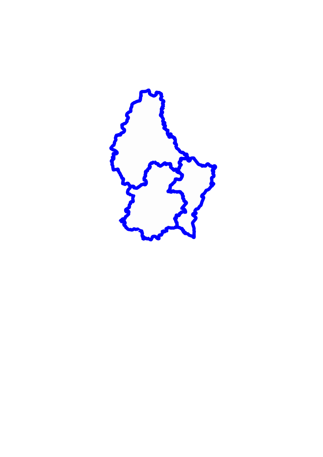
Districts
This layer shows the 3 districts in which the territory of the Grand-Duchy of Luxemburg is officially divided.
Simple
- Date (Creation)
- 2000-01-01T00:00:00
- Citation identifier
- / b9edd03f-3aef-4fd6-a3d9-db076b1cf237
- Presentation form
- Digital map
- Status
- On going
- Point of contact
-
Organisation name Individual name Electronic mail address Role Administration du Cadastre et de la Topographie
Service du géoportail et de l'ILDG (ACT)
Point of contact
- Maintenance and update frequency
- As needed
-
Entités au Grand-Duché de Luxembourg
-
-
Grand-Duché du Luxembourg
-
- Keywords
-
- Keywords
-
-
administrative boundaries
-
boundary
-
administration
-
subdivision
-
territory
-
canton
-
municipality
-
geoportail.lu
-
-
geoportail.lu themes
-
-
Agriculture
-
Environment
-
Tourism
-
Main
-
PAG
-
-
geoportail.lu structure
-
-
Agriculture>Administrative units
-
Environment>Administrative units
-
Tourism>Administrative units
-
Main>Geographical location>Administrative units
-
PAG>Geographical location>Administrative units
-
- Use constraints
- Other restrictions
- Other constraints
-
Creative Commons 1.0 Universal (CC0 1.0) Public Domain Dedication
- Spatial representation type
- Vector
- Denominator
- 2500
- Language
- Lëtzebuergesch
- Language
- Deutsch
- Language
- Français
- Language
- English
- Character set
- UTF8
- Topic category
-
- Structure
))
- Reference system identifier
- EPSG / http://www.opengis.net/def/crs/EPSG/0/2169
- Distribution format
-
Name Version DWG
SHAPE
DXF
- OnLine resource
-
Protocol Linkage Name OGC:WMS-1.3.0-http-get-map
https://wms.geoportail.lu/public_map_layers/service 354
OGC:WMS-1.3.0-http-get-map
http://wmts1.geoportail.lu/opendata/service?request=getCapabilities&service=WMS&version=1.3.0 districts
WWW:LINK-1.0-http--link
https://data.public.lu/fr/datasets/limites-administratives-du-grand-duche-de-luxembourg/ OGC API-Features
https://features.geoportail.lu/collections/354 OGC API - Features
- OnLine resource
-
Protocol Linkage Name https://map.geoportail.lu/theme/main?version=3&zoom=8&X=667917&Y=6394482&lang=fr&layers=354&opacities=1 Districts
Metadata
- File identifier
- b9edd03f-3aef-4fd6-a3d9-db076b1cf237 XML
- Metadata language
- Français
- Character set
- UTF8
- Hierarchy level
- Dataset
- Hierarchy level name
-
dataset
- Date stamp
- 2021-02-04T22:22:53Z
- Metadata standard name
-
ISO 19115:2003/19139
- Metadata standard version
-
1.0
- Metadata author
-
Organisation name Individual name Electronic mail address Role Administration du Cadastre et de la Topographie
Service du géoportail et de l'ILDG (ACT)
Point of contact
- Other language
-
Language Character encoding Luxembourgish; Letzeburgesch UTF8 English UTF8 German UTF8 French UTF8
)))