 geocatalogue.geoportail.lu
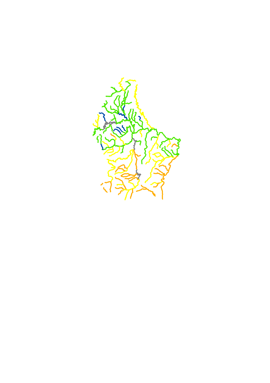
Macrobenthos 2015
The macroinvertebrates are sampled according to the French method IBGN ( indice biologique global normalisé , agences de l' eau 2000). The results allow to classify the surface water bodies into 5 classes : high - good - moderate - poor - bad. Macroinvertebrates are sensitive to the hydromorphology, organic pollution , biological continuity , water regime and acidification. The Macroinvertebrates are one out of four biological parameters of the ecological status of surface water.
Simple
- Date (Creation)
- 2014-05-21T00:00:00
- Date (Revision)
- 2016-12-01T00:00:00
- Date (Publication)
- 2015-12-22
- Citation identifier
- / b8a59482-2696-4b9a-a527-3201597a4caf
- Presentation form
- Digital map
- Status
- Completed
- Point of contact
-
Organisation name Individual name Electronic mail address Role Administration de la gestion de l'eau
Division de la protection des eaux
Point of contact
- Maintenance and update frequency
- As needed
-
Entités au Grand-Duché de Luxembourg
-
-
Grand-Duché du Luxembourg
-
- Keywords
-
-
surface water body, river basin, Chiers, river basin district, Meuse, Moselle, Rhine, ecological status, Water Framework Directive (DIR 2000/60/CE), biological quality elements, macroinvertebrates
-
- Keywords
-
-
geoportail.lu
-
-
geoportail.lu themes
-
-
Water
-
Main
-
-
geoportail.lu structure
-
-
Water>Water framework directive [WFD]>River Basin Management Plan 2015>Water bodies [WB] status 2015>Surface waters 2015>Quality elements of the ecological status 2015
-
Main>Environment, Biology and Geology>Water framework directive [WFD]>River Basin Management Plan 2015>Water bodies [WB] status 2015>Surface waters 2015>Quality elements of the ecological status 2015
-
- Access constraints
- Other restrictions
- Other constraints
-
Pas de limitations
- Spatial representation type
- Vector
- Denominator
- 5000
- Language
- Français
- Character set
- UTF8
- Topic category
-
- Inland waters
- Environment
))
- Reference system identifier
- EPSG / http://www.opengis.net/def/crs/EPSG/0/2169
- OnLine resource
-
Protocol Linkage Name OGC:WMS-1.3.0-http-get-map
https://wms.geoportail.lu/public_map_layers/service 600
WWW:LINK-1.0-http--link
https://data.public.lu/fr/datasets/macrobenthos-2015/ Open data
OGC API-Features
https://features.geoportail.lu/collections/600 OGC API - Features
- OnLine resource
-
Protocol Linkage Name https://map.geoportail.lu/theme/main?version=3&zoom=8&X=667917&Y=6394482&lang=fr&layers=600&opacities=1 Macrobenthos 2015
Metadata
- File identifier
- b8a59482-2696-4b9a-a527-3201597a4caf XML
- Metadata language
- Français
- Character set
- UTF8
- Hierarchy level
- Dataset
- Hierarchy level name
-
dataset
- Date stamp
- 2025-12-04T14:24:44.858112Z
- Metadata standard name
-
ISO 19115:2003/19139
- Metadata standard version
-
1.0
- Metadata author
-
Organisation name Individual name Electronic mail address Role Administration de la gestion de l'eau
Administration de la gestion de l'eau
Point of contact
- Other language
-
Language Character encoding Luxembourgish; Letzeburgesch UTF8 English UTF8 German UTF8 French UTF8
)))