 geocatalogue.geoportail.lu
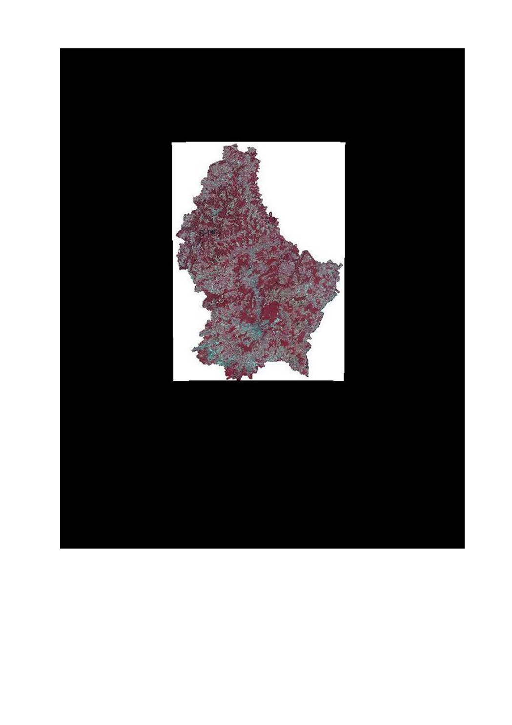
Layer air and satellite image - orthophoto 2007 infrared
This layer contains the infrared version of the orthophoto 2007.
Simple
- Citation identifier
- / 9848c7ac-0c12-430d-a05f-62dda9e234a0
- Presentation form
- Digital map
- Status
- On going
- Point of contact
-
Organisation name Individual name Electronic mail address Role Administration du Cadastre et de la Topographie
Service du géoportail et de l'ILDG (ACT)
Point of contact
Point of contact
No information provided.
Point of contact
No information provided.
Point of contact
No information provided.
Point of contact
No information provided.
Point of contact
No information provided.
Point of contact
No information provided.
Point of contact
No information provided.
Point of contact
No information provided.
Point of contact
No information provided.
Point of contact
No information provided.
- Maintenance and update frequency
- As needed
-
Entités au Grand-Duché de Luxembourg
-
-
Grand-Duché du Luxembourg
-
- Keywords
-
- Keywords
-
-
layer
-
orthophoto
-
image
-
infrared
-
geoportail.lu
-
-
geoportail.lu themes
-
-
Water
-
-
geoportail.lu structure
-
-
Water>Geographical location>Aerial and satellite photographs
-
- Use constraints
- Other restrictions
- Other constraints
-
Creative Commons 1.0 Universal (CC0 1.0) Public Domain Dedication
- Spatial representation type
- Vector
- Denominator
- 0
- Language
- Français
- Language
- English
- Language
- Lëtzebuergesch
- Language
- Deutsch
- Character set
- UTF8
- Topic category
-
- Geoscientific information
N
S
E
W
))
- Reference system identifier
- EPSG / http://www.opengis.net/def/crs/EPSG/0/2169
- OnLine resource
-
Protocol Linkage Name OGC:WMS-1.3.0-http-get-map
https://wms.geoportail.lu/public_map_layers/service 311
OGC:WMS-1.3.0-http-get-map
http://wmts1.geoportail.lu/opendata/service?request=getCapabilities&service=WMS&version=1.3.0 ortho_irc
WWW:LINK-1.0-http--link
https://data.public.lu/fr/datasets/orthophoto-officelle-du-grand-duche-de-luxembourg-edition-2007/
- OnLine resource
-
Protocol Linkage Name https://map.geoportail.lu/theme/main?version=3&zoom=8&X=667917&Y=6394482&lang=fr&layers=311&opacities=1 Orthophoto 2010 (infrared)
Metadata
- File identifier
- 9848c7ac-0c12-430d-a05f-62dda9e234a0 XML
- Metadata language
- Français
- Character set
- UTF8
- Hierarchy level
- Dataset
- Hierarchy level name
-
dataset
- Date stamp
- 2021-02-04T22:13:56
- Metadata standard name
-
ISO 19115:2003/19139
- Metadata standard version
-
1.0
- Metadata author
-
Organisation name Individual name Electronic mail address Role Administration du Cadastre et de la Topographie
Service du géoportail et de l'ILDG (ACT)
Point of contact
- Other language
-
Language Character encoding French UTF8 Luxembourgish; Letzeburgesch UTF8 English UTF8 German UTF8
)))