 geocatalogue.geoportail.lu
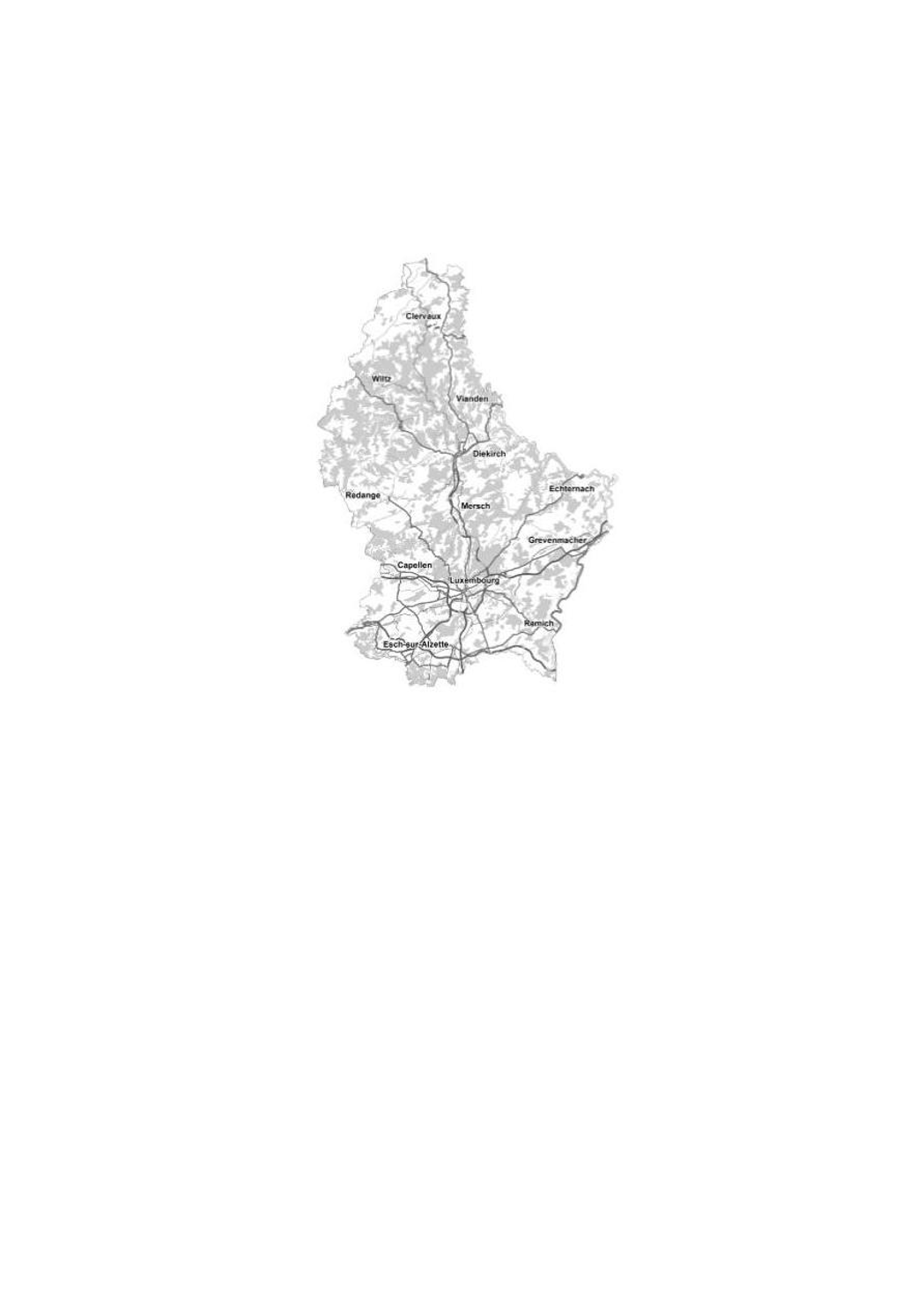
Topographic map B/W
A topographic map is intended to be a representation of the terrain. It differs from thematic maps (city maps, road maps etc.) by the richness of its content, its high precision and above all the representation of the topography by the contour lines.
The cadastre and topography administration publishes topographic maps at the scales of 1:5,000, 1:20,000, 1:50,000, 1:100,000 and 1:250,000.
Simple
- Date (Creation)
- Invalid DateT00:00:00
- Date (Revision)
- Citation identifier
- / c3088583-8ddf-4ee1-9658-0c13db1c5878
- Presentation form
- Digital map
- Status
- On going
- Point of contact
-
Organisation name Individual name Electronic mail address Role Administration du Cadastre et de la Topographie
Administration du Cadastre et de la Topographie
Author
- Maintenance and update frequency
- As needed
-
Entités au Grand-Duché de Luxembourg
-
-
Grand-Duché du Luxembourg
-
-
GEMET - Concepts, version 2.4
-
- Keywords
-
-
topographic map black white
-
- Keywords
-
-
geoportail.lu
-
- Access constraints
- Other restrictions
- Spatial representation type
- Vector
- Denominator
- 500
- Character set
- UTF8
))
- Reference system identifier
- EPSG / http://www.opengis.net/def/crs/EPSG/0/2169
- Distribution format
-
Name Version ShapefileTODO
- OnLine resource
-
Protocol Linkage Name OGC:WMS-1.3.0-http-get-map
https://wms.geoportail.lu/public_map_layers/service 502
OGC:WMS-1.3.0-http-get-map
http://wmts1.geoportail.lu/opendata/service?request=getCapabilities&service=WMS&version=1.3.0
- OnLine resource
-
Protocol Linkage Name https://map.geoportail.lu/theme/main?version=3&zoom=8&X=667917&Y=6394482&lang=fr&layers=502&opacities=1 Topographic map B/W
- Hierarchy level
- Dataset
Metadata
- File identifier
- 8a2cf910-72ae-4ae2-8c4e-9bd24df7c7d5 XML
- Metadata language
- Français
- Character set
- UTF8
- Hierarchy level
- Dataset
- Hierarchy level name
-
dataset
- Date stamp
- 2021-02-04T23:37:41
- Metadata standard name
-
ISO 19115:2003/19139
- Metadata standard version
-
1.0
- Metadata author
-
Organisation name Individual name Electronic mail address Role Administration du Cadastre et de la Topographie
Administration du Cadastre et de la Topographie
Point of contact
- Other language
-
Language Character encoding Luxembourgish; Letzeburgesch UTF8 English UTF8 German UTF8 French UTF8
)))