 geocatalogue.geoportail.lu
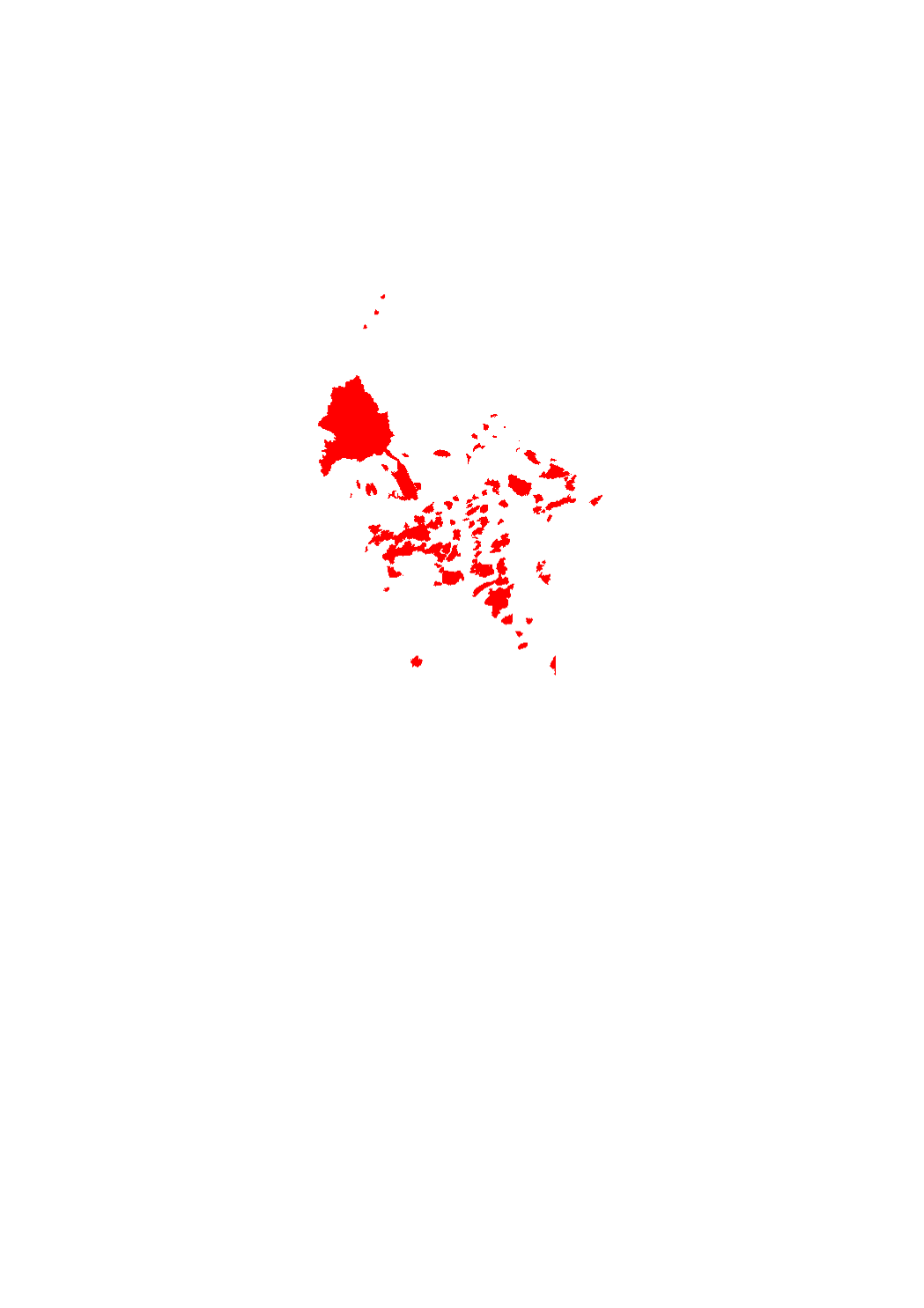
Areas in which the application of Metazachlor is forbidden
Areas in which the application of Metazachlor is forbidden
Simple
- Date (Creation)
- 2017-02-02T00:00:00
- Citation identifier
- / 803e93f8-588f-4697-8d76-972be1ad3531
- Presentation form
- Digital map
- Status
- On going
- Point of contact
-
Organisation name Individual name Electronic mail address Role Administration de la gestion de l'eau
Division des eaux souterraines et des eaux potables
Point of contact
-
Entités au Grand-Duché de Luxembourg
-
-
Grand-Duché du Luxembourg
-
- Keywords
-
- Keywords
-
-
Areas
-
Metazachlor
-
geoportail.lu
-
-
geoportail.lu themes
-
-
Agriculture
-
Water
-
Main
-
-
geoportail.lu structure
-
-
Agriculture>Protected sites
-
Water>Drinking water safeguard zones [ZPS]
-
Main>Environment, Biology and Geology>Drinking water safeguard zones [ZPS]
-
- Use constraints
- Other restrictions
- Other constraints
-
Creative Commons 1.0 Universal (CC0 1.0) Public Domain Dedication
- Spatial representation type
- Vector
- Denominator
- 0
- Language
- Français
- Character set
- UTF8
N
S
E
W
))
- Maintenance and update frequency
- Monthly
- Reference system identifier
- EPSG / http://www.opengis.net/def/crs/EPSG/0/2169
- OnLine resource
-
Protocol Linkage Name OGC:WMS-1.3.0-http-get-map
https://wms.geoportail.lu/public_map_layers/service 559
WWW:LINK-1.0-http--link
https://data.public.lu/fr/datasets/zones-dans-lesquelles-une-application-du-metazachlore-est-interdite/
- OnLine resource
-
Protocol Linkage Name https://map.geoportail.lu/theme/main?version=3&zoom=8&X=667917&Y=6394482&lang=fr&layers=559&opacities=1 Areas in which the application of Metazachlor is forbidden
Metadata
- File identifier
- 803e93f8-588f-4697-8d76-972be1ad3531 XML
- Metadata language
- Français
- Character set
- UTF8
- Hierarchy level
- Dataset
- Hierarchy level name
-
dataset
- Date stamp
- 2025-07-16T09:08:42
- Metadata standard name
-
ISO 19115:2003/19139
- Metadata standard version
-
1.0
- Other language
-
Language Character encoding Luxembourgish; Letzeburgesch UTF8 English UTF8 German UTF8 French UTF8
)))