 geocatalogue.geoportail.lu
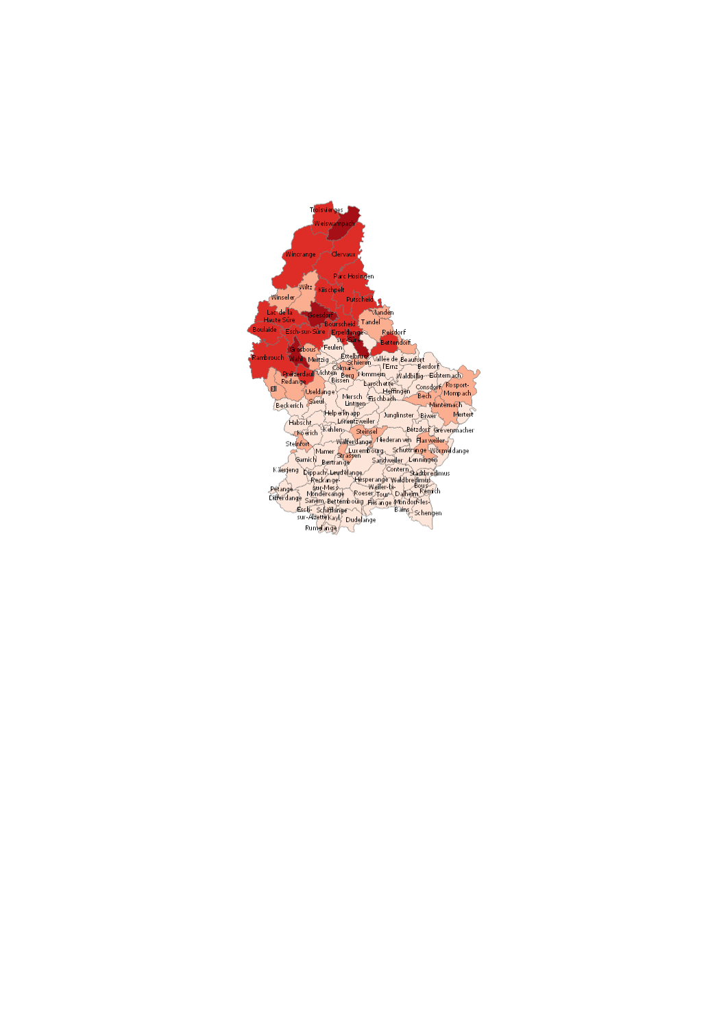
Radon concentrations per municipality
The results were taken from 3-month measurements in private housing. These measurements were done on a voluntary basis.
Simple
- Date (Creation)
- 2019-01-01T00:00:00
- Date (Revision)
- 2024-07-01T00:00:00
- Citation identifier
- / 80309cdb-b664-4ea8-a3a4-c602f5814f79
- Presentation form
- Digital map
- Status
- On going
- Maintenance and update frequency
- As needed
-
Entités au Grand-Duché de Luxembourg
-
-
Grand-Duché du Luxembourg
-
- Keywords
-
-
radon, concentration, private housing
-
- Keywords
-
-
geoportail.lu
-
-
geoportail.lu themes
-
-
Environment
-
-
geoportail.lu structure
-
-
adon
-
- Access constraints
- Other restrictions
- Spatial representation type
- Vector
- Denominator
- 0
- Character set
- UTF8
N
S
E
W
))
- Reference system identifier
- EPSG / http://www.opengis.net/def/crs/EPSG/0/2169
- OnLine resource
-
Protocol Linkage Name OGC API-Features
https://features.geoportail.lu/collections/1468 OGC API - Features
- OnLine resource
-
Protocol Linkage Name OGC:WMS-1.3.0-http-get-map
https://wms.geoportail.lu/public_map_layers/service 1468
https://map.geoportail.lu/theme/main?version=3&zoom=8&X=667917&Y=6394482&lang=fr&layers=1468&opacities=1 Radon concentrations per municipality
Metadata
- File identifier
- 80309cdb-b664-4ea8-a3a4-c602f5814f79 XML
- Metadata language
- Français
- Character set
- UTF8
- Hierarchy level
- Dataset
- Hierarchy level name
-
dataset
- Date stamp
- 2024-12-04T15:47:19Z
- Metadata standard name
-
ISO 19115:2003/19139
- Metadata standard version
-
1.0
- Metadata author
-
Organisation name Individual name Electronic mail address Role Direction de la Santé - Division de la Radioprotection
Karin Pier
Point of contact
- Other language
-
Language Character encoding Luxembourgish; Letzeburgesch UTF8 English UTF8 German UTF8 French UTF8
)))