 geocatalogue.geoportail.lu
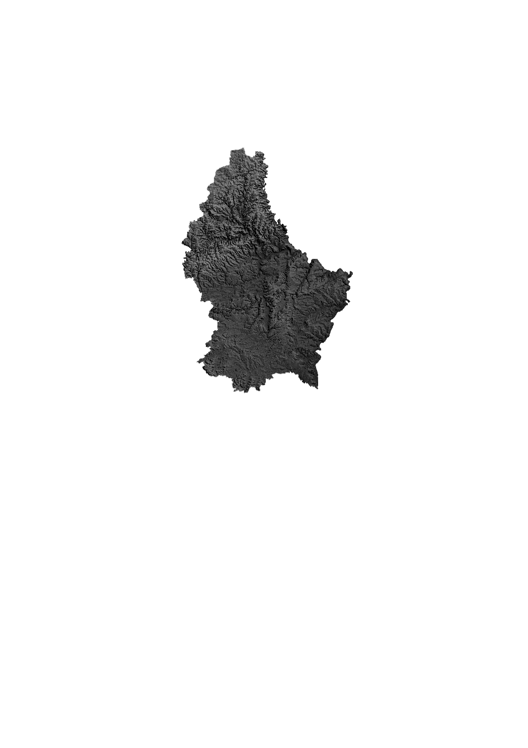
Relief 2017
Grayscale relief raster based on Digital Elevation Model from 2017. The DEM from 2017 is based on a photogrammetric exploitation of aerial images and has a ground resolution of 1 m approximately.
Simple
- Date (Creation)
- 2018-06-18T00:00:00
- Citation identifier
- / 7d195815-23c2-4963-863c-60e3a39ab8af
- Presentation form
- Digital map
- Status
- On going
- Maintenance and update frequency
- As needed
-
Entités au Grand-Duché de Luxembourg
-
-
Grand-Duché du Luxembourg
-
- Keywords
-
-
Relief, digital elevation model
-
- Keywords
-
-
geoportail.lu
-
-
geoportail.lu themes
-
-
Main
-
-
geoportail.lu structure
-
-
Main>Land surface>Morphometric attributes
-
- Access constraints
- Other restrictions
- Spatial representation type
- Vector
- Denominator
- 0
- Character set
- UTF8
N
S
E
W
))
- Reference system identifier
- EPSG / http://www.opengis.net/def/crs/EPSG/0/2169
- OnLine resource
-
Protocol Linkage Name OGC:WMS-1.3.0-http-get-map
https://wms.geoportail.lu/public_map_layers/service 1460
https://map.geoportail.lu/theme/main?version=3&zoom=8&X=667917&Y=6394482&lang=fr&layers=1460&opacities=1 Relief
Metadata
- File identifier
- 7d195815-23c2-4963-863c-60e3a39ab8af XML
- Metadata language
- Français
- Character set
- UTF8
- Hierarchy level
- Dataset
- Hierarchy level name
-
dataset
- Date stamp
- 2025-01-22T08:16:52
- Metadata standard name
-
ISO 19115:2003/19139
- Metadata standard version
-
1.0
- Metadata author
-
Organisation name Individual name Electronic mail address Role Administration du Cadastre et de la Topographie
Service Géoportail
Point of contact
- Other language
-
Language Character encoding Luxembourgish; Letzeburgesch UTF8 English UTF8 German UTF8 French UTF8
)))